
The wave of heavy rain and gales set to pound the UK this week has been dubbed “Storm Christoph” by meteorologists, with people warned to brace themselves for a period of very unsettled weather.
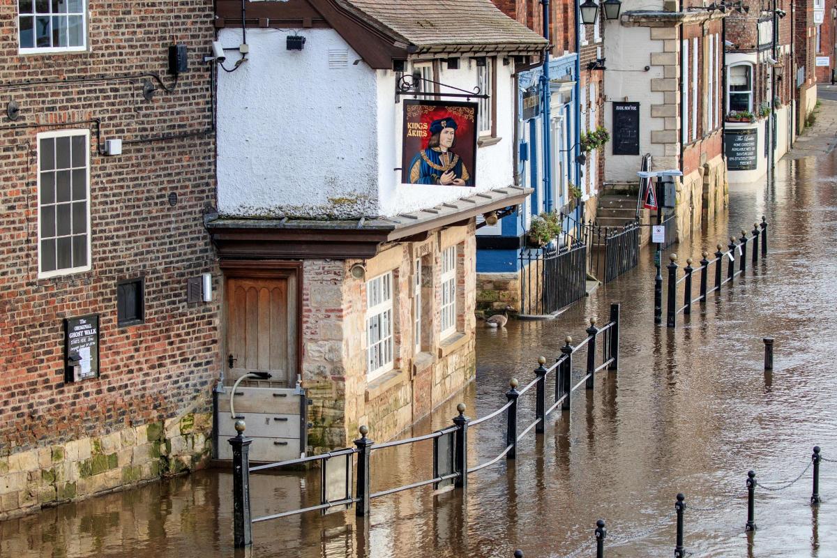
Some areas of the UK could see up to 200mm of rain over the first half of the week which, coupled with snow melt, poses a serious risk of flooding in eastern parts.
Met Office chief meteorologist Dan Suri said: “Following a cold spell where the main hazard was snow, our focus now turns to notably heavy rain moving across the UK this week.
“Some locations could see over 100mm of rain falling through the course of just a couple of days. with up to 200mm possible over higher ground.
“These amounts of rainfall along with snow melt present a real threat of flooding and people should keep a close eye on flood warnings from the Environment Agency and Natural Resources Wales.”
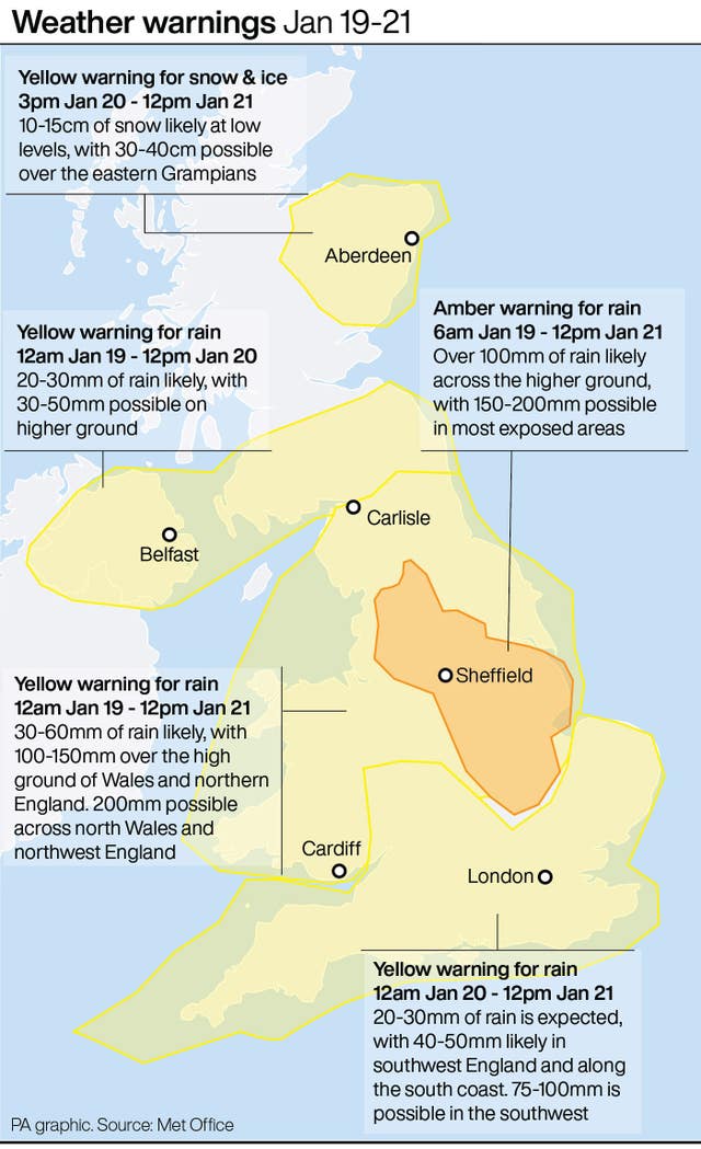
There is an amber weather warning for Tuesday and Wednesday for central northern England, affecting an area around Manchester, Leeds and Sheffield and stretching down to Peterborough.
Up to 70mm is expected to fall in that area but in isolated spots, particularly in the northern Peak District and parts of the southern Pennines, 200mm could be possible.
The warning says there is a “danger to life” due to fast-flowing or deep floodwater and a “good chance some communities cut off by flooded roads”.
A yellow rain alert is also in place for most of northern England and Wales from Tuesday to Wednesday, before most of the UK falls into the warning on Thursday.
The Environment Agency has issued 11 local flood warnings covering parts of Yorkshire, Derbyshire, Lancashire, Greater Manchester, Merseyside and Cheshire.
There are a further 61 flood alerts, meaning flooding is possible in the area, although the number is expected to increase significantly as the impact of the first heavy rain is felt overnight.
The Environment Agency has urged people living in those areas to prepare for the risk of significant flooding as early as Tuesday morning, as the heavy rain hits already saturated ground.
Defences including temporary barriers and the opening of flood storage reservoirs are being prepared, the Environment Agency said.
Katharine Smith, flood duty manager at the Environment Agency, said: “Environment Agency teams are out on the ground clearing grilles, screens and closing flood barriers.
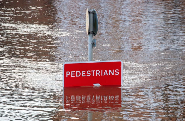
“We urge people to keep away from swollen rivers and not to drive through flood water – it is often deeper than it looks and just 30cm of flowing water is enough to float your car.”
⚠️ ⚠️ Storm Christoph has been named, with heavy rain and flooding likely on Tuesday, Wednesday and Thursday ⚠️ ⚠️#StormChristoph#WeatherAware pic.twitter.com/LHKYniBkfi
— Met Office (@metoffice) January 18, 2021
There will be cooler, calmer conditions towards the later half of the week going into the weekend as Storm Christoph blows its way across the North Sea, leaving strong winds along the east coast.
As of Wednesday afternoon until noon on Thursday, a yellow weather warning for snow and ice is in force stretching from Dundee to Elgin and across to the east coast of Scotland.
It warns there is a small chance of travel disruption, as well as a risk of power cuts and also injury from slips and falls on icy surfaces.
Mr Suri said: “Colder air coming southwards into the weather system brings the risk of further snow on the back edge of this system.
“Temperatures will gradually fall across the UK through the end of the week and into the weekend bringing a return to widespread overnight frosts.”


Comments: Our rules
We want our comments to be a lively and valuable part of our community - a place where readers can debate and engage with the most important local issues. The ability to comment on our stories is a privilege, not a right, however, and that privilege may be withdrawn if it is abused or misused.
Please report any comments that break our rules.
Read the rules here