
FORGE Valley was refilling with wildlife, like Scarborough down the road with holidaymakers. The ‘V’ shape was greened over in National Nature Reserve quality, in the sunlight and coloured with flowers. Some trees frizzed with new leaves, all under an Icelandic blue sky.
We pulled in at the Green Gate car park, one of a string of small ones along the valley. There were 15 listed on an information board, although the number does vary year to year. Whichever is yours, look out for little connecting paths through the open access woods to reduce the road work.
There is five minutes of asphalt marching, dead straight, dead flat to Mowthorpe Bridge where the Scalby Cut, a channel dug in 1800, takes flood water from the River Derwent straight to the sea.
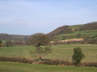
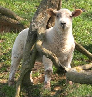
A shoal of a dozen fry flickered in the minimal flow. Otherwise there’s a farm here from which we climbed by sunken track to the pastures above and the good views of the split of the valley. Then we wandered the sheep pastures, burnished in gorse for colour, with tree creepers active in an ash, and the lambs turning from cute to culinary.
Another five minutes of road took us through the lunchtime aromas emitting from the Everley Country Hotel.
We took the bench by the river, the upper Derwent, down on the valley floor, and very down in flow.
Along the river, in the adjacent grassland, are springs and seepages that make boggy bits, and shallow curved ponds where the river once flowed, one of which had warmed and was lively with insects.
However my navigator, as is her wont, dangled her naked feet in the river, but not for long, a cold ten seconds, I counted. Also she spied a pair of eel, leech, or lamprey wriggling over the gravel. Otter food, the fish not the toes, and heron titbits indeed.
You probably won’t see an otter but you will see the herons. They will watch you. I counted nine. Herons have a near six-foot wingspan and in this they outstretch all bar the golden eagle, the common crane, the sea eagle and the eagle owl. Heron nests are large, untidy and obvious and they will want to be on them so give them privacy, like the celebrities they are.
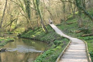
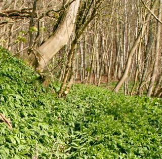
Then come the wooden duckboards, we needed quarter of a mile of them and they are sound and entertaining, a promenade of hand-holding and wet dogs, by the river, above the lovely wood anemones and marsh marigolds. This brought us out at one of the Forge Valley car parks named Old Man’s Mouth. To reach ours at Green Gate we took a climb, in a gully packed with garlic, so salad days are here again.
Fact file
Distance: Five miles.
General location: Near Scarborough.
Start: Forge Valley.
Right of way: Public and Open Access.
Dogs: Legal.
Date walked: April 2010.
Road route: Forge Valley signed off the A170 at East Ayton.
Car parking: Green Gate car park.
Lavatories: None.
Refreshments: The Everley Country Hotel.
Tourist and public transport information: Scarborough TIC 01723 373333.
Map: Drawn from OS Explorer OL 27 North York Moors eastern.
Terrain: Valley.
Difficulty: Moderate.
Please observe the Country Code and park sensibly. While every effort is made to provide accurate information, walkers set out at their own risk.
Directions
When in doubt look at the map. Check your position at each point.
Keep straight on unless otherwise directed.
1. From Green Gate car park, cross road to path through woods, right to road.
2. Over bridge, pass farm, path on right (sign), ten yards, snickelgate (waymark) and immediately right, 150 yards, left uphill at wall corner (waymark post) grass track.
3. Fifteen yards before stile/fieldgate cut back left (waymark post), contour on valley side.
4. Gate (waymark) and right, left at corner so fence to right, gate (waymark), stile by fieldgate (waymark), join track to house (waymark post) downhill, fieldgate (waymark) between buildings.
5. Right to road, first left (Wrench Green only), over river, first left (dead-end sign), becomes track.
6. Fingerpost then cattle grid by fieldgate (waymark). Cross field, stile and plank bridge (waymark), stile/fieldgate (waymark), stile/fieldgate (waymark), by river, skirt gorse, 100 yards, stile/fieldgate.
7. Stile to riverside duckboard path.
8. Footbridge on left to Old Man’s Mouth car park, left to road for 50 yards, right to path (sign) uphill, step stream, up between two streams, path fades, 100 yards.
9. Left to track, contour, join another track and ignore right forks, downhill to car park.


Comments: Our rules
We want our comments to be a lively and valuable part of our community - a place where readers can debate and engage with the most important local issues. The ability to comment on our stories is a privilege, not a right, however, and that privilege may be withdrawn if it is abused or misused.
Please report any comments that break our rules.
Read the rules here