
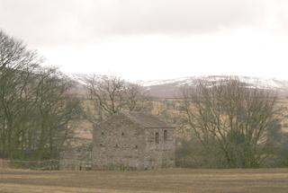
CARLTON, that’s Carlton in Coverdale, has a village hall car park with an honesty box. And from it you get great views, as we did all day, and from it you can see the high ground to the north, our target, four miles walking away and 1,000 feet higher.
We walked, took the one and only street of old grey stone houses, passed the Foresters Arms and then a quad bike garage where I joked “can I hire one?” The response was ribald, including a “tire him out love” to my navigator.
It’s not a hard climb, a great zigzag takes out the sting and tracks are head-up smooth.
In order of altitude – four curlews fluted, lapwings circled, grouse sought the patches of heather, a couple of geese honked by, sheep took hay from a bale, and snipe type darted.
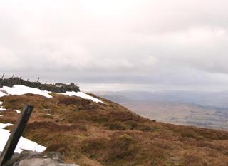
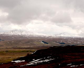
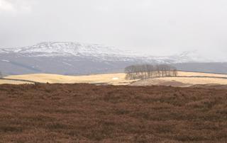
The top is wide and flat, half a mile across, and was just on the snow drift lingering line. Such clean and shiny drifts, and especially towards the south-west where higher hills wore whispers of white, held brilliant hollows and had white stripes along walls and in ditches.
For all year delight, you can see down on to Wensleydale, miles of the valley and a view lengthening and broadening as you parallel. A trig point marks an imperceptible high point at 1,726 feet and a pile of stones is worth detouring to for the vantage point.
The descent is slightly more difficult, sometimes you do need to watch your feet and my navigator broke through a crust of snow to soak her sock in the tiny stream invisible below. And here over Melmerby Moor was the only messy length, a short length damaged by 4X4s, foolish on a soft peaty ‘green lane’. Otherwise the walk is all lovely.
Coming in we passed a rock face that was chattering with jackdaws and a cascading waterfall on Mel Beck and this water we followed into Carlton.
Fact file
Distance: Six and a half miles.
General location: Yorkshire Dales.
Start: Carlton.
Right of way: Public and open access.
Dogs: Illegal.
Date walked: March, 2010.
Road route: Various, considering the A1 repairs.
Car parking: Car park by village hall, honesty box.
Lavatories: None.
Refreshments: The Foresters Arms.
Tourist and public transport information: Leyburn TIC 01748 828747.
Map: Drawn from OS Explorer OL30 Yorkshire Dales northern and central.
Terrain: Valley side and tops.
Difficulty: Moderate if clear.
Please observe the Country Code and park sensibly. While every effort is made to provide accurate information, walkers set out at their own risk.
Directions
When in doubt look at the map. Check your position at each point.
Keep straight on unless otherwise directed.
1. From car park, left to road through village.
2. On left-hand road bend, fork right, at next left-hand bend walled track on right (fingerpost West Burton 4 miles), takes a sharp left.
3. Fieldgate to moor, 100 yards, track on right which soon joins wall, fieldgate, gateway.
4. Fieldgate and bridge, 100 yards, left at track junction and uphill, then snakes over the flat top.
5. Before wall and fieldgate, path on right near to wall on left.
6. From trig point, 100 yards then path angles away from wall to cut corner for 200 yards, rejoin wall.
7. At small gate on left, go through it to viewpoint pile of stones 200 yards away, then return through same gate to path ahead for 25 yards then swing left steep downhill 150 yards until near corner.
8. Angle left downhill on path to next corner then rejoin wall.
9. Track curves away from wall, 100 yards, left at junction to stone track.
10. About 100 yards before road, track on right which cuts back, short eroded stretch. After half a mile, step-stream, 150 yards, cross track and bridge.
11. Fieldgate, was damaged, into field, track downhill by wall, 200 yards, fork right to path which angles across field, gate, 11 o’clock downhill for 150 yards, fieldgate to track.
12. Cross ford, 50 yard uphill on track, left across field, fieldgate by barn. Track downhill, joins wall then beck. Left through village.


Comments: Our rules
We want our comments to be a lively and valuable part of our community - a place where readers can debate and engage with the most important local issues. The ability to comment on our stories is a privilege, not a right, however, and that privilege may be withdrawn if it is abused or misused.
Please report any comments that break our rules.
Read the rules hereComments are closed on this article