

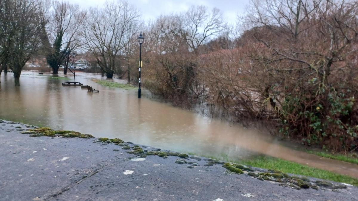
Areas of Ryedale are on flood alert once again.
There are 11 flood warnings in place across North Yorkshire following a yellow weather warning from the Met Office for heavy rain.
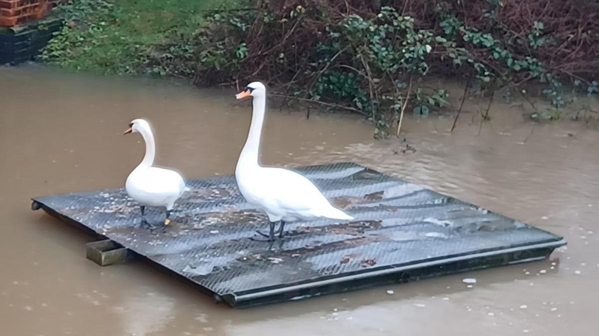
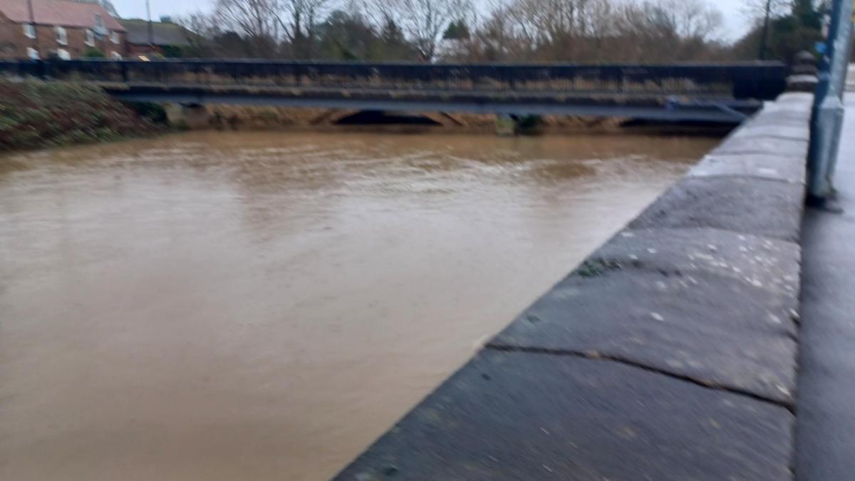
The River Derwent level at Malton is currently around 4m and is expected to stay at around that level for 48 hours.
The highest level ever recorded at the River Derwent at Malton, A64 Road Bridge is 5.23m, reached on Friday, January 22 2021 at 7:30am.
North Yorkshire Council officers said: "We are hopeful that it will not reach 4.2m which is the point to consider closing County Bridge but this will be closely monitored over the forth coming days and weeks.
"The ground water level is currently at 21.64mAOD with a slow increase.
"There are currently 11 pumps active - six in Old Malton, four in Malton and 1 in Norton. This is constantly being reviewed throughout the day and more pumps will be turned off as and when they can.
"Norton Road remains open to two-way traffic. and a one-way system is still in effect on Church Street.
"The council have restricted the parking on St Nicholas Street to support the flow of traffic."
Flooding is expected to affect locations near the River Derwent, with low-lying land and properties expected to be most affected, particularly around Buttercrambe Mill at Buttercrambe Bridge.
Other areas impacted include land around the River Seven and its tributaries including Northdale Beck, Hartoft Beck, Ings Beck, Lastingham Beck, Sutherland Beck, Cropton Beck and Catter Beck, including properties in Sinnington and to the east of Normanby.
A spokesperson for the Environment Agency said: " We are closely monitoring the situation. Plan driving routes to avoid low-lying roads near rivers, which may be flooded and do not walk, cycle or drive through flood water."
The River Ouse in York was was 3.85 metres above normal levels yesterday (Tuesday). The river has now been at or near to four metres since 5am on December 29 and highest level expected is 4.01 metres today(January 3) at 2am.
The highest ever level was 5.40m, recorded on November 4, 2000.
The Met Office forecast for the coming days is for a mixture of some brighter spells, especially in the east, with scattered heavy showers, mainly in the west. Maximum temperature 9 °C.
Thursday to Saturday: will see brighter spells interspersed with the odd shower through this period. Showers initially mainly in the west, changing to mostly coastal by Saturday. Temperatures near average, turning colder by Saturday.


Comments: Our rules
We want our comments to be a lively and valuable part of our community - a place where readers can debate and engage with the most important local issues. The ability to comment on our stories is a privilege, not a right, however, and that privilege may be withdrawn if it is abused or misused.
Please report any comments that break our rules.
Read the rules here