


MALTON has long been known for its 'bottle neck' crossroads known locally as Butcher Corner or Snow's Corner.
At one time, when Malton was mentioned in conversation the response was 'OH! Traffic jam.’
Therefore, in the 1930s, a plan was drawn up whereby the worst aspects of the problem area would be swept away to create a totally linear junction having all-round vision and (hopefully) straightforward traffic flow.
The pre Second World War proposals are shown in a document (pictured) found in Woodhams Stone archives.

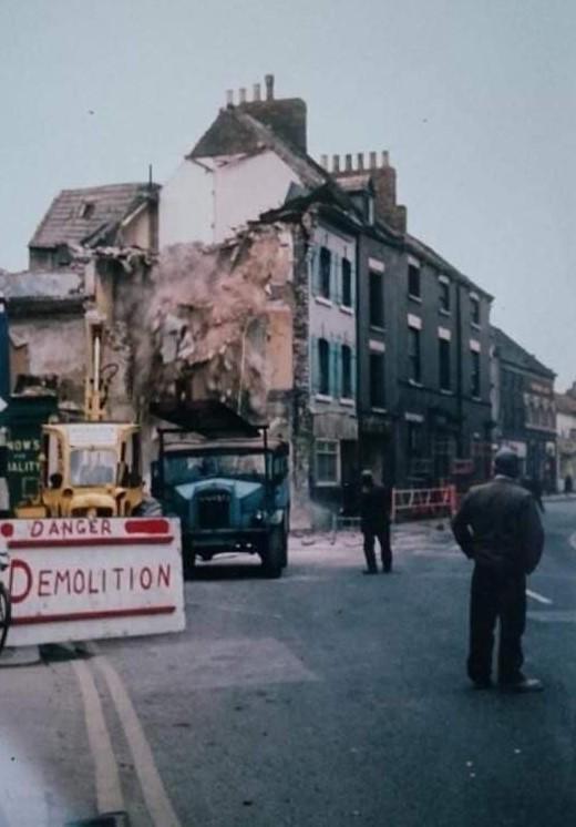
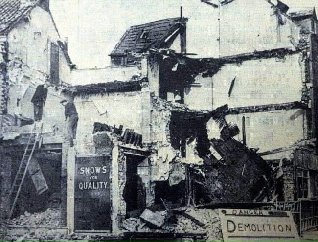
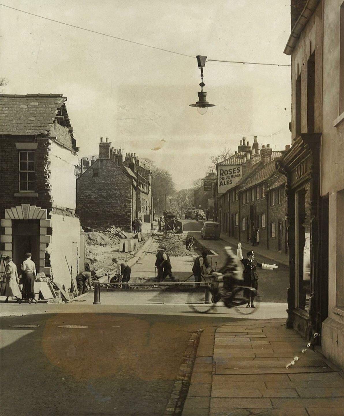
Partial attempts at reorganisation in 1956 and 1966 resulted in a somewhat improved situation and the photographs show work in progress in Old Maltongate and Castlegate Wednesday respectively.
The bypass of the late 1970s did further improve matters but nowadays increased car ownership has resulted, again, in a poor traffic flow situation.
The offset nature of the junction caused rather complicated manoeuvres whenever long vehicles attempted to clear a right-angled turn; cyclists and horse-drawn vehicles had been known to crash into Snow's window.
If the demolition of the Southern buildings had occurred, some interesting features would probably have been revealed.
There had been, in the 1850s, a fish market at the top end of Castlegate in the space just outside of the town wall where the building line swings towards Wells Lane.
It is therefore quite apt that one of the town's favourite fish and chip shops (Jackie Taylor's) was to be found just in this area.
Here are the remains of a Market Cross (pictured) and a contemporary, 1860s, account of the surroundings also mentions a 'cobbled area.'

Nowadays occasional reports are made of a foul smell around Butcher Corner: this has been ascribed to a complex series of storm drains feeding in from Wheelgate and Old Maltongate en route to an outlet down in the river.
Perhaps opening up the area would have facilitated access and attention to these watercourses?
The town wall lies under there too... Would we have seen that as well?
READ NEXT: A look back at Flour Lane in Malton


Comments: Our rules
We want our comments to be a lively and valuable part of our community - a place where readers can debate and engage with the most important local issues. The ability to comment on our stories is a privilege, not a right, however, and that privilege may be withdrawn if it is abused or misused.
Please report any comments that break our rules.
Read the rules here