

MANY of York's city centre streets look pretty much the same today as they did 100 years ago.
The cars, the businesses and the fashions may have changed. But if you look at an old photograph of Coney Street or Petergate, it is instantly recognisable.
There are exceptions, of course. And Rougier Street where it meets Station Road is certainly among them.
This area of York has changed almost out of all recognition in the last century or so. Don't believe us? Then take a look at these photographs.
They all come from Explore York's wonderful Imagine York archive. And we've arranged them in date order so you can see how the area changed over time...
The photographs show:
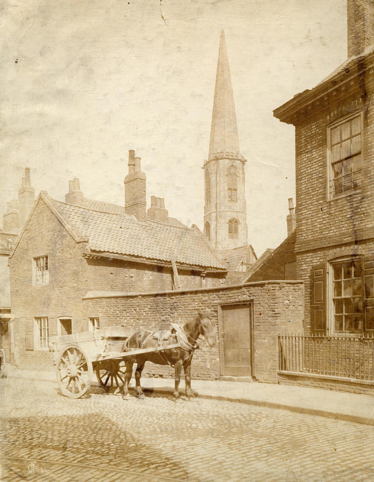
1. The spire of All Saints Church on North Street in the 1870s, shown from what is thought to be Rougier Street.
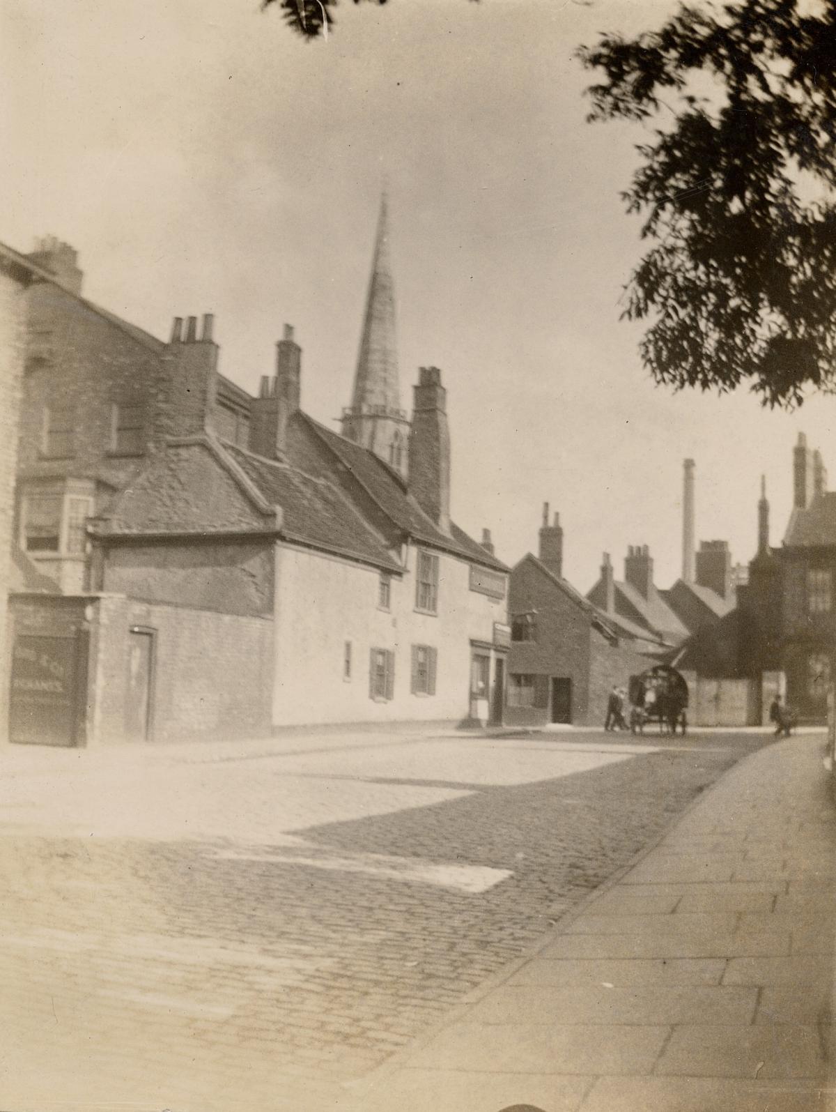
2. Rougier Street, probably in the late 1880s. At least, the caption to this photo insists it shows Rougier Street, though it is almost unrecognisable from the street we have today. A horse and cart can be seen in a street otherwise empty of traffic, in what almost appears to be a village or small town scene.
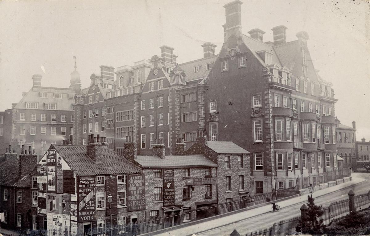
3. Station Road and the NER offices pictured from the city walls in the early 1900s - but clearly taken after the NER building, York's new 'Palace of Business', was completed in 1906. The NER building, which dominates the photograph, is very much recognisable today. But the smaller buildings which it overshadows in the photograph have all gone, to be replaced by a large office block.
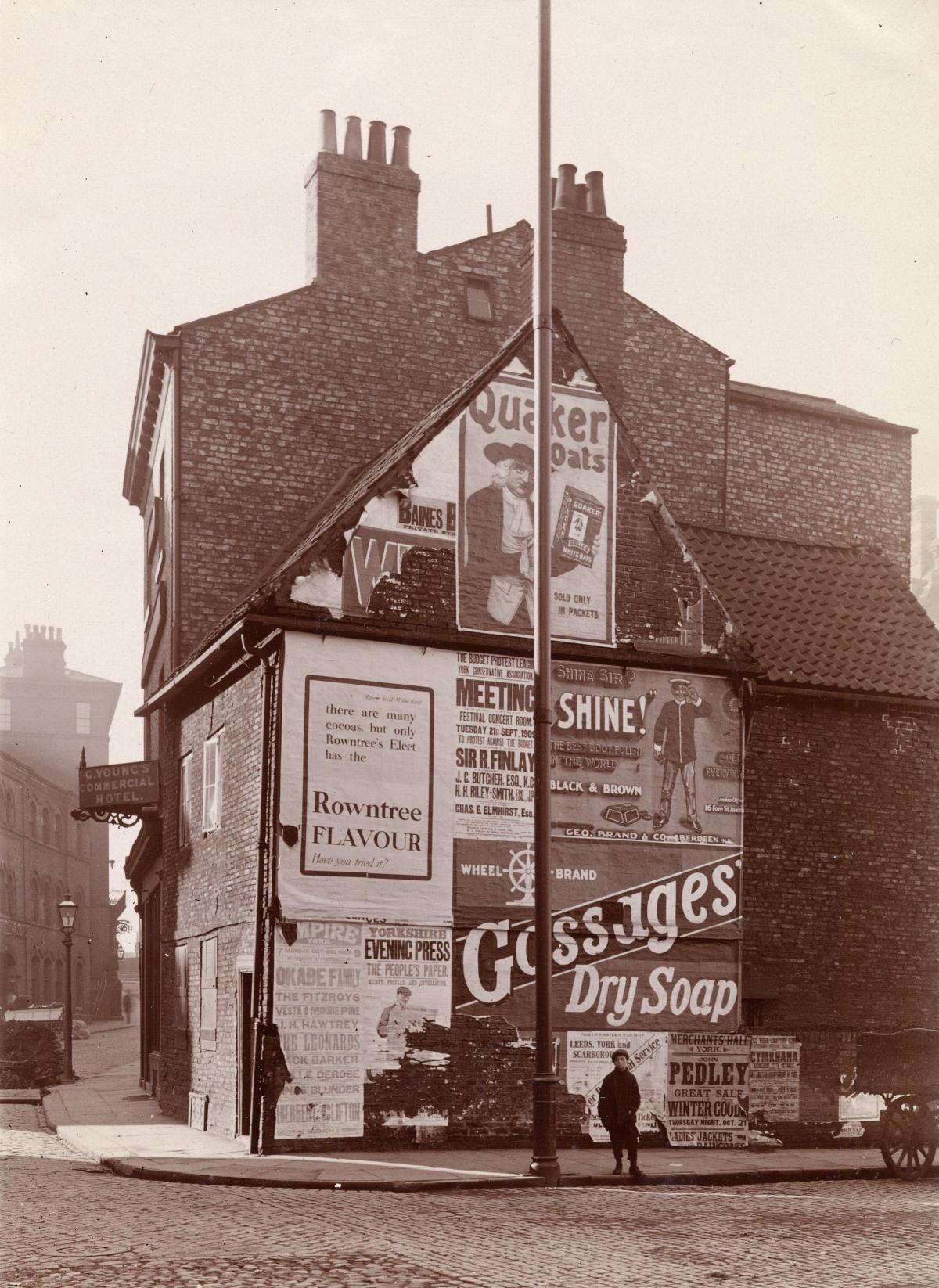
4. Advertisements on the side of Young's Commercial Hotel on Rougier Street, photographed in 1909. They include posters for Rowntrees, Quaker Oats, Shine boot polish, Gossages soap and John Pedley's sale of Winter Goods.
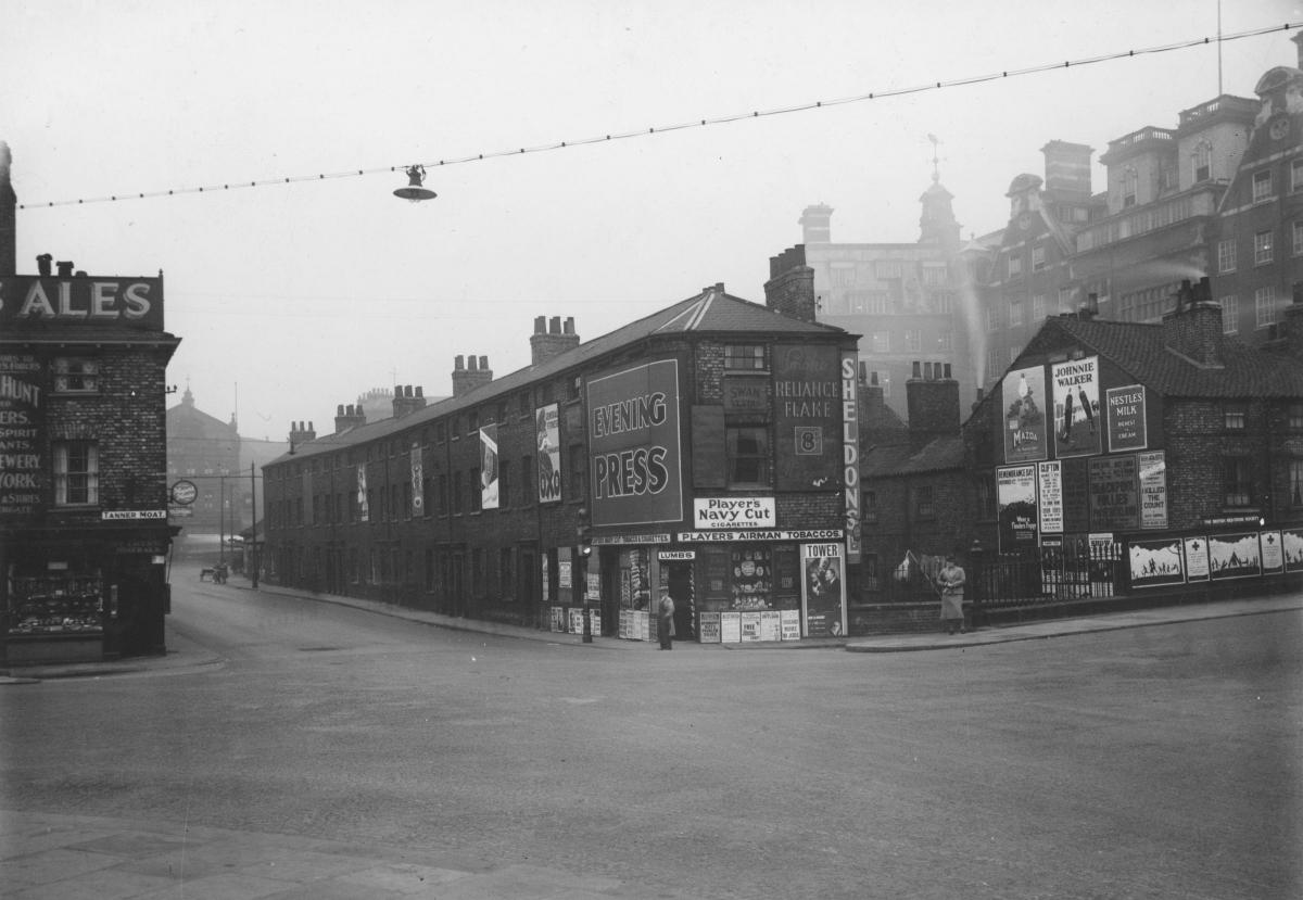
5. The junction of Rougier Street, Tanner Moat and Station Road in about 1933. The building on the far right of the image is the NER offices. The shop on the corner is Lumb's newsagents, which is covered with a large number of advertisements, as is the end wall of the adjacent row of terraces.
6. Providence Place and Rougier Street from Station Road, also in about 1933. The street at the far left of the photograph is Tanner Row. Lumb's newsagents is on the corner of the junction. There is a large amount of washing on the lines in Providence Place, which was demolished between 1937 and 1940.
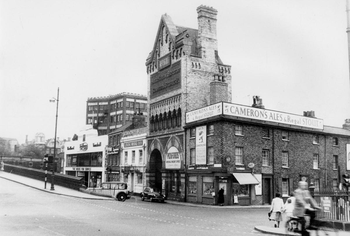
7. The junction of Tanner Moat, Rougier Street and Museum Street in about 1955. The photograph is dominated by the former Walker's (later Botterill's) horse depository, which first appeared in about 1850 following the opening of Lendal Bridge and was, according to York local historian Peter Stanhope, the 'equivalent of a multi-storey parking place for horses and ground floor parking for carriages well before cars had been invented'. The depository had a distinctive Moorish style of decorative brickwork. The frontage of the repository building still exists, although the upper stories and the elegant gable have been removed and replaced by a flat-topped modern extension. The distinctive Moorish archways are still there, however – right next to the Maltings pub.
Stephen Lewis
All the photos on these pages, and thousands more, are held on Explore York’s Imagine York archive. You can browse it yourself by visiting imagineyork.co.uk/


Comments: Our rules
We want our comments to be a lively and valuable part of our community - a place where readers can debate and engage with the most important local issues. The ability to comment on our stories is a privilege, not a right, however, and that privilege may be withdrawn if it is abused or misused.
Please report any comments that break our rules.
Read the rules hereLast Updated:
Report this comment Cancel