
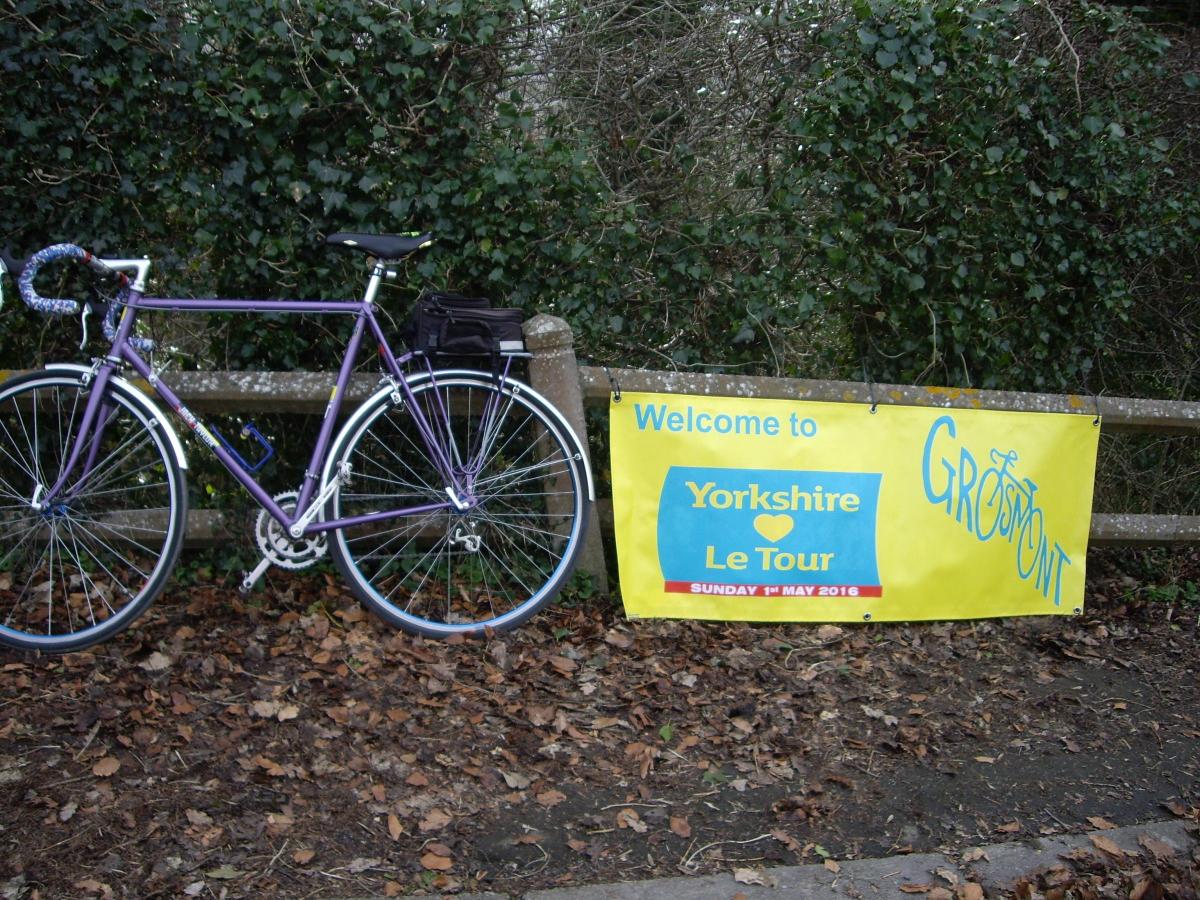
FEATURING British and Continental teams of professional cyclists, the Tour de Yorkshire again visits our region this year. For readers in Hambleton and Ryedale, the best day to see the race may be the third and final stage on Sunday, May 1.
Starting just south of Middlesbrough, the route takes the riders to Northallerton and Thirsk, before climbing Sutton Bank, and descending via Helmsley to Kirkbymoorside. Here the route swings north to climb up Blakey Ridge, descending again into Esk Dale and following the valley, east to Whitby. Climbs then follow at Robin Hood's Bay and Harwood Dale, before the finish in Scarborough.
The official website, letour.yorkshire.com gives the distance as 198km, or 124 miles if you prefer.
I’m going to tackle the second half of the full professional route, from Kirkbymoorside to Scarborough. I’m still going to break that down again into two more manageable chunks. So this month I’ll tell you about the route as far as Whitby. In next month’s issue, I’ll cover Whitby to the finish in Scarborough.
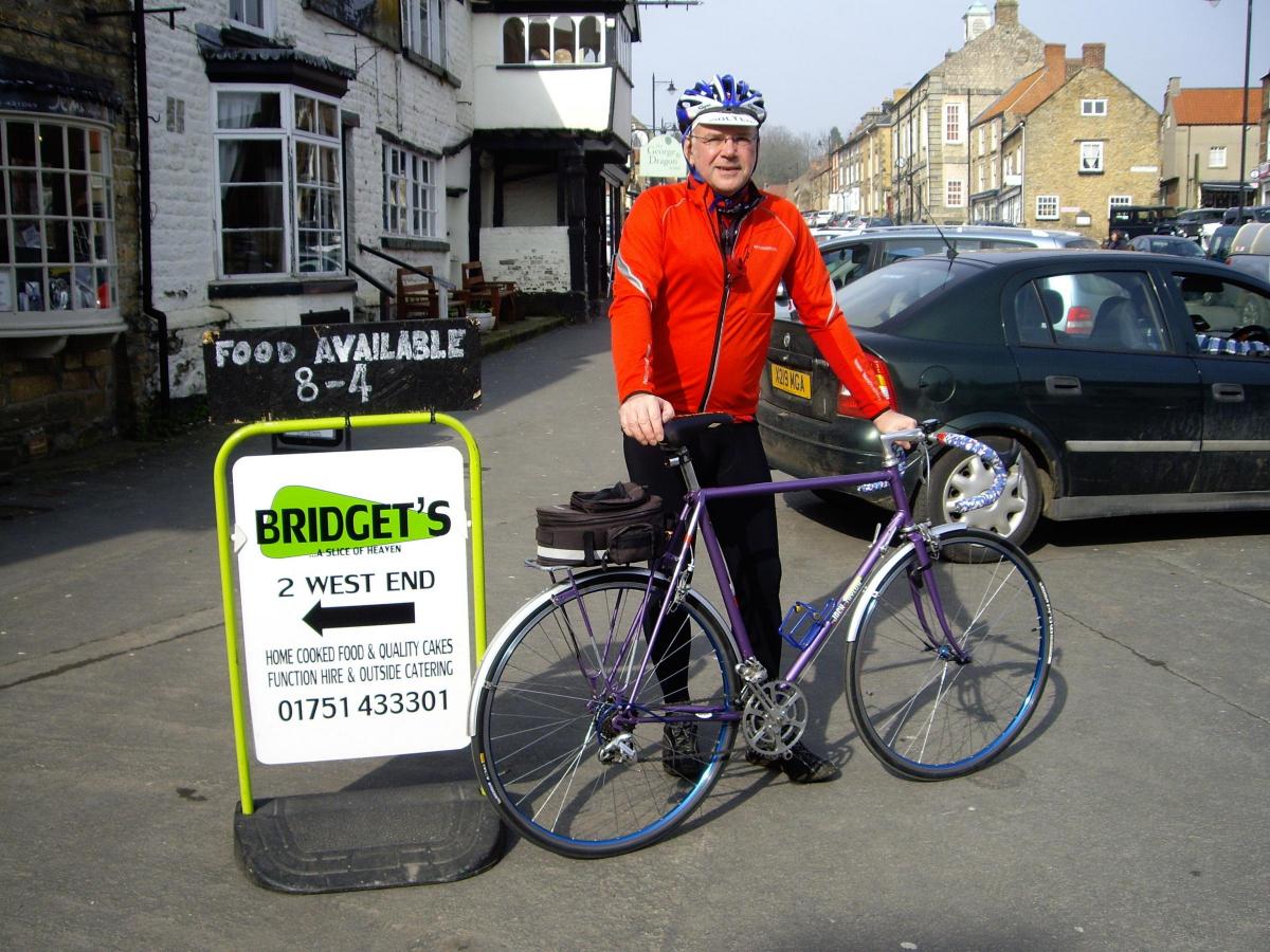
Start in Kirkbymoorside Market Place, where there’s a good choice of eateries. I tried and can recommend Bridget’s cafe. The race also has a feed zone at Kirkbymoorside (knife and fork symbol on the race map) so a cooked breakfast seemed appropriate. Then south to join the main A170 where left, direction Scarborough.
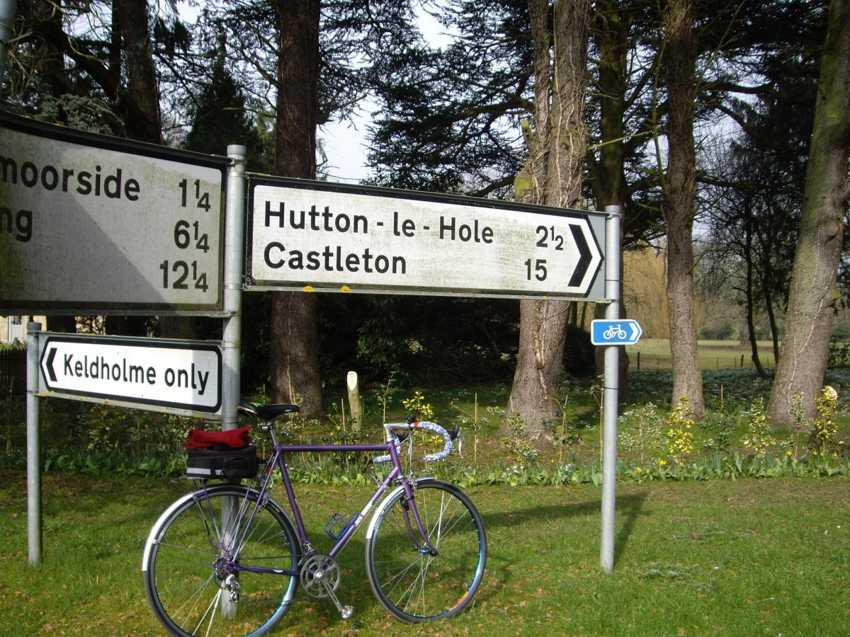
Watch for sign to Keldholme (only) on the left, and take this (it is a through road, despite what the sign suggests) rather than staying on the main road for a later turn which will be followed by the race route in about half a mile.
At three points in today’s ride, I’ll suggest quieter, safer roads than will be followed by the race, which will, of course, benefit from road closures. We don’t have that pleasure. I’ll be clear where these options arise, so you can make your own choice.
So whichever way you arrive at Keldholme, the next sign to look out for is for Hutton-le-Hole. Two miles of gentle climb, then a short descent into the village. More cafe opportunities if you’ve not eaten earlier. Keep straight on through the village and the real climbing starts here.
I had a total of seven and a half miles on my computer by the time the road levelled off on Blakey Ridge at about 350 metres altitude. Points on offer to the racers here, so congratulate yourself on conquering the Cote de Blakey Ridge.
Look half right, into the valley of Rosedale, and you’ll see a faint horizontal line half-way down the facing hillside.
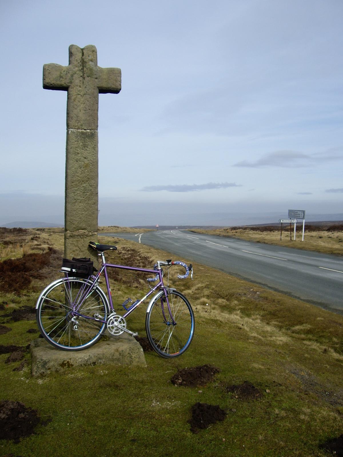
This is the route of the old ironstone railway, which ran all the way down to Middlesbrough. The Lion Inn is then passed on the left, before you arrive at the stone Ralph’s Cross, traditionally marking the top of the moor.
From here it’s four miles all downhill into Castleton. Depending on the time you arrive, I can recommend the Downe Arms, on the right, towards the bottom of the high street. I resisted and pressed on to Danby (just follow the road, avoiding any turn offs).
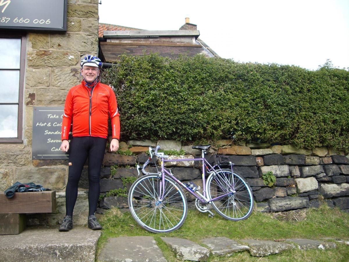
Watch for sand and gravel on the bridge as you enter the village. Here give way at cross road (Duke of Wellington pub facing you) and cross to the right of the pub, signed for Lealholm, four miles. Just past Danby village shop, look left up the grass bank to spot Stonehouse bakery and cafe, where I enjoyed a mug of tea in the sunshine.
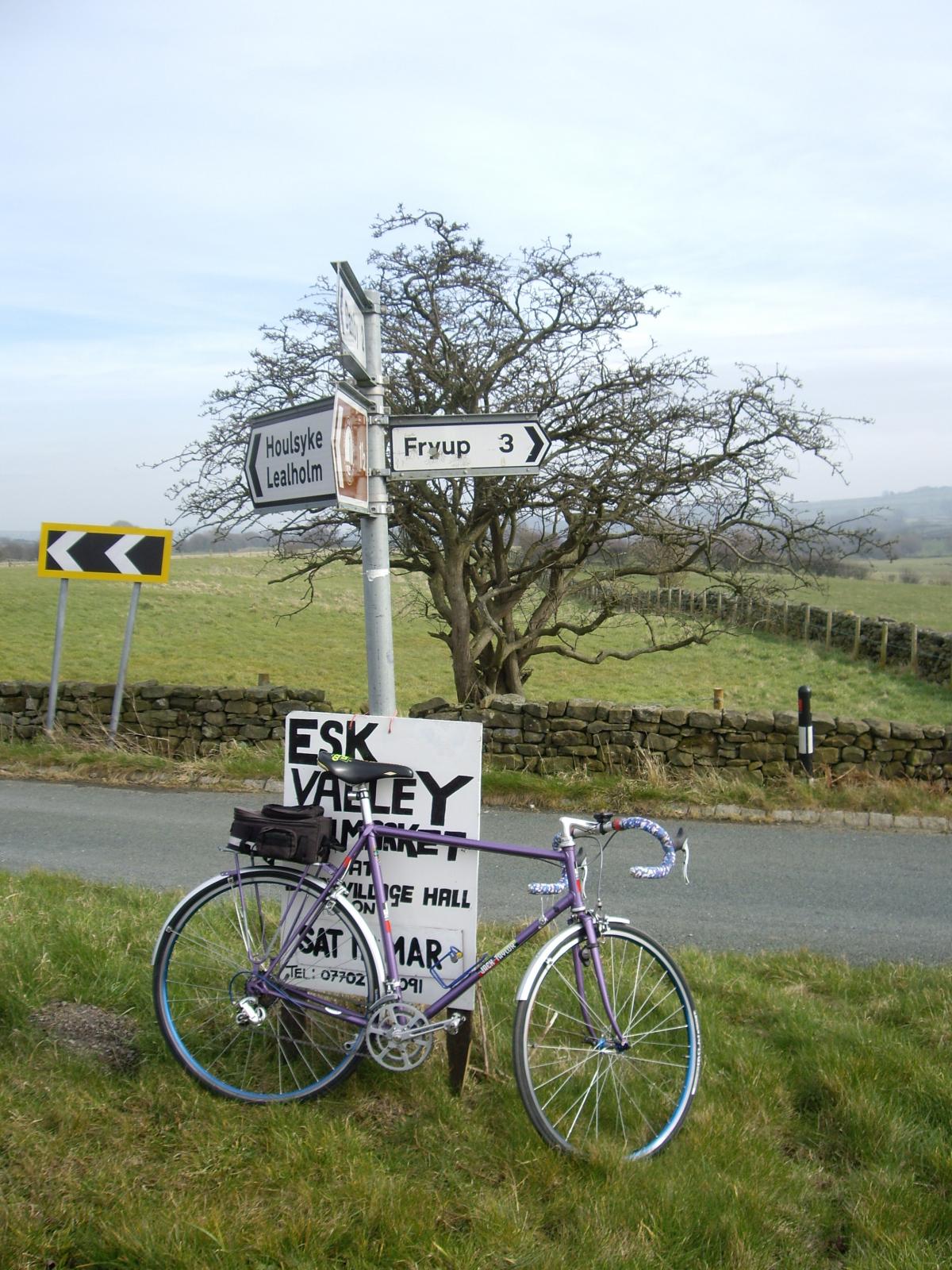
A short climb out of Danby, then descend with care to a sharp bend right and pass Danby Lodge (National Park information and cafe) on right. Pass beneath the railway and curve left. Then in half a mile watch for small turning to right, signed for Fryup, three miles.
Take this turn to cross the River Esk, and then left at T-junction, signed Glaisdale 3. Avoiding a succession of minor turnings, continue towards Glaisdale. Give way at a T-junction, where right, for the last mile into the village. Descend out of Glaisdale, curving left, past tennis courts, and continue down, passing railway station and under the line, to arrive at the bottom of Limber Hill. It’s always worrying when hills have names.
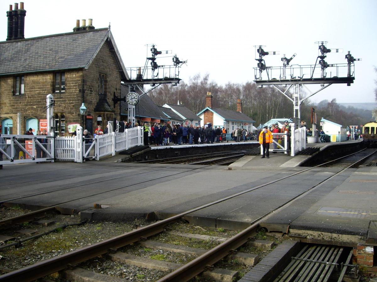
At the top of the hill, avoid a sign for Egton Bridge, but continue straight on instead to plain old Egton. Here go right at T-junction (again signed for Egton Bridge) but the quickly left, signed Grosmont. A steep descent, with blind bends, follows. Inadvertently, I’d picked the day that the Flying Scotsman arrived on the North Yorkshire Moors Railway. I joined the crowds to await the arrival of the 15.00 from Pickering.
A steep climb starts immediately over the level crossing. At the end of the village, the race route takes the junction off to the right, signed for Goathland, and a 33 per cent hill. So here’s a choice: take this steep climb, up to the A169 (about two miles) where left and descend the notorious Blue Bank, into Sleights. Or, take the scenic (and flatter) left fork out of Grosmont, signed direct to Sleights. Here, turn left onto the A169 and you have rejoined the race route.
Descend through Sleights, and cross the River Esk, then immediate right into Briggswath (the B1410) and towards Ruswarp. A flat mile and a half along the river bank follows, before reaching the B1416 in Ruswarp at a T-junction. Options now arise. First, is an opportunity for refreshment at the Bridge Inn, close to the railway crossing and river. Second, is to follow the race route, which goes left at the T junction, climbing up to the A171. Here, right towards Whitby, following subsequent signs (A174) for the town centre and railway station. Past the station, cross the swing bridge, and curve right, along the quayside. In a quarter mile, watch for the sign to Abbey Headland (parking), and take the sharp left here to climb up to the race sprint point, just before the allotments. The painted line across the road still survives from last year’s race. Carry on ahead for a few hundred yards, and you’ll see the Abbey car park over the wall to the left.
Personally, I’ll suggest an alternative starting from the T junction in Ruswarp. Go right here and cross the railway and river in quick succession. Then immediate left. This is Glen Esk Road, and the river should now be just over the hedge to your left. It’s narrow and lumpy in places so take care on bends and don’t be afraid to have a little walk. I know I did! Eventually, you meet the main A171 at a staggered junction. Cross with care, and a short descent brings to to the turn off (now on your right) for the Abbey Headland.
PANEL
Date of ride: March 12, 2016
The map: Ordnance Survey Landranger. Number 94 Whitby and Esk Dale
The pub: Bridge Inn, Ruswarp, Whitby, YO21 1NJ. Tel. 01947 602780, facebook.com/The-Bridge-Inn, open noon to midnight. Many others in Whitby to choose from at the end of the ride.
The bike: Classic 1976 Jack Taylor, Tour of Britain model
Distance: 35 miles.
Car parking: Limited roadside parking on Market Place, Kirkbymoorside (or follow sign for pay and display). Whitby: follow sign for Abbey Headland (YO22 4EY)


Comments: Our rules
We want our comments to be a lively and valuable part of our community - a place where readers can debate and engage with the most important local issues. The ability to comment on our stories is a privilege, not a right, however, and that privilege may be withdrawn if it is abused or misused.
Please report any comments that break our rules.
Read the rules here