
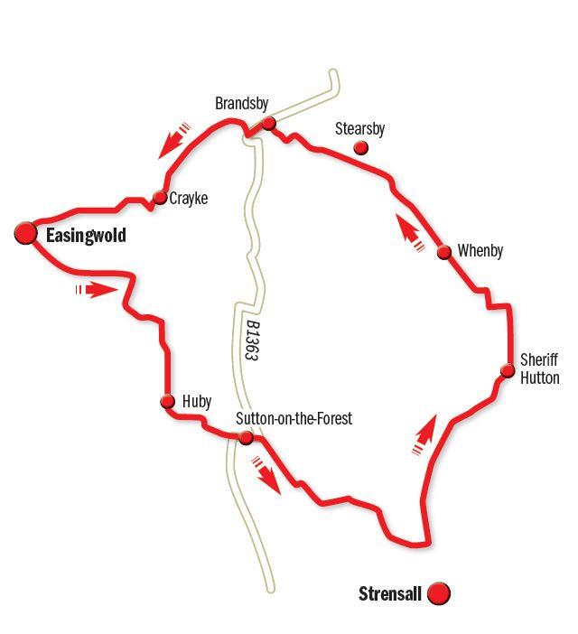
THIS month’s ride is a circular route. I’m starting in Easingwold, with the village of Sheriff Hutton as the furthest point.
However, as this is a circular route you can just as easily start and finish in Sheriff Hutton if you wish.
Start in Long Street, the main road through Easingwold, and where you’ll find ample on-street parking. Pre-ride fuelling at Clarks Cafe in Long Street (right hand side as you head down Long Street, in direction of York). Leaving the cafe, turn right and quickly take the minor road left, direction Stillington.
In one and a half miles take the first road on the right, Green Lane. This is one of my favourite little quiet stretches. Follow this as it curves left through trees and then give way at crossroads. There’s no road sign here, but turn right. To reassure yourself that you are on the correct road, watch out for a smallholding named Fox Covert, on the left at the next double bend. Through Huby village, passing the New Inn and village shop on the right, then keep left, signed Sutton 1½. Keep straight ahead in Sutton, joining Main Street, (the B1363, direction Helmsley).
At the end of Main Street, there’s a mini-roundabout, where turn right, (south), onto Carr Lane, signed Strensall four miles. Resist the temptation to take the next left, which is signed to Sheriff Hutton, but instead continue straight ahead, signed for York. All along here to your left you are skirting the edge of what was once RAF East Moor, flying Halifax bombers in the Second World War and for some time operated by the Royal Canadian Air Force. Take the next left which comes after about a mile out of Sutton, (again signed for Strensall).
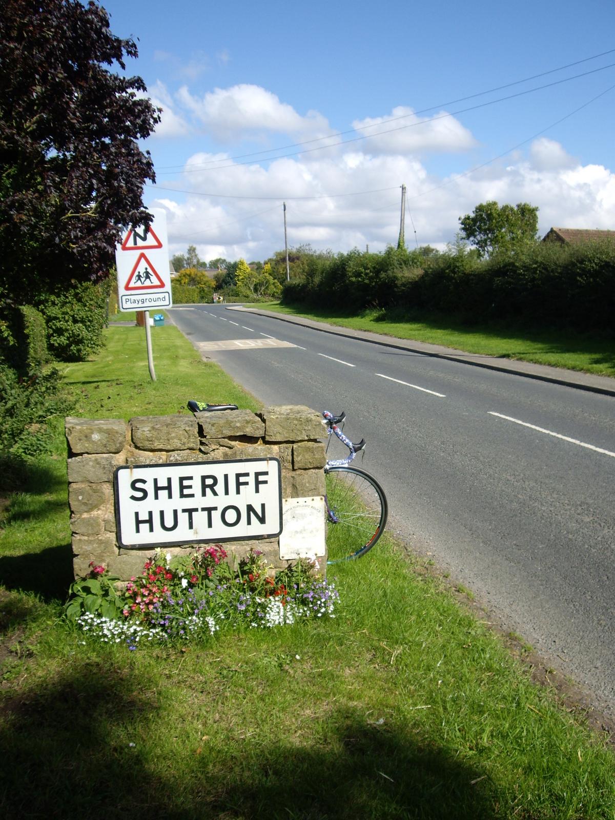
This is a nice quiet single track road, but do listen for the occasional vehicle approaching from behind. In two miles, meet a T-junction where left (north) in direction of Sheriff Hutton, three and a quarter miles. The village is built on a ridge, so there’s a small climb, but nothing serious.
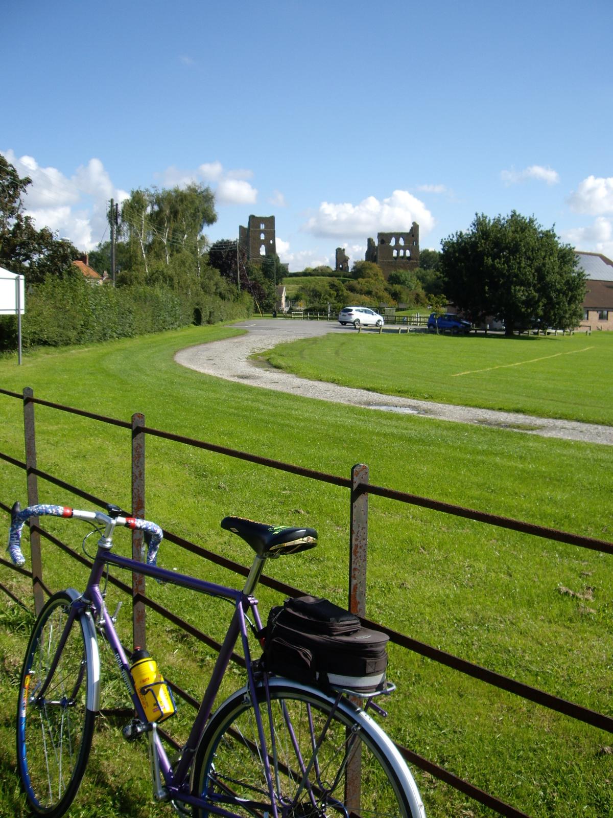
As you approach the village sign, over the hedge to the right you’ll spot the remains of the castle built by the Neville family (completed 1398). Pass the Highwayman Inn to your left, and then turn right onto Main Street.
You might well wonder if there was ever an actual person, Sheriff Hutton – as in Sheriff of Nottingham. Well yes, effectively there was. The earlier Norman castle, (pre-dating the ruins you’ve just seen) at the far eastern end of the village by the churchyard, was built by the de Bulmer family on land given to them by William the Conqueror. Hutton stems from the Old English hoh (a projecting piece of land) and tun (a farmstead). The sheriff prefix results from Bertram de Bulmer being Sheriff of York in 1115. So Bertram was indeed the sheriff.
Seek out the Norman church, at the far end of Main Street, off to the right. It looks like you are entering the private driveway of someone’s house, but it is a public footpath, so carry on, on foot. St Helen and the Holy Cross is unique among English village churches in that it contains the tomb of a member of the royal family, Edward, Prince of Wales, son of King Richard III. You’ll recall the recent discovery of Richard III’s body under a car park in Leicester? He’d had an ignominious burial following his defeat in battle. Ironically, his son Edward had also already had an unusual burial.
Sheriff Hutton, along with York, was an important centre of local administration. Richard III visited often. Unfortunately, his son Edward died at Middleham in Wensleydale, in 1484, aged 11. It may be that Richard buried Edward at Sheriff Hutton as a temporary measure, with a view to a more elaborate burial in York Minster being arranged later. Richards’s plans were however overtaken by events, as Richard himself was killed the very next year, 1485, at the Battle of Bosworth.
The rest, as they say, is history, and Edward, Prince of Wales, remains at rest in Sheriff Hutton.
Inside the church, you’ll find the small tomb to the left hand side. Look above it for the small stained glass window, the Sun in Splendour, the badge of the Plantagenet Kings, and a symbol used by Richard III.
There are two pubs in Sheriff Hutton, and I’d checked out via the internet that both were open. However, such research is not infallible and both were closed this Thursday lunchtime. I was tempted by Quarmby’s Deli & Cafe in the centre of the village, but I decided to press on in search of a pint instead.
Leave the church, retracing along Main Street, to the crossroads near the Highwayman & Quarmby’s, where right on to New Lane. Quickly reaching a mini roundabout, straight ahead, north, signed Terrington four miles. Descend, and after one mile, left on to Whenby Lane, signed Brandsby five miles.
This becomes single track with few passing places. Through the hamlet of Whenby and climb gently for about a mile. Pause just before the top and there’s a view of York Minster away to the left. Passing the next hamlet of Stearsby, which is off to the right, you’ll then catch your first sight of Brandsby Hall straight ahead, dramatically covered with red autumnal ivy this September lunchtime. Enjoy the view now, as when you shortly get to the front gates of the hall, it is obscured. Left on to the B1363 for a few yards, direction York, but quickly right off the B road again, now in direction of Crayke.
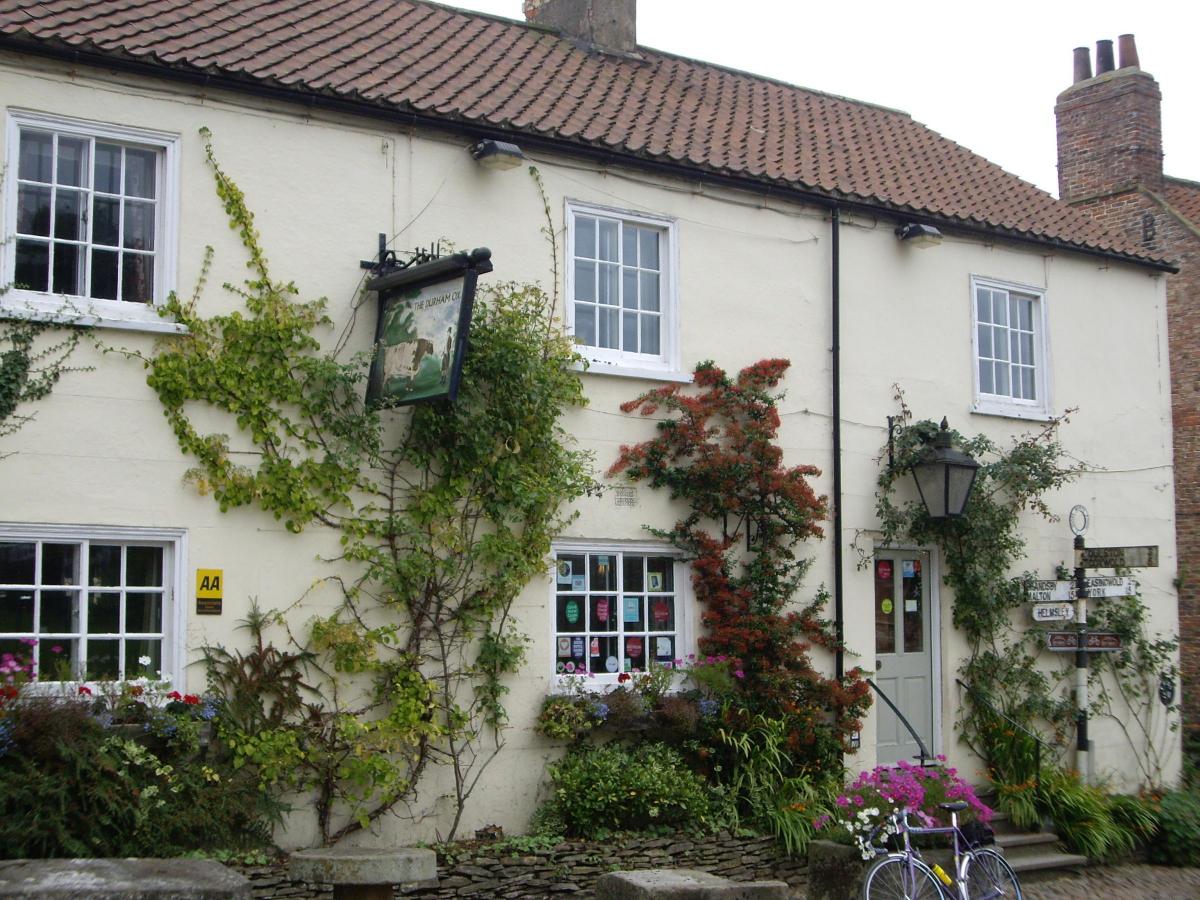
A short climb into the village is not too stressful, and the reduction in speed allowed me to admire the cottage frontages of river cobbles, looking very much like that old 1970’s TV ad for Hovis, featuring Gold Hill in Shaftsbury. At the top was the Durham Ox. Very pleasant beer garden up the alleyway to the rear. I had some York Brewery Guzzler, (3.6 per cent) with a Cryer & Scott Cheddar and tomato chutney sandwich, including small portion of fries, salad and even a soup ‘shot’ (that’s soup in an expresso cup) all for about £9. Timothy Taylor’s Boltmaker was also on offer.
Continue downhill and watch for junction to right for the final two-mile run into Easingwold.
Ride details Date of ride: Thursday, September 17.
The map: Ordnance Survey Landranger. Number 100 Malton, Pickering
The cafe: Clarks, 195 Long Street, Easingwold YO61 3JB (8am to 3pm, closed Sundays)
The pub: The Durham Ox, Crayke YO61 4TE, 01347 821506, thedurhamox.com
The bike: 1976 Jack Taylor, Tour of Britain model. Hand built in Stockton-on-Tees
Distance: 25 miles Car parking: Long Street, Easingwold (Free on-street)


Comments: Our rules
We want our comments to be a lively and valuable part of our community - a place where readers can debate and engage with the most important local issues. The ability to comment on our stories is a privilege, not a right, however, and that privilege may be withdrawn if it is abused or misused.
Please report any comments that break our rules.
Read the rules hereComments are closed on this article