
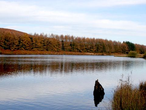
OSMOTHERLEY’S Cod Beck Reservoir is a magnet off the A19, a hotspot conveniently out of sight and sound of the village. It is the countryside of urban legend and consequently is furnished by more signs than an inner city ring road.
These prohibition boards are largely to preserve the lives of those who would camp, light fires, drink and then swim and cavort in the deadly cold moors water. Walkers are welcome though. Fifteen Canada geese floated sedately on the surface and Labradors leapt in after sticks. This is a doggy walk.
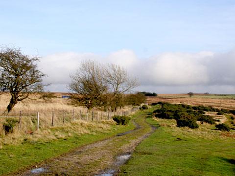
We left the reservoir and warmed up on a climb on a ‘Red Route’, number 65 on the National Cycle Network. It didn’t seem heavily used, a sign for cyclists gave Middlesbrough at 19 miles and York at 46; as the crow flies it’s ten and 30 miles.
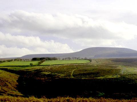
Eight hundred feet of altitude brought the edge of the moors and lovely colours; there was grouse shooting so the moors might have been closed. On pastures sheep grazed and starlings grubbed around mole hills. And now there were views: on a clear day you see to the Dales, and on our bright day Black Hambleton was a characteristically dark smooth mass.
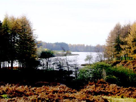
The next track was very pretty with ancient thorns and took us to a bench with a view down to Osmotherley. It’s the Cleveland Way from here – a bridge over Cod Beck, worn stone steps, new flagstones, and a back alley where one is asked to be quiet and not drop mud.
The alley brings you out bang in the middle of the village and within sight of loos, food, drink and the walking shop, where we talked about routes and bought waterproofing.
A narrow road goes out of the village to the reservoir, a mile to avoid on foot, but we needed a short section of it.
As luck would have it, a shiny black pickup with blacked out windows lurched by and, with a yell, an occupant threw a drinks bottle at me. And for a moment I thought that the reservoir alcohol and swimming rules could, with advantage, be relaxed for the festive season.
But that was just an interlude, and my response a spasm of improper social Darwinism and we cheered up as the caravan site was hardly visible. The Osmotherley Youth Hostel is en route, in an old mill building on Cod Beck; the mill was used for flax a man told us, also saying something about early aircraft wings. The mill weir is good and regular, vertical and noisy.
We weaved through woods of moss and old walls, an avenue of cypress guided us in and we reached the 80-foot high 1953 reservoir dam. The Canada geese looked to have hardly moved except maybe to paddle from the shadow line of the late low sun.
Fact file
Distance: Five miles.
General location: North York Moors.
Start: Cod Beck Reservoir.
Right of way: Public and permissive.
Dogs: Legal.
Date walked: November 2009.
Road route: Via A19.
Car parking: Car parks north of reservoir.
Lavatories: Osmotherley.
Refreshments: Osmotherley.
Tourist and public transport information: Sutton Bank 01845 597426.
Map: OS Explorer OL26 North York Moors western.
Terrain: Mixed.
Difficulty: Quite easy.
Please observe the Country Code and park sensibly. While every effort is made to provide accurate information, walkers set out at their own risk.
Directions
When in doubt look at the map. Check your position at each point.
Keep straight on unless otherwise directed.
1 From main car park north of reservoir, south on path over rise, down to stepping stones over stream, if these flooded use other stepping stones or bridge upstream. Twenty yards, snickelgate into trees (signs), steps, surfaced path along east bank of reservoir. Just before dam, path swings left uphill 100 yards.
2 Left at junction to track uphill.
3 Left at T-junction with main track (sign 65), 200 yards, track on right uphill (no sign).
4 Right at T-junction at top edge of wood (cycle 65 sign), track.
5 After fields, track on right (fingerpost), moor edge.
6 Stile at wall corner (waymarked post), into field and stay by wall to your left, fieldgate (waymark), downhill, two fence ‘gaps’ and stile/fieldgate. Left to grassy track, pass bench.
7 Squeezer on right in wall 100 yards before small barn (fingerpost Cleveland Way), ten yards, join drive downhill. Fork right before house (fingerpost) to path (waymarked post), fieldgate (waymark), gate (waymark), pass bench.
8 Cross track in valley bottom, path into trees, gated footbridge (waymark), steps uphill, snickelgate to fenced and flagged path (waymark), cross road to alley between houses in Osmotherley (signs). Right to road through village (mostly pavement).
9 Metalled drive on right (YHA/caravan park signs). Bridge over Cod Beck. After white youth hostel fork left (waymark) to path uphill in edge of woods, snickelgate (Yorkshire Water sign).
10 In wood at stone walls and ruins, path on left. Left at junction to rejoin outward route to dam, cross dam and immediately path on right to car park.


Comments: Our rules
We want our comments to be a lively and valuable part of our community - a place where readers can debate and engage with the most important local issues. The ability to comment on our stories is a privilege, not a right, however, and that privilege may be withdrawn if it is abused or misused.
Please report any comments that break our rules.
Read the rules hereComments are closed on this article