
TURMOIL and tragedy are etched into the history of Tockwith.
There is little evidence of unrest on this sunny spring day, peace and tranquillity being more the watchwords on this circular walk taking in the well-kept village near York and the nearby River Nidd.
Hard as it is to imagine, wind back 372 years and Tockwith was at the centre of the English Civil War, occupied by Thomas Fairfax's Parliamentarian army on the eve of the pivotal Battle of Marston Moor.
On July 2, 1644, the Parliamentarian cavalry under Oliver Cromwell routed the Royalists in a decisive battle on fields between Tockwith and Long Marston, a bloody battle which left 4,500 men dead and effectively drove the Royalists from the north of England.
If that was the turmoil, tragedy struck the village shortly after the end of the Second World War, when a Stirling Bomber bound for Marston Moor airfield crashed into Marston Road at 1.34am on October 9, 1945.
Tockwith postmaster Arthur William Carlill and all six aircraft crew members were killed, and 19 houses were wrecked.
A memorial was unveiled in the village in October last year to mark the 70th anniversary of the crash, and that impressive structure is on our return route.
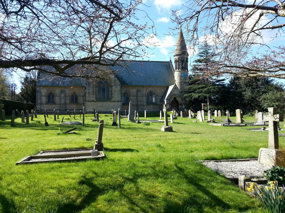
We set out in the opposite direction, past the immaculately manicured grounds of the Church of the Epiphany on the road to Cattal.
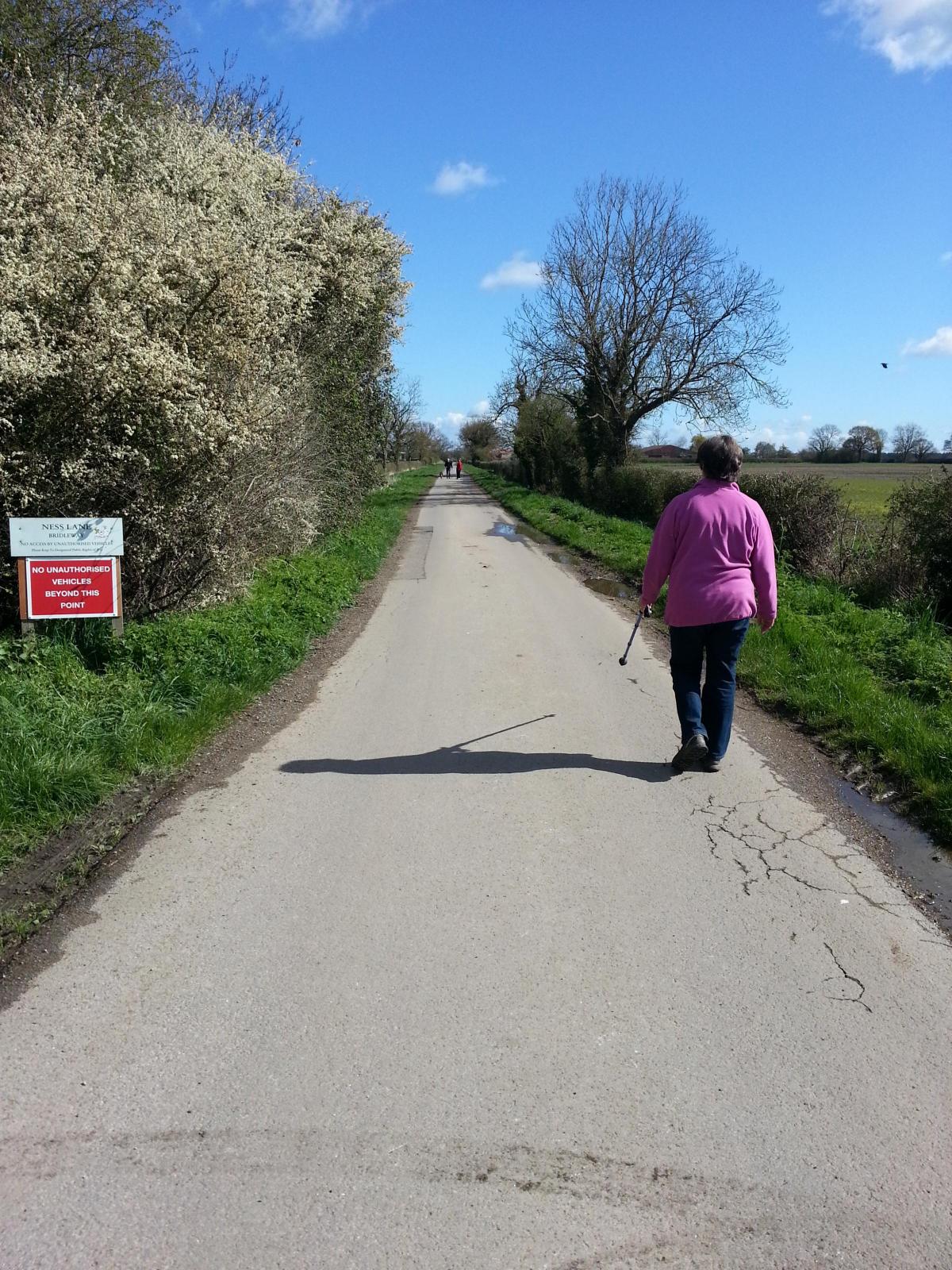
After several friendly "good mornings" on the main street, we turn right into Ness Lane, a south-west to north-east track that neatly dissects our walk.
The loss of hedgerows is always a burning issue in the countryside but here they abound, alive with wildlife to emphasis their value.
Keep your eyes peeled for the golden flash of a yellowhammer darting across the tracks or dancing among the branches of the miles of hedges criss-crossing this area.
We caught a fleeting glimpse of this delightful hedgerow dweller between Ness Lane and Whinnythwaite Field.
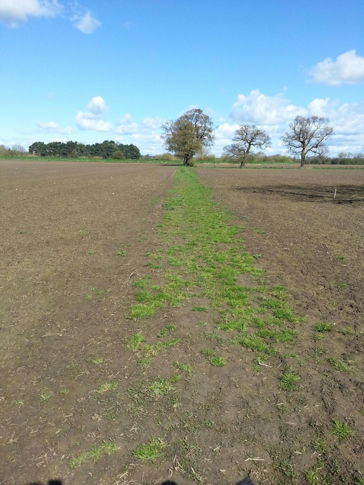
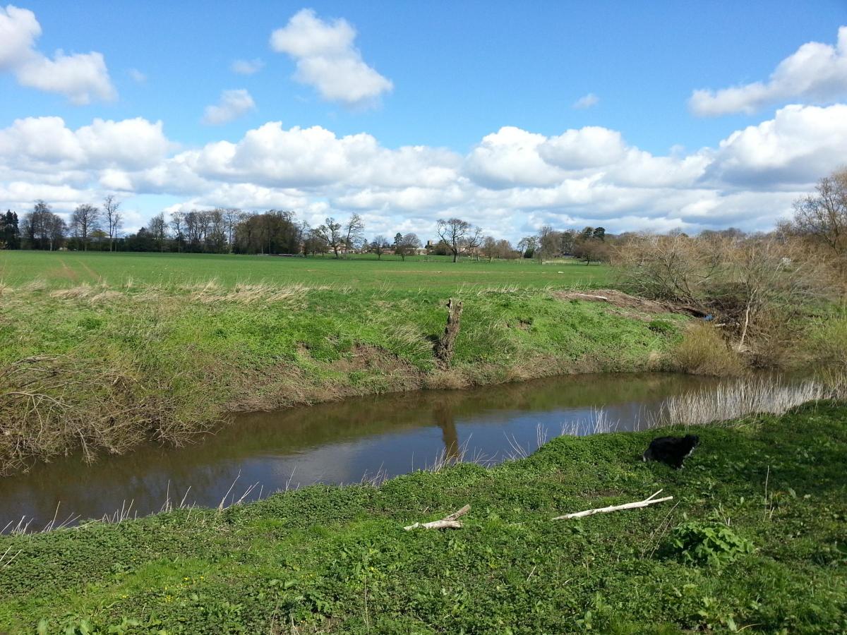
Our five and a half mile route is awash with evidence of a winter full to the brim with flooding; browned muddy fields, still swollen ditches, and tree branches resting wherever flood water carried them.
Having negotiated one of those boggy fields, the route is elevated onto the flood bank next to the Nidd, and the river then arcs around the raised hump of Tockwith Ness.
We've caught the best weather of the day, giving us superb views across the river to the church at Kirk Hammerton as well as more distant corners of the Vale of York.
Where once there was cattle in the fields on the Tockwith bank, there is now evidence of widespread tree planting - albeit in its early stages.
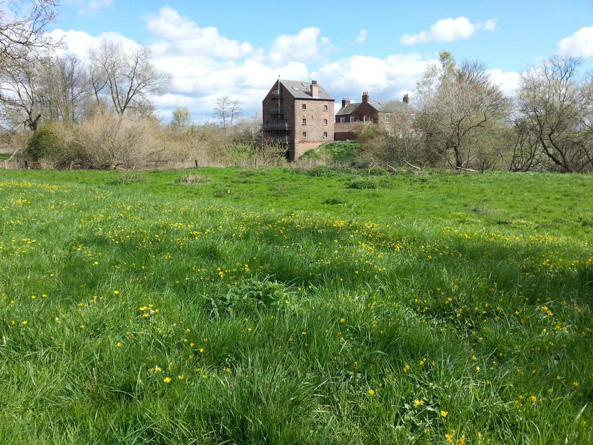
The old mill on the far bank cuts an imposing figure as the river curves back towards the village, and this is our cue to head back to hedge-lined tracks.
Skewkirk Hall is at first expertly screened by evergreens before revealing its full glory as we regain Ness Lane at its northerly extreme.
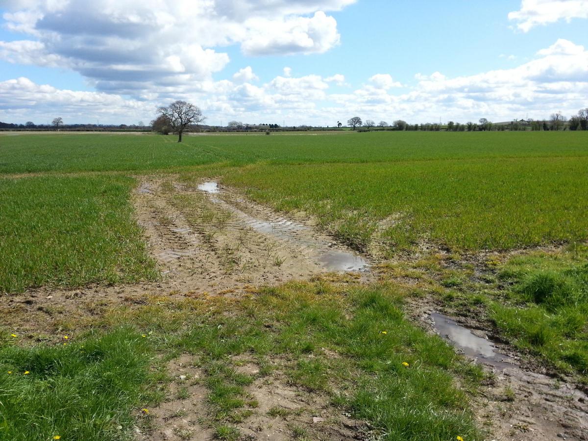
Tockwith Moor is traversed via a slushy Moor Lane before Kendal Lane carries us back to the village, with views across the battle fields of Marston Moor to our left.
The Stirling Bomber crash memorial - a striking metal sculpture - takes pride of place in the main street and is fitting tribute to those who died in the tragedy.
The village itself is a fascinating mix of character cottages and grand houses, and boasts a choice of two good pubs - the Spotted Ox and the Boot & Shoe - so it is worth spending some time here to reflect on a superb spring walk.
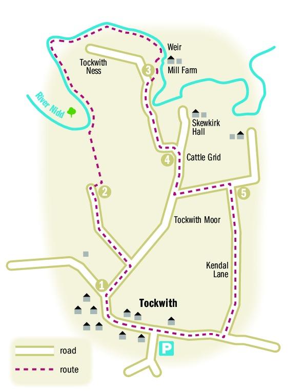
ROUTE DETAILS
* Walk west away from the centre of the village on Westfield Road towards Cattal and Cowthorpe, passing the impressive church on your left. Follow the main road around to the right and, where it turns left, cross the road and at a public bridleway sign go right along Ness Lane.
* After a few hundred yards turn left at a public footpath fingerpost and follow the hedge-lined track for almost half a mile. Just before a farm gate and barn, turn right to follow a public footpath sign along a hedge-lined grass track. Turn left into a field, cross diagonally to a gate at the far side.
* Emerge into a field and go straight ahead towards a large lone tree and a raised bank next to the River Nidd. Go through a gate, climb the bank and turn right. Follow the curve of the river to the right for about a mile, crossing a series of styles.
* Look out for an old mill on the opposite bank. About 100 yards after passing it, where the remains of two styles can seen on the left, turn right across the field to a gate. Go through the gate onto a hedge-lined track. Go left and follow track which eventually bears left to a junction.
* Turn right back onto Ness Lane and, shortly before reaching a cream coloured house, turn left to a gate onto the grassy track of Moor Lane. Go straight ahead to another gate at the far end. Go through and turn right onto Kendal Lane. Follow lane back to the main road through Tockwith. Turn right and follow road back into the centre of the village.
FACTFILE
Distance: five and a half miles.
Parking: roadside parking in Tockwith.
Refreshments: village shop in Tockwith and two pubs, the Spotted Ox and the Boot & Shoe.
Map: Ordnance Survey Explorer 289 Leeds.


Comments: Our rules
We want our comments to be a lively and valuable part of our community - a place where readers can debate and engage with the most important local issues. The ability to comment on our stories is a privilege, not a right, however, and that privilege may be withdrawn if it is abused or misused.
Please report any comments that break our rules.
Read the rules here