
GEORGE WILKINSON enjoys a pleasant stretch in and out of Pateley Bridge on the Nidderdale Way.
PATELEY BRIDGE spring rain encouraged us into a café, where we lurked, over a tasty toastie, discussing in hushed tones our best options for underwear and waterproofs, then making the adjustments.
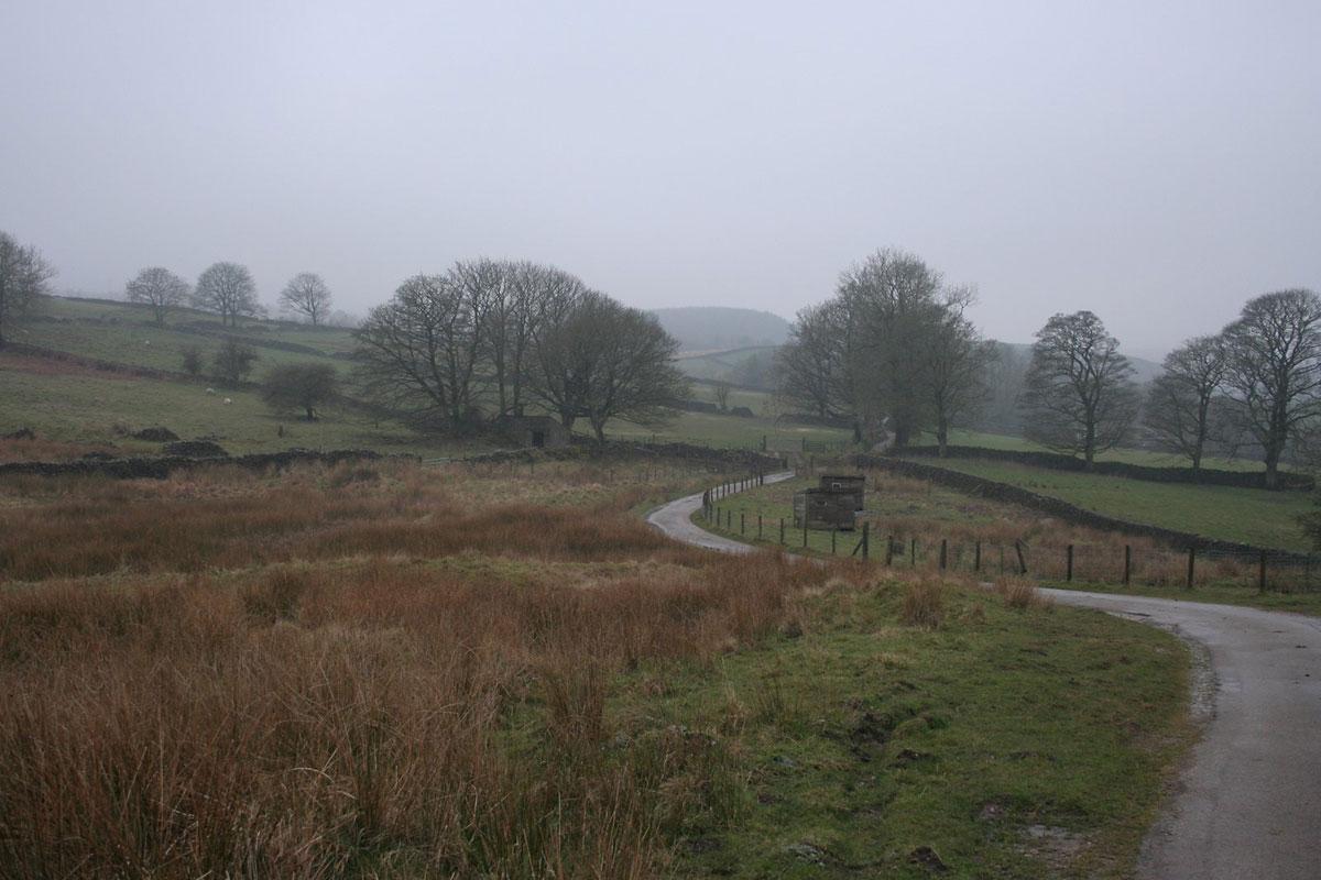
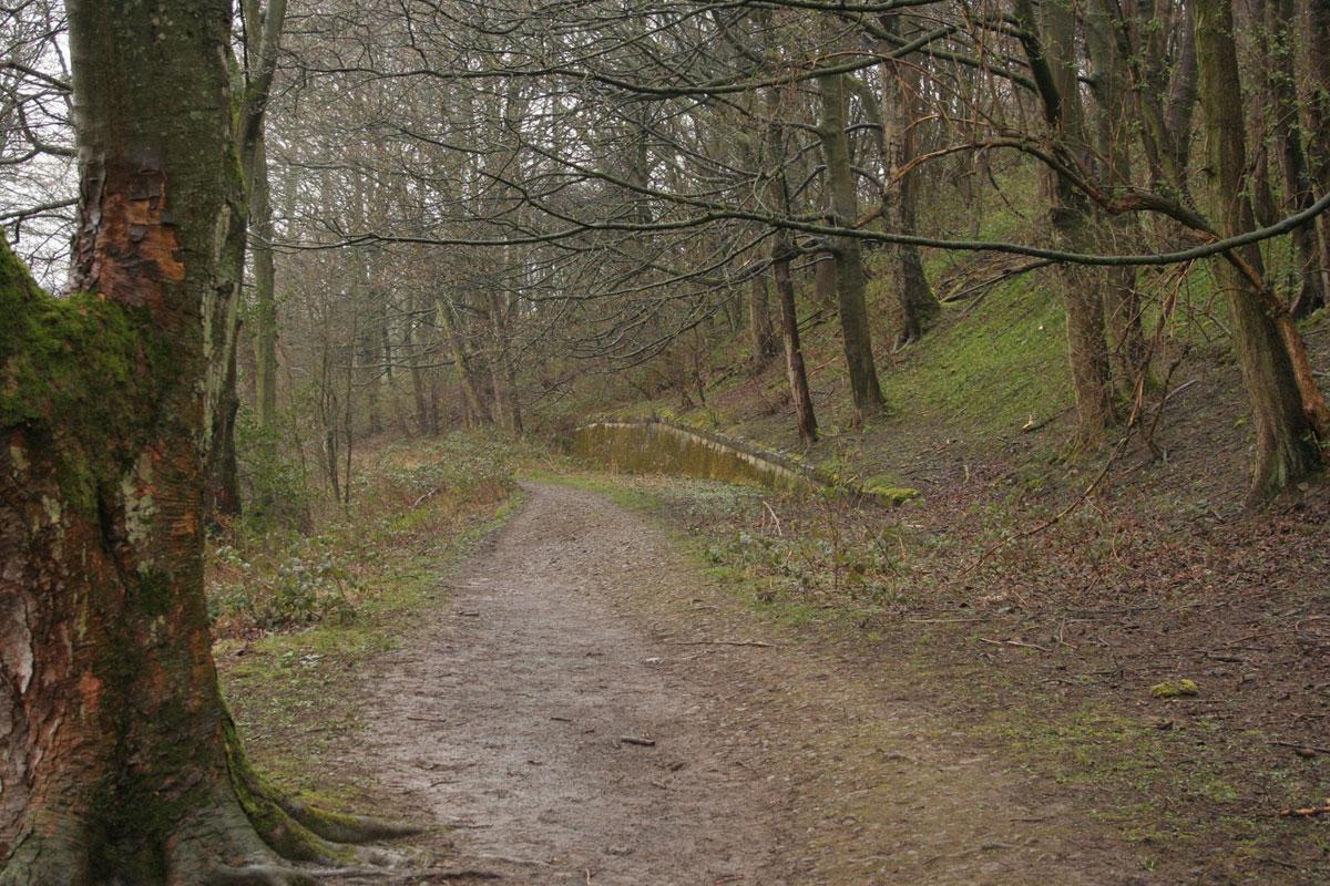
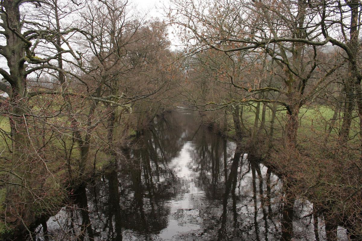
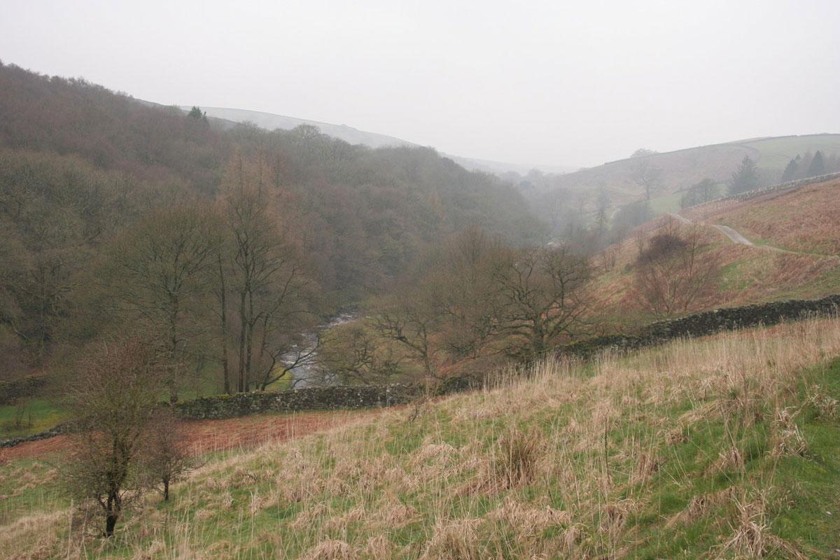
Once under way, we built up a head of steam along the Nidderdale Way, under the alder trees, on an old railway track and alongside the River Nidd. The river was glassy, tamed by the reservoirs up the valley, but Foster Beck, that we join later, injected quite a gush.
Over the river from the hamlet of Wass there’s a short sharp climb up to Spring Hill where curlews called and there’s a glimpse of Gouthwaite Reservoir.
This and other reservoirs kept Nidderdale out of the Dales National Park, or so the story goes. We were carrying a different prejudice; one festering since 1998 when we were repulsed by a mile of caravans chock-a-block along Foster Beck.
So, to avoid any repeat, we bypassed them and came down from Spring Hill not on the Nidderdale Way but angling across some sweeping pastures where a shepherd rode a quad bike and his sheepdog rode pillion. But note, the fieldgates are industrial and there is the pleasure of negotiating clanky sheep pens.
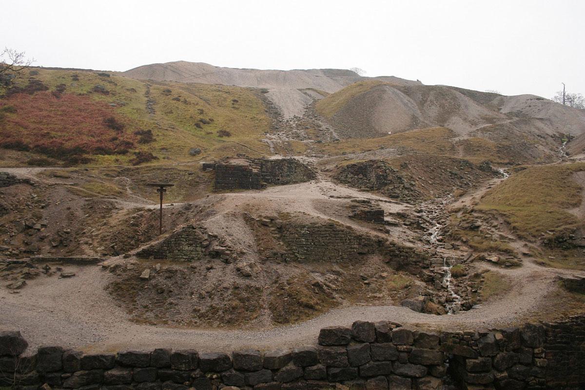
Beyond the caravans, Foster Beck ran fast with the fresh name of Ashfold Side Beck. It’s a sharp valley, quite lovely until we reached the edge of lead mining land of Greenhow Hill.
The change is sudden and arresting. A stone arch remains, a rusty drive shaft stands free, and grey mounds of spoil are bare and laced with impromptu paths. The names here transmit the contemporary cares.
We walked over the Providence Mine, adjacent was the Prosperous Mine and together they produced 200 tons of lead a year between 1837 and 1845, working the profit and loss of the Perseverance Level and the Wonderful Level.
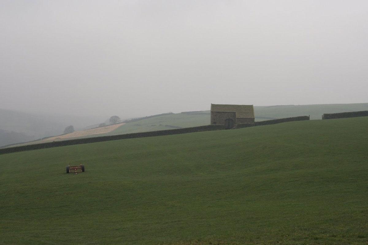
It is nice to finish with tranquillity and the Nidderdale Way leads back to Pateley Bridge for a smooth hour of walking, with a farm or a cottage now and then views over Ladies Riggs; just the way for the evening light.
Directions
When in doubt look at the map. Check your position at each point. Keep straight on unless otherwise directed. (wm=waymark, fp=fingerpost).
1. From bridge over River Nidd, take Mill Lane (fp Nidderdale Way/Wath) to walled path on right, then between gardens, then riverside, 4 snickelgates and squeezer. Railway line track bed.
2. A few hundred yards before Wath’s houses, at inset fence (slightly angled wm), angle 11 o’clock across field, squeezer, cross field, stepstile/footbridge. Left to road, bridge.
3. Cross main road, snickelgate(fp), path uphill, gateway, squeezer, snickelgate (wm), 11 o’clock, snickelgate (wm), uphill to left of tree, snickelgate (wm), cross field to small gate by wall at far end of garden, path by garden, left to track uphill.
4. Right to road uphill, first left (Heathfield, fp Foster Beck).
5. At left-hand bend after buildings and by trees, either: stay on track for 100 yards for Nidderdale Way south via bench, or: as on map, steps on right uphill in trees (fp Ashfold Side), right by wall, track, into yard and to left of barns.
6. Fieldgate by barn at bottom of yard, diagonally across field 300 yards to mid wall fieldgate, diagonally across field to fieldgate, downhill by wall, join track.
7. Double gates into yard (wm), right and through yards, ignore right fork, left to double gates by barn at bottom of last yard. Immediately right across field, gate (wm) near barn, through sheep pens near barn (wm), by wall to your right, fieldgate, ruin. Right-hand gateway of pair (wm), gateway (wm), ruin, diagonally downhill across field to stile (wm).
8. Right to good track (Nidderdale Way), 3 fieldgates.
9. Fork left to path (fp, wm) downhill 100 yards to footbridge. Fork right on narrow path uphill in mining area for about 30 yards, fork left to eroded path in grass straight uphill, becomes track by heather, or use path around on right.
10. At homemade ‘foot path’ sign approximately opposite/ level with some buildings a field away, join or continue on track uphill heading just east of south with heather each side, gateway (wm), straight on at junction ( 3-way fp), 200 yards.
11. Right fork downhill (old broken fp on ground). Track becomes dead-end road.
12. Cross main road (Bewerley), downhill on road, first left, pavement, right and into Pateley Bridge.
Fact file
Distance: Seven miles.
Car parking: Pay and display in Pateley Bridge.
Right of way: Public.
Date walked: March 2014.
Tourist information: Pateley Bridge TIC 01423 711147.
Refreshments: Inns and cafes in Pateley Bridge.
Map: OS Explorer Nidderdale 298.
Terrain: Mixed.
Difficulty: Moderate.
Please observe the Country Code and park sensibly. While every effort is made to provide accurate information, walkers set out at their own risk.


Comments: Our rules
We want our comments to be a lively and valuable part of our community - a place where readers can debate and engage with the most important local issues. The ability to comment on our stories is a privilege, not a right, however, and that privilege may be withdrawn if it is abused or misused.
Please report any comments that break our rules.
Read the rules hereComments are closed on this article