
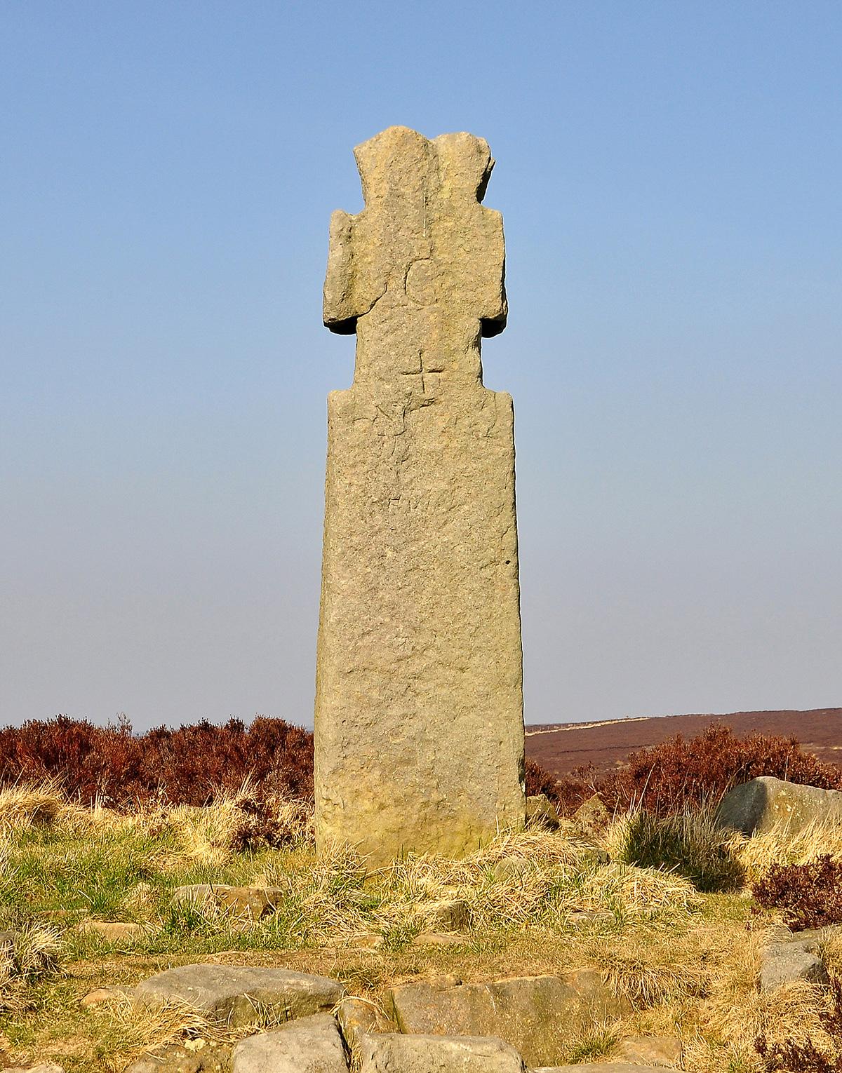
STANDING proud on the North York Moors surrounded by the mists of time is a cross hewn out of solid stone, its name is Lilla Cross.
It was said to have been erected in memory of a Saxon Thane who saved the life of King Edwin of Northumbria.
What I can’t understand is why it was erected at this site. The attempt on the king’s life is recorded as being at his palace on the Yorkshire Wolds which was more than 30 miles away.
Let us take a look at the Anglo Saxon Chronicles to find out what happened at that point in King Edwin’s reign.
It was in 626AD when Quicelm, King of the West Saxons, employed a ruffian by the name of Eumerus to assassinate his deadly enemy Edwin.
Little did he know that this deed would change Edwin’s view of Christianity and bring the religion to his Northumbrian kingdom.
Eumerus, equipped with a long, poisoned-tipped dagger hidden in his robes, arrived at King Edwin’s palace at Goodmanham during the Easter celebrations. He proclaimed to have a message of great importance for Edwin from the West Saxon King Quicelm.
He was allowed into the court and as he approached the king, he swiftly drew his dagger thrusting its deadly blade towards him.
The chronicles say that Thane Lilla saved the king by taking the main blow, but the blade passed all the way through Lilla’s body and penetrated Edwin leaving him injured. The king survived, Lilla died, and another Thane, Forthere, was killed in the fight that ensued.
That same night King Edwin’s daughter was born, and his wife, who was allowed to practice her Christian beliefs in the pagan kingdom, had the babe christened by Bishop Paulinus.
It was then that a strange turn of events took place. The pagan King Edwin, in front of Paulinus, surprisingly gave thanks to God for his life and the birth of his daughter. He then set out to avenge the death of his friend, Lilla.
Whether or not God had a helping hand in the victory we will never know but Edwin advanced on the West Saxon army, completely destroying them and their murderous king.
Edwin was elated with his victory, and on his return, thinking that God had helped him, he renounced the worship of idols and converted to Christianity.
Surprisingly, he had the consent of the wise men who also renounced idol worship, to prove their sincerity and enthusiasm for Christianity the high priest mounted a warhorse, then carrying weapons for battle, he and his fellow priests rushed at the pagan idol, smashing it to pieces and setting fire to the remains.
They named the place where the act of defiance took place Godmanham, which means “a receptacle of gods”. The present church at Goodmanham is built on this site.
In 628AD, Edwin and his niece, Hilda, who was to become St Hilda of Whitby Abbey, were baptised by Paulinus and shortly afterwards thousands of his subjects also converted to the Christian faith.
So what really happened to the mighty Lilla? The Anglo Saxon Chronicles make no further mention of him after his death.
There is no record of a march from the Wolds to the Moors to Lilla Howe and no mention of a memorial.
Some historians say that Edwin, Lilla and his entourage were crossing the moors on their way towards the coast when they were attacked by the assassin, and they buried Lilla on the spot where he was slain.
However, the Chronicles refer to a palace on the Wolds for the killing at what we know today as Goodmanham, which fits in tidily with the destruction of the pagan gods.
So who erected the original cross on the North York Moors? Is today’s cross from the seventh century? Some think it is a later stone. There is no evidence of a Saxon burial under the cross, but jewellery from a later date has been recovered. So where is Lilla buried?
We will never know for certain where the brave warrior was laid to rest, but when you arrive at Lilla Cross see if you can feel anything which just might be still floating around in the mists of time on these lonely moors.
Your route
This month’s walk is a linear route. As there is no public transport from the end of the walk, you will have to arrange to be picked up or leave a car at the May Beck car park in advance.
Leave Ravenscar walking towards Scarborough, not far past the church, turn right along Robin Hood Road, formerly School House Road.
When the road ends, continue straight ahead onto a track. It is not far to a seat on the left. Walk past it, then ignore the blue and yellow waymarks to continue straight on.
In a few paces the track splits. On the right is a private road. You must take the left fork, then turn almost immediately left again onto a narrow, muddy track leading uphill onto the moor. Soon the track forks, go left here following the yellow waymark.
Just a short walk now to the top of the hill and the radio tower. Cross the road here to walk on a wide track across the moor signed as a bridleway.
Keep on this track across the moor for about a mile, then just after the wildlife pond on the left, the road forks. Keep straight ahead here in the direction of the yellow waymark.
In about a quarter of a mile, leave the wide track to bear right onto a narrow path through the heather. Not far and the path splits again near a larch tree. Bear right here to walk uphill onto the moor.
The track varies in width and quality now but you soon reach the A171. Descend the stone steps, then take care crossing the road to walk up the old road opposite onto Jugger Howe.
Enter the moor over the stile at the public footpath sign in front of you and walk along the old army concrete road. When the road veers sharp left, leave it to continue straight ahead on a dirt road through the heather.
Eventually you reach a steep, paved descent into the valley below, bear right at the bottom, then left across a footbridge to start a climb up the steep paved ascent opposite onto the moor.
Follow this track for about three miles aiming all the time for Lilla Cross, which you will soon see on the horizon in front of you.
As you get nearer to Lilla, take the smaller path which takes you to the cross.
Enjoy the fabulous all round views from here until it is time to leave, then take the narrow path in front of you which leads to a wide forest road.
Go right here to walk to a large gate with two red squares on it. Pass through the small gate to join a wide forest road. Keep straight ahead here and soon the road descends into the forest.
Easy walking now compared to the rough moorland tracks you started on and it is simple to navigate yourself through the forest.
At the T-junction, go left downhill and continue along to a felled part of the forest, then pass a wildlife pond.
In about half a mile, turn right at the Moor to Sea Cycle Route sign, then descend steeply to a small gate to leave the forest.
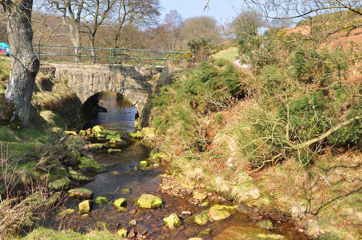
Not far and you reach May Beck to perhaps remove your boots and dangle your feet in the cool water of the beck, and if you’re lucky you might even be able to have that ice cream I promised you.
The facts
Distance – 10miles/16km
Terrain – Moorland and forest tracks, rough in places. One steep descent and ascent
Best map – OS Outdoor Leisure 27
Start/grid ref – Ravenscar, grid ref: 980015
Parking – Roadside at the Ravenscar start and as this is a linear walk you must leave a second car at the car park at the finish at May Beck
Refreshments – Café at the old railway station square in Ravenscar. Ice cream, coffee and snacks in the summer at May Beck – if you are lucky.
Public toilets – Along the road at the start


Comments: Our rules
We want our comments to be a lively and valuable part of our community - a place where readers can debate and engage with the most important local issues. The ability to comment on our stories is a privilege, not a right, however, and that privilege may be withdrawn if it is abused or misused.
Please report any comments that break our rules.
Read the rules here