
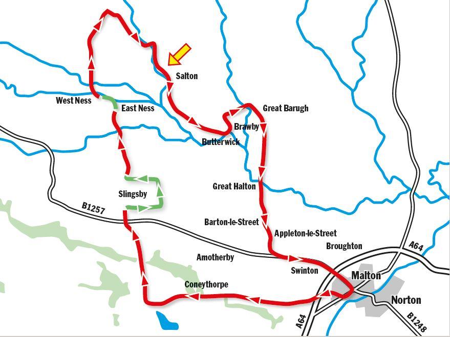
THE school holidays are upon us, and for my theme today I’ve prepared a route on which you should encounter little traffic. So if you are the parent of teenage children you might like to try this one as a family activity. The lunch stop comes early on and makes for an unhurried departure from home. The quietest part of the route comes after lunch; to be tackled in a relaxed manner, on foot in places.
Start from central Malton, where there are a variety of cafes for a last minute coffee. If you need a recommendation, however, try the cafe on the station platform. Just don’t clutter the platform with bikes, but leave them in the rack provided to the eastern (Scarborough) end of the platform.
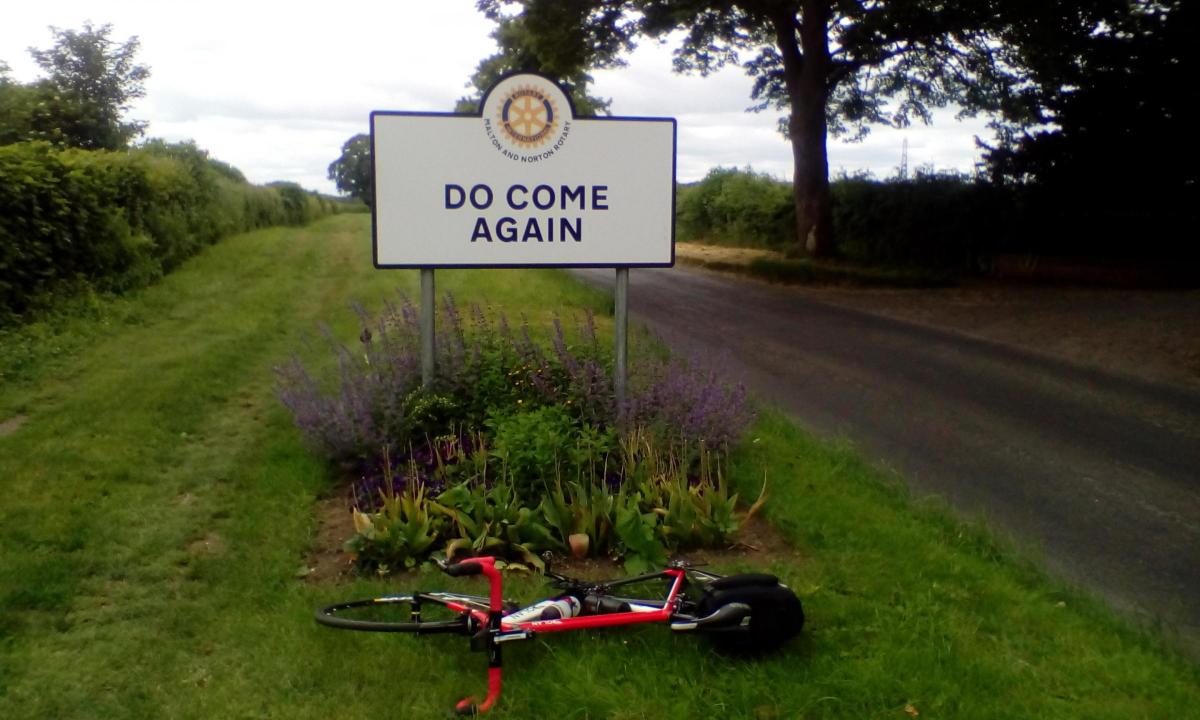
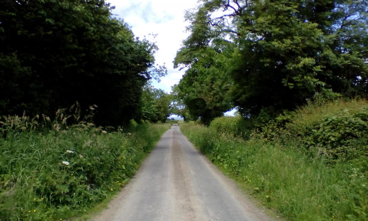
Head away from the traffic lights in the town centre, in Yorkersgate, the B1248 west, signed for York and the A64. In 500 yards, bear right onto Castle Howard Road. New signs were put up last summer to welcome visitors to the town, but also to encourage those leaving, to return in the future. Or perhaps, like Shrek on a bike, I was entering the fairytale land, not Far Far Away, but of Do Come Again.
On the OS map it can appear that Castle Howard Road climbs steadily into the Howardian Hills. The reality is that it undulates, and there are some nice down-hills too. About four miles out of town and at the foot of one descent, you’ll come to the village of Coneysthorpe. Turn off right here to have a quick look.
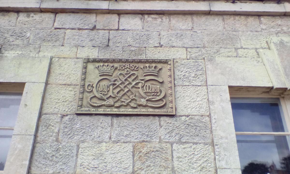
The village hall on the left was once the village school. Built in 1852, it was extended in 1895. I’m guessing the commemorative plaque, bearing the names of George & Mary Howard, and the date 1852 was actually added at the time of the subsequent building works in 1895, as George, 9th Earl of Carlisle, was only nine when the school was first built.
Back on the road, and travelling the same direction as before, quickly arrive at a cross road, and go right, signed Slingsby. A short climb brings you to the top of Slingsby Heights, where the Centenary Way long distance path crosses. It’s then downhill to the B1267. Cross with care and into Slingsby.
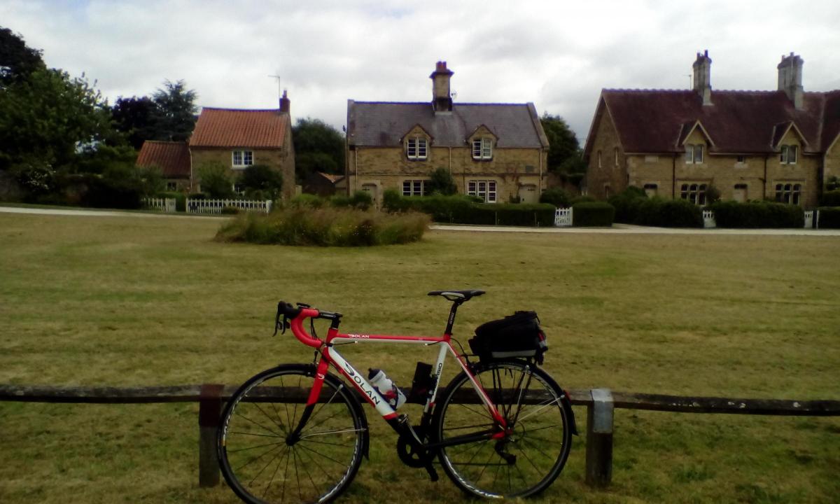
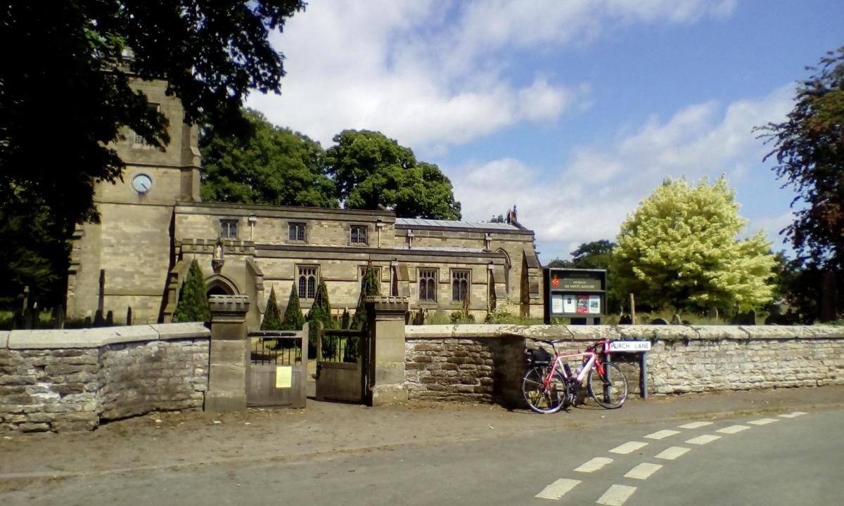
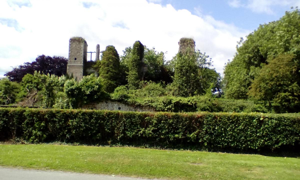
Past some modern housing, the road then bears left to the village green, where note the maypole. Proceed up the right hand side of the green, to find All Saints Church and also, to the left of the church, the remains of Slingsby Castle. Built as a Jacobean mansion, about 1630, to replace an earlier (c1344) fortified structure on the same site, it is thought that the house was never occupied as owner Sir Charles Cavendish fled to Europe to escape the civil war
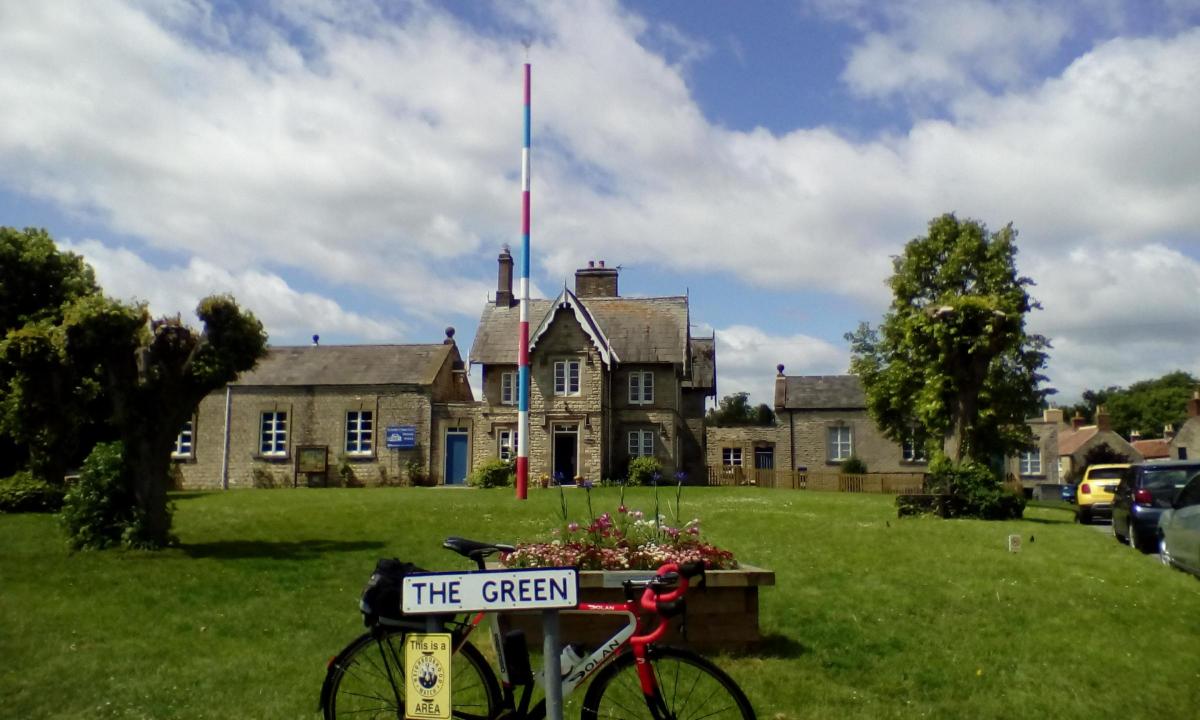
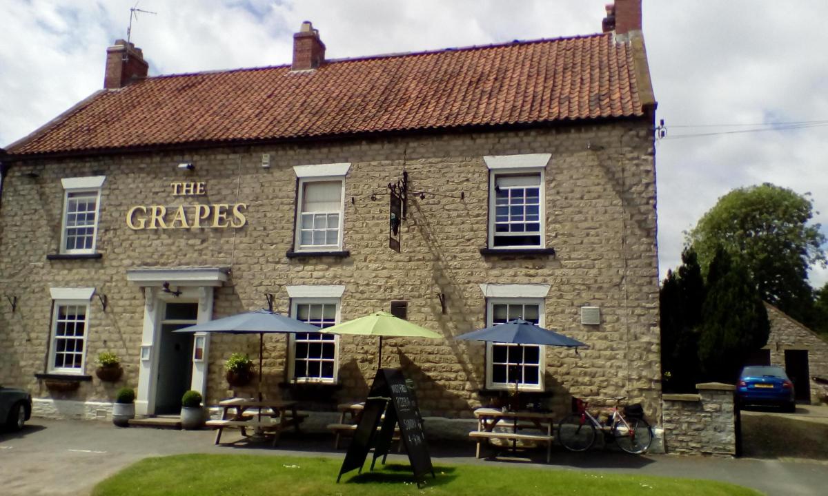
Retrace to the village green and bear left onto Railway Street to arrive at The Grapes, on your left. York branch of CAMRA voted The Grapes Winter Pub of the Season, 2018. It’s easy to see why. I enjoyed some Slingsby Pale Ale (3.9% abv) brewed for the pub by Elland of West Yorks, and stored in oak firkins made by Alastair Simms, Master Cooper of White Rose Cooperage, Wetherby. There’s a small, but nice, selection of lunchtime sandwiches. I chose chicken fillet with lemon mayonnaise, in a ciabatta, with chips and a dressed salad.
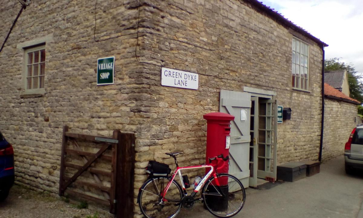
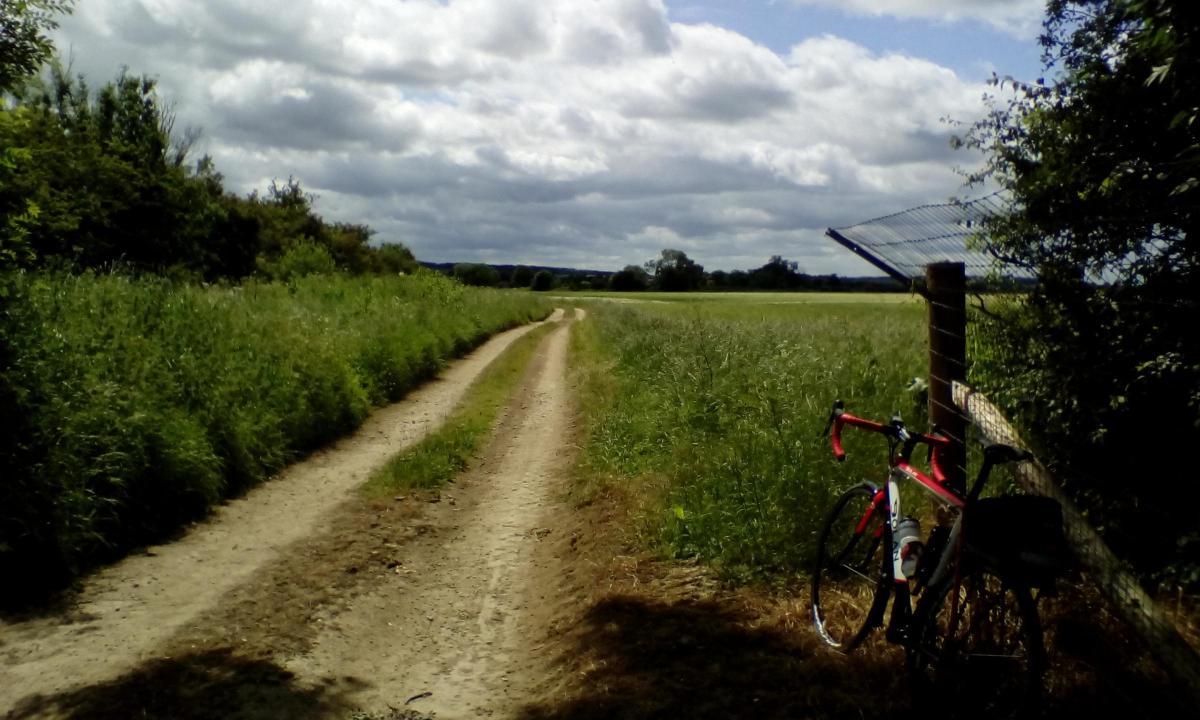
After lunch there’s a choice. Continue as before to leave the village heading north in direction of East and West Ness. Or, if it’s a nice dry day follow me for a little off road detour. Retrace to the village green, and bear left, to leave Slingsby past the shop onto Green Dyke Lane. Pass a small cemetery on the left to confirm you have the right road.
On reaching a farm entrance ahead, take the left fork, marked with a farm sign as Long Lane. The surface is gravel now for about 100 yards before re-joining tarmac. Continue until the Tarmac curves away right, and at this point take a bridleway left instead. Look for the blue and yellow arrows on a short wooden post partially obscured by grass. The surface is now packed earth. Re-join Tarmac at a T-junction just north of Slingsby, turning right for East Ness (unsigned).
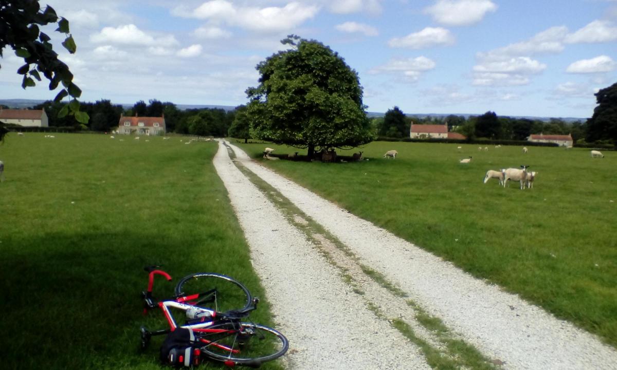
At East Ness water treatment works, the road bends left. Around the bend look out for the next farm entrance on the right in 100 yards. Cross the cattle grid and follow the stony track across the field. I had a little walk to avoid startling the sheep who live here.
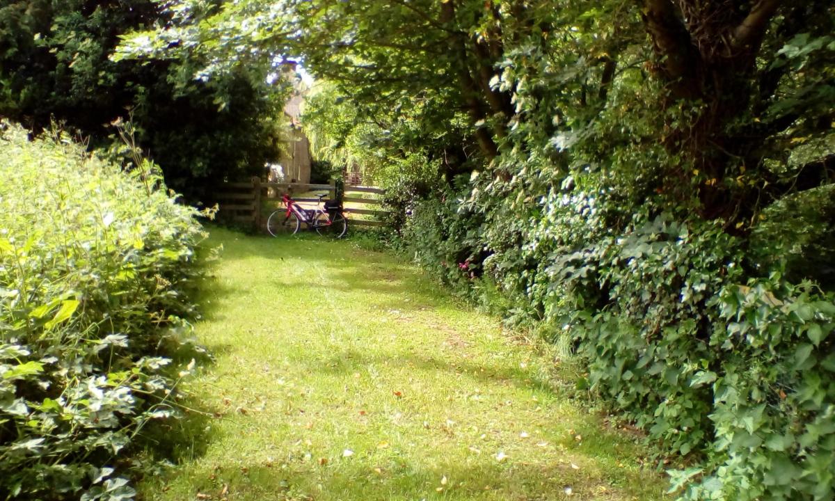
Exit the field by another cattle grid. Ignore the tempting driveway to the left as it’s a private entrance. Instead, walk straight ahead, across some mown grass, till you reach a fence and hedge at right angles. Turn left and follow the line of the fence to find a five bar gate.
This is a bridleway, with a right of access, but nonetheless is the entrance to a private garden. I’m grateful to the nice chap with the blue rimmed glasses who’d been mowing the lawn and who pointed me in the right direction. Apologies for not getting your name sir.
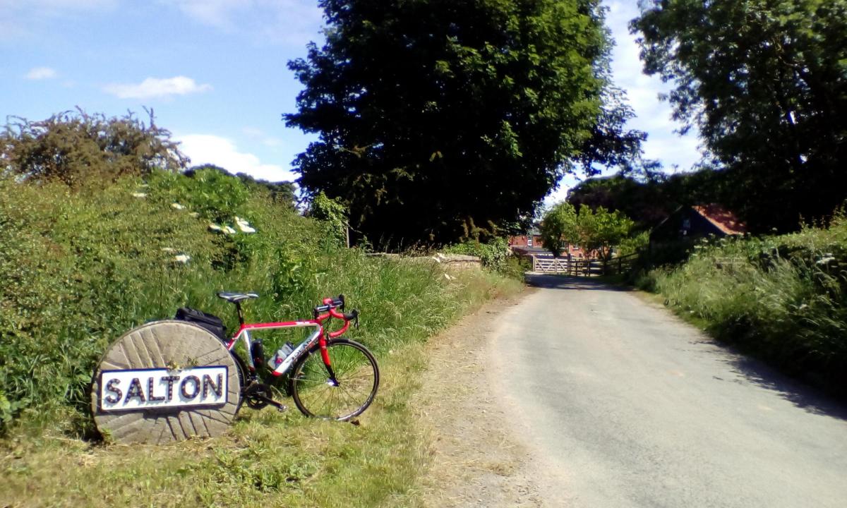
Walk through the private garden with respect, and don’t be tempted by the bench with a nice view over the River Rye. A farm road continues beyond the garden, where remount and proceed to meet tarmac at a T-junction. Go right, unsigned. Cross the River Rye, and continue for another mile, picking up a sign for Welburn. Continue in this direction until reaching a minor road off right, signed Salton.
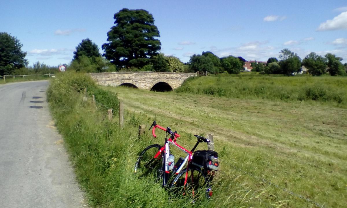
Follow this very minor road, taking care to avoid a farm entrance (Northolme) straight on, where the road swings left sharply. Right at the next T (unsigned) and through Salton, where pick up a sign for Brawby and Malton, right. In Brawby, bear left, signed Gt Barugh and Malton. Cross the twin arched Barugh Bridge, over the River Seven, right at T-junction, and into Gt Barugh.
Climb gently up through the village, past the Golden Lion, and right at T-junction, signed Malton. Continue straight on for just over three miles and into Amotherby. Continue to meet the B1257, where left, for the final three miles back into Malton.
Cycle ride facts
Date of ride: Tuesday, June 12, 2018
The map: Ordnance Survey Landranger No. 100, Malton & Pickering
The cafe: Whistlestop Cafe, Railway Station, Malton, YO17 9RD. 01653 696558. facebook.com/WhistlestopCafeAlPetesBistro
The pub: The Grapes, Railway Street, Slingsby, YO62 4AL. 01653 628076. thegrapesinnslingsby.co.uk/
The bike: 2016 Dolan Preffisio on narrow 23mm tyres. I was able to ride all off road sections at a gentle pace. The section at West Ness should be walked, with respect for residents.
Distance: 28 miles
Car parking: Several pay and display signposted in Malton


Comments: Our rules
We want our comments to be a lively and valuable part of our community - a place where readers can debate and engage with the most important local issues. The ability to comment on our stories is a privilege, not a right, however, and that privilege may be withdrawn if it is abused or misused.
Please report any comments that break our rules.
Read the rules here