
THIS month we visit the Lake District for an exciting ride along Borrowdale to the tiny Hamlet of Watendlath which is hidden away out of sight behind Grange Fell.
The ride starts from Seatoller, a hamlet of one farm, one pub/restaurant and a few dwellings situated at the head of Borrowdale at the foot of the mighty Honister Pass.
Its name is of Scandinavian origin and before miners arrived in the 17th century to quarry slate on Honister it supported only one farm.
The slate quarry was opened in 1643 and in the 19th century miners cottages were built at Seatoller to accommodate more workers to satisfy the demand for slate.
There are many delights as you ride along Borrowdale, but go prepared for wet weather as this area has the highest rainfall in England.
You pass through pretty villages like Rosthwaite and Grange as you approach the “jaws of Borrowdale”, where Castle Crag is a natural fortress guarding the way through the jaws.
You will see Castle Crag on your left, a 1,000ft high rock which Wainright described as being “magnificently independent, rugged and aggressively unashamed of its lack of inches”.
Along the road from Rosthwaite look out for the Bowder Stone, a huge glacial rock dumped here when the ice melted, it weighs around 2,000 tons and has a ladder on the side for visitors to experience the view from the top.
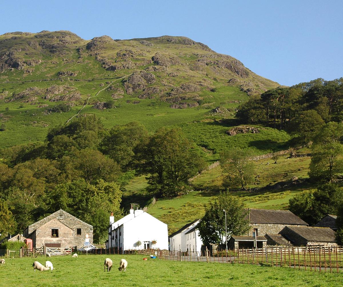
You might like to stop off at the tiny village of Grange in Borrowdale for some refreshment. Grange was originally a farmstead used by the monks from Furness Abbey, the word Grange meant a farm in those days.
Nearby at Watendlath monks from Fountains Abbey were resident, farming their sheep much in the same way as the monks at Grange. But there was a dispute over land along Borrowdale concerning a farm in Stonethwaite, which is near Seatoller.
The monks could not agree, and when King Edward heard of it he settled the dispute pretty quickly by seizing the land then selling it back to the monks of Fountains Abbey for the kingly sum of 40 shillings.
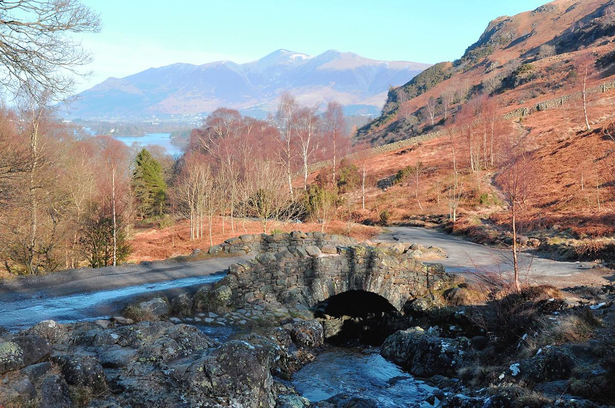
So let us take the very narrow and steep twisty road between Grange Fell and High Dodd to cycle along to Watendlath and its beautiful tarn. But before we get there, stop for a rest at the packhorse bridge at Ashness and enjoy the view across Derwentwater to Keswick and Skiddaw in the distance.
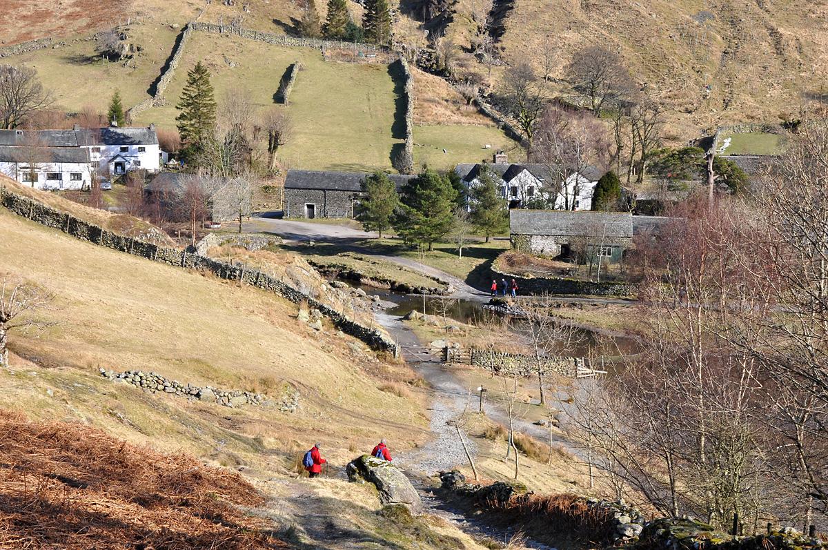
Continue along the twisty road and in a couple of miles you arrive at Watendlath, the hamlet is hidden from sight from surrounding villages and public roads, the only way to see it is to either travel up the dead end road or on foot from the surrounding fells.
It is thought that Watendlath was on the coach road to Keswick many years ago and the farm/tea rooms would probably have been a stop along the way for refreshment.
Watendlath was featured in a book by Hugh Walpole who described it with joyous raptures and romance which encouraged visitors to seek it out. I am sure today you will be welcomed to visit, especially if you use the café, you will be surprised how many people will be there before you in this isolated place tucking into tea and cakes.
It is not unusual if you are walking around the associated fells in the area that almost everyone asks, “is the café at Watendlath open yet?”
Your route
Leave the car park at Seatoller turning left then go left again at the junction signed to Keswick. Continue along Borrowdale cycling along through Rosthwaite then past the impressive Castle Crag a little further along on the left, then further along the dale you find the huge Bowder Stone on your right.
Continue along past Grange, or stop off for refreshment then in about two miles look out for the Watendlath junction. Turn right here onto a steep, narrow road signed to Ashness and Watendlath.
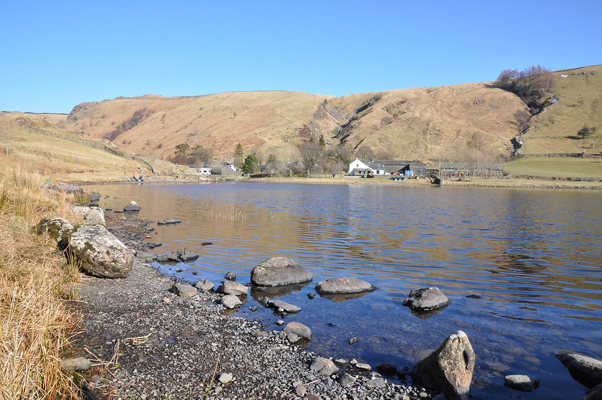
After a short climb you arrive at the old packhorse bridge, Ashness Bridge where I suggest you stop for a while to admire the view across Derwent Water to Keswick and Skiddaw in the distance then continue along still climbing for almost three miles to the end of the road at Watendlath. The little farmhouse café opens at about 10.30am and as you sit in the garden you can admire the view across the tarn where you might like to linger, or buy a fishing permit instead of cycling across the fells.
As you enter Watendlath bear right between the buildings, the café is on the left, your route is straight ahead, across the bridge then left past the rocks to a large gate, pass through the gate then keep right at the fork signed to Rosthwaite on a wide, stony track heading steeply uphill.
This track will test your mountain biking skills as you negotiate your way through rough, slippery stones on the ascent. As you approach the summit the track becomes smoother and narrower giving you a rest before you start your descent towards Rosthwaite. Keep following occasional signs for Rosthwaite and eventually you exit onto the road along a wide driveway.
Turn left into Rosthwaite village, if you would like to visit the tea rooms there turn right in the village, the tea rooms are just along the road. If not cycle along through the village and soon you reach Seatoller where you should be able to have a cool pint in the pub.
The facts
Distance – 12 miles/19km
Terrain – Two good ascents, one slippery descent
Best map – OS Outdoor Leisure 4
Start/grid ref – Seatoller Car Park, GR245137
Refreshments – Seatoller, Rosthwaite, Grange in Borrowdale and Watendlath
Public toilets – Watendlath car park, Seatoller car park


Comments: Our rules
We want our comments to be a lively and valuable part of our community - a place where readers can debate and engage with the most important local issues. The ability to comment on our stories is a privilege, not a right, however, and that privilege may be withdrawn if it is abused or misused.
Please report any comments that break our rules.
Read the rules here