

IT was believed in medieval times that demonic creatures flew the night skies looking for prey to satisfy their lust for blood, usually human.
The sole purpose of these creatures of the devil was to promote evil and to cause the ruination of mankind. This demonic vampire was able to take human form, it was was created by magic and witchcraft and held all the powers of its mother witch. The blood drinking demon was called a Broxa.
Before he acceded to the throne, King James wrote a book about demons and demonic practices. He wrote of witchcraft, witches and their association with the devil. He said that the witch would summon up the devil and give their souls to him in exchange for power. He said that witches and demons should be hunted down and killed.
Another king who spoke about demons was King Solomon who was allowed by God to summon them to him and help him build his temple in Jerusalem. I dare not think what he fed them on.
Jewish folklore mentions the Broxa as being a large bird that lived on goat’s milk, taking its share by suckling the goat in the night. They believed that the Broxa evolved from the bird to take human shape and became thought of as a demon.
In this form it was still able to fly. Perhaps this is where the witch’s broomstick first appeared, but its eating habit changed from suckling goat’s milk to drinking human blood.
As time passed by, the Broxa found new powers and was able to change shape at will and appear as a witch in female form or a demon in male form. So the tales of witches flying in the night sky on their broomsticks and casting spells could have been the evil, demonic Broxa.
Our route takes us to the hamlet of Broxa. Is this a place of demons, witches and the demonic Broxa? Or was it visited by blood-sucking vampires that roamed the night sky having travelled from their home on the cliff top at Whitby?
Whatever the answer, take care when riding these tracks around the hamlet of Broxa and the nearby forest – and whatever you do, get home before dark.
Your route Leave the parking area turning towards Scarborough on a long, straight road. At the crossroads, turn right where there is a sign for Silpho and another stating the unsuitability for long vehicles.
In a couple of hundred metres, turn right at the T-junction, (unsigned). Cycle through the village of Silpho then soon start to descend towards a steep, twisty hill through a wood called Hackness Hairpins. Take care negotiating the slippery, tight hairpin bends as you descend this treacherous hill.
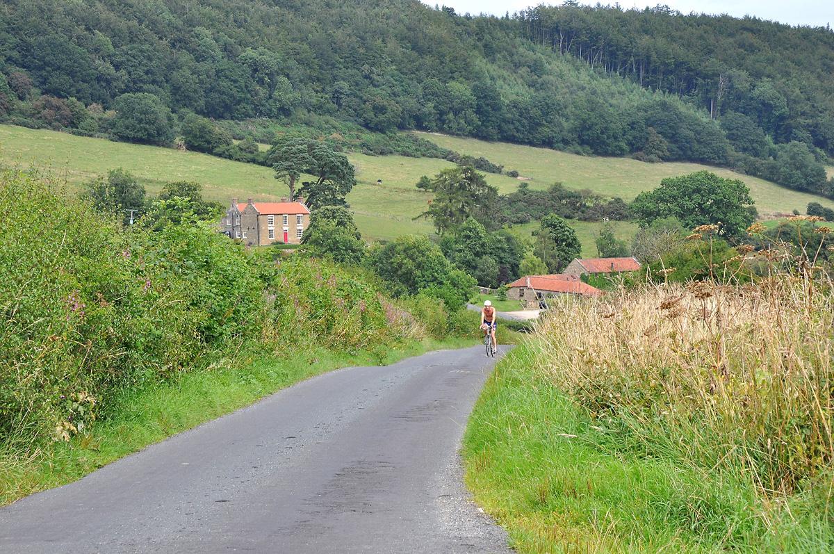
At the bottom of the hill you arrive at Hackness village, turn right here signed to Forge Valley, Troutsdale and Langdale End. As you ride along, look to the left to see Hackness Hall and its grand lake. At the village hall, turn left signed to Forge Valley and West Ayton.
Not far along the road, turn right onto a narrow road signed as Wrench Green Only. At the T-junction bear right then at the houses of Wrench Green keep left up the hill. It is a long, slippery and sometimes muddy ascent but eventually you reach the top to arrive at Wykeham Forest.
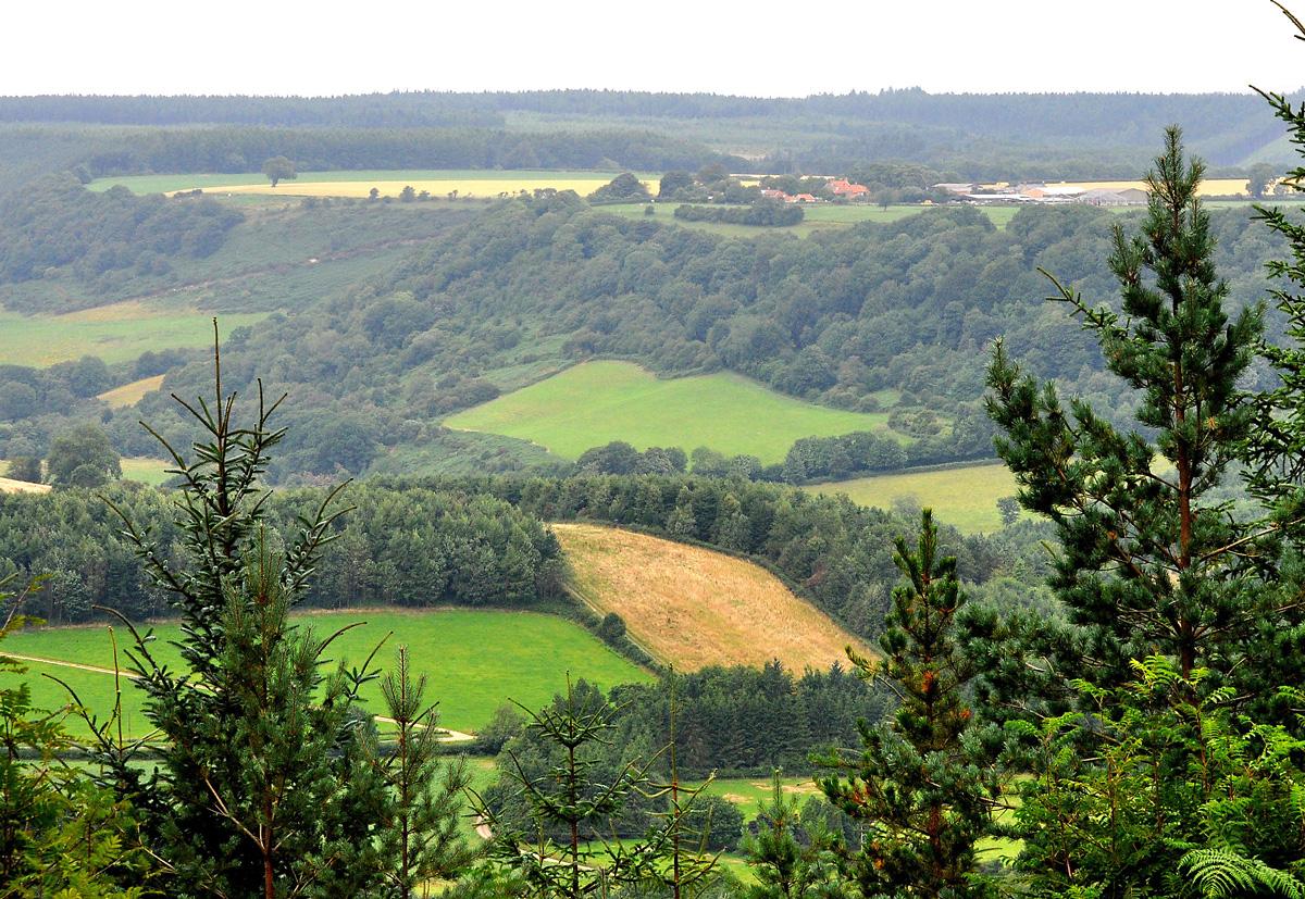
Turn right here onto a wide forest road and in about one mile you reach the viewpoint at High Wood Brow. Enjoy the grand view over Troutsdale across to the distant moors then continue straight ahead on the forest road.
Keep on the main forest road until you reach a sign for Wykeham Nursery. Just before this sign, turn right onto another forest road leading away at an angle, then follow the waymarks for Moor to Sea cycle route and the Tabular Hills Walk.
Not far along here and you exit the forest through a gate, cycle along through the small car park to the road.
Turn right now down a steep descent and another hairpin bend. Keep right around this bend signed to Troutsdale and Hackness to continue your descent to the old mill at the bottom to begin a serious ascent.
At the top of the hill you have grand views along Troutsdale; the road undulates and twists past a farm, through a farmyard then past a ruined old school building at the roadside. Keep pressing on and in about two miles you reach a T-junction. Turn left here signed to Broxa and Langdale End.
Not far along the road, turn right up a steep, long hill signed to Broxa where you will find a few pretty houses dominated by the village farm. Look out here for witches and demons...
Keep straight on through the village bearing left at the end onto a narrowing and deteriorating road which takes you to Broxa Forest. Keep straight on into the forest keeping an eye out for cyclist-eating potholes, keep on the main forest road all the way back to the Reasty car parks.
The Facts
Distance: 17miles/27km
Terrain: Hilly with a rough forest road
Best map: OS Outdoor Leisure 27
Start: Reasty hill top car parks adjacent to Broxa Forest
Parking: There are two parking areas at Reasty on top of the hill, one each side of the road
Grid ref: 965945
Refreshments: None Public toilets: None


Comments: Our rules
We want our comments to be a lively and valuable part of our community - a place where readers can debate and engage with the most important local issues. The ability to comment on our stories is a privilege, not a right, however, and that privilege may be withdrawn if it is abused or misused.
Please report any comments that break our rules.
Read the rules here