
ON a high piece of land overlooking the Yorkshire coast a group of Saxons built their tiny wooden church.
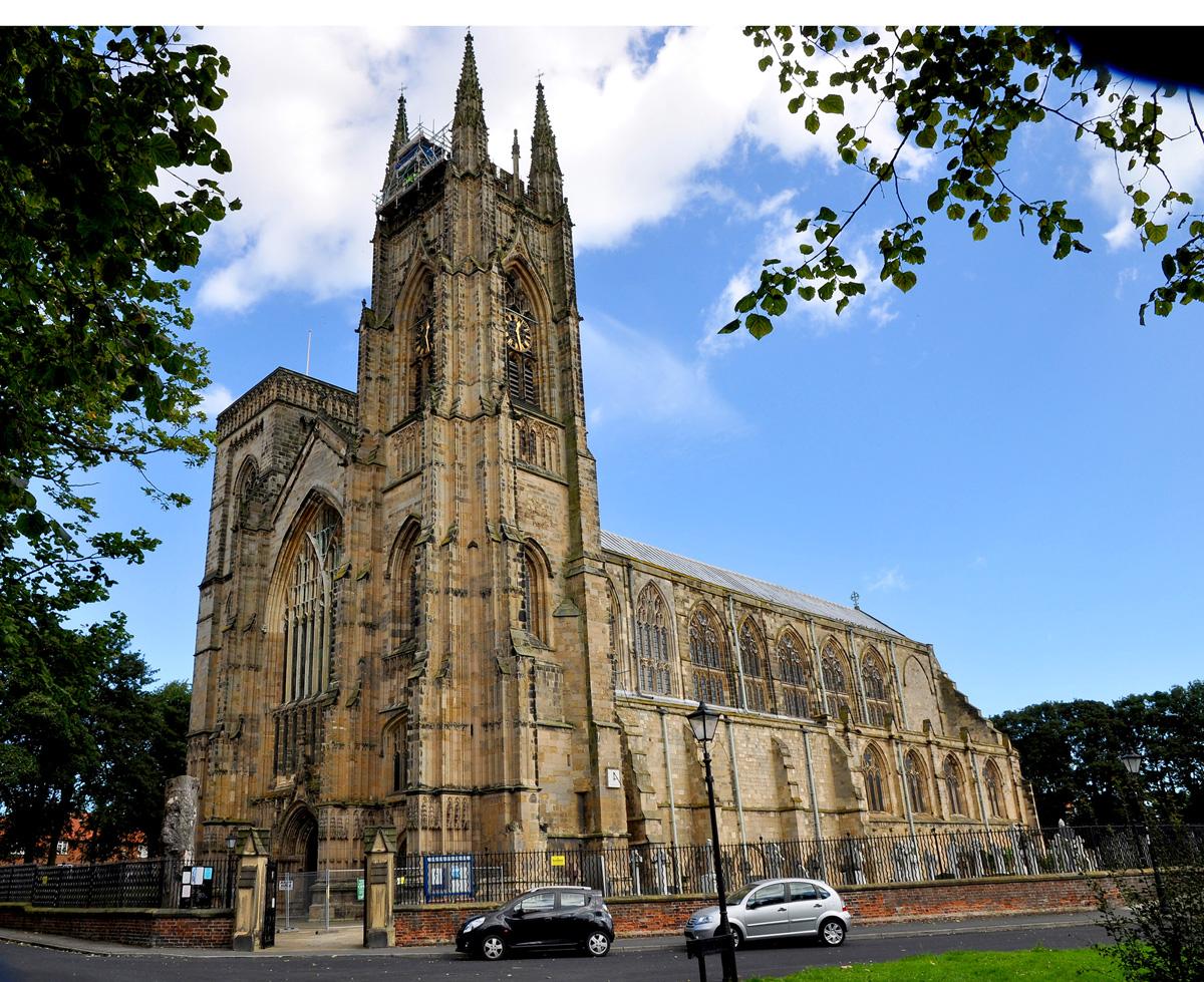
This was replaced early in the 12th century by a huge stone priory which was built on the same site. It was one of the first Augustinian houses in England. It was 120m long and 23m wide. It was a fine landmark looking out across the town of Bridlington to the sea.
Over the years the priory expanded its territories with land given them by the nobles. They became prosperous and were given the rights to take property from felons and to take an income from the nearby harbour.
After troubles during the battle of the Hunmanby, the priory was fortified and crenelated and continued to grow, being given more land stretching as far as Holderness.
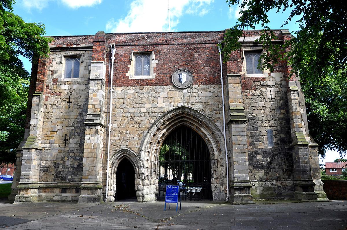
There were four gates or entrances to the priory grounds, West Gate, Nun Gate, Kirk Gate and the only one still standing, the Bayle Gate.
It is a 12th century two-storey building and was the main entrance to the priory. It was also a prison and a porter’s lodge.
There is a spiral staircase to the first floor which was used for The Court of Priors.
All this wealth and land stretching from Blubberhouses to Spurn came to nothing for the monks as it befell the dissolution of the monasteries in 1538. The buildings were destroyed and some of the stone was used in building works around the town.
The most famous of priors at Bridlington was John of Thwing who was prior from 1362 until his death in 1379. He was a deeply devout man and is credited with performing miracles of healing, even after his death his grave was visited by pilgrims where miracles healing the sick continued.
John became St John of Bridlington in 1401 and became the last English saint before the reformation.
Your route
Start from the Bayle Gate and head off towards the traffic lights. Go right here along the Scarborough road, then keep straight ahead at the small roundabout and straight ahead at the large roundabout onto the Hull road.
Continue along under a bridge and round a left bend, then take the next turning right onto the B1253 signed to Rudston.
Soon pass the Eastfield Garden Centre and partake of your morning coffee if appropriate. Continue along until you reach the village of Boynton. At the crossroads in the village, leave the B1253 to turn right onto a narrow road signed to Boynton Village North and Grindale.
Cycle through the village and takecare as the road narrows, then start to climb for some time until you reach the Wolds.
Enjoy the all-round views as you cycle along this undulating road which is also quite bumpy, then soon descend into Grindale.
Keep left into the village, then at the T-junction, go left again signed to Burton Fleming and Malton. A better road now, with a little more traffic but the views are good as you once more undulate as you cycle up and down the Wolds.
Not far to Burton Fleming to the crossroads in the centre of the village with the Burton Arms pub on the corner. Turn left here signed to Kilham and Driffield and soon start to climb. When you reach the sharp left bend go immediately right signed to Thwing. This is a very narrow road so treat it with care as you climb high once again for a short ride into the village of Thwing.
At the T-junction, bear right into the village past the Falling Stone Pub, then take the next left turn signed to Kilham and Driffield.
Descending again now, with good views across to the sea to reach the crossroads at the B1253. Go straight across here, with care, signed to Kilham. The road ascends and descends as you cross the Wolds once again, then eventually you have a long descent into Kilham. Look-out for a left turn along North Back Lane which takes you into the village, then at the Tjunction, go right. In a few metres, turn left signed to Bridlington.
When the road bends to the right, leave it to go straight ahead and uphill on a narrow road. Good views again across the Wolds and over to the coast and the sea. Eventually you arrive at a T-junction. Go straight ahead here and then in a few metres, when the road turns left, bear right (almost straight ahead) onto a very narrow road.
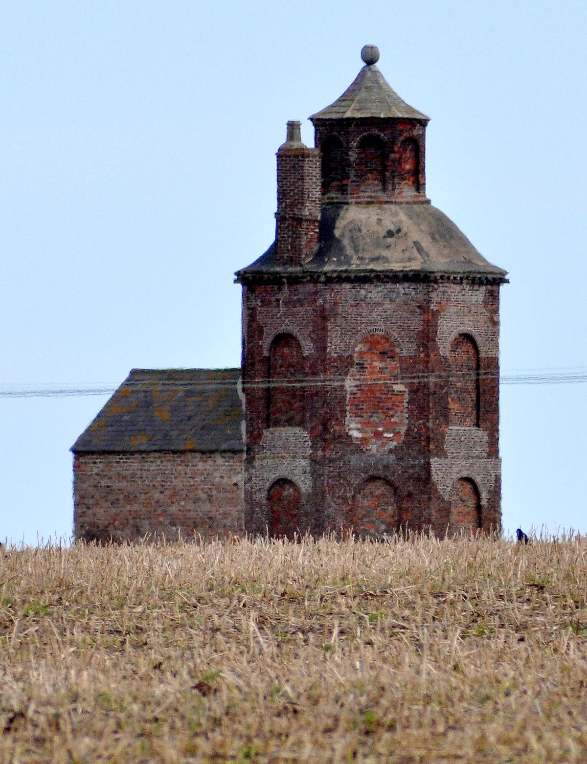
Continue climbing gently until eventually you reach a colonnade of trees and a wood. As you reach the end of the wood, there is a wide parking area/farm track on your right. If you walk through the wood to the edge on the left and look across the field, you will see the amazing Carnaby Temple rising on the horizon.
The temple is a folly built in 1770 by Sir George Strickland, a turkey farmer. He enjoyed climbing to the top of the tower to see his turkeys in the fields below then being taken to market on boats from Bridlington Harbour.
Continue along now as the road undulates and passes a cattery and camping site and becomes bumpy with potholes. At the T-junction, turn left onto the busy B1253 to return to Bridlington on the road your came on to your transport at the Bayle Gate.
The facts
Distance – 24miles/39km
Terrain – Easy
Best Map – OS Landranger 101
Start/grid ref – Bridlington Bayle Gate. GR175679
Refreshments – Eastfield Garden Centre and pubs along the way, plenty in Bridlington
Toilets - garden centre as above


Comments: Our rules
We want our comments to be a lively and valuable part of our community - a place where readers can debate and engage with the most important local issues. The ability to comment on our stories is a privilege, not a right, however, and that privilege may be withdrawn if it is abused or misused.
Please report any comments that break our rules.
Read the rules here