
ROSEBERRY Topping and the Captain Cook Monument were on my walking "to do" list for about five years.
They remained unconquered largely due to the perception that it would take too long to get there by car from York.
Had the great explorer James Cook shown such prevarication, it is fair to assume that several far flung corners of the globe would have remained uncharted.
The walk starts in Great Ayton, the village Cook called home as a young boy in the 1730s, and takes in both the iconic summit of Roseberry Topping and Captain Cook's Monument on Easby Moor.
I was pleasantly surprised to reach Great Ayton in a little over an hour (okay, five years and one hour), taking the A19/A172/A173 route.
And I was equally pleasantly surprised to find a bustling and picturesque village, having not known what to expect of our destination.
After a quick double-take at the free parking (a rarity these days), we got our bearings and set off along Newton Road, before ducking through a hole in the wall.
The path quickly takes you out of the village, but cunningly keeps Roseberry Topping out of sight for the first mile or so.
Cliff Ridge Wood is a superb interlude among the fields and paths, and is said to be something to savour in spring, when carpeted with bluebells.
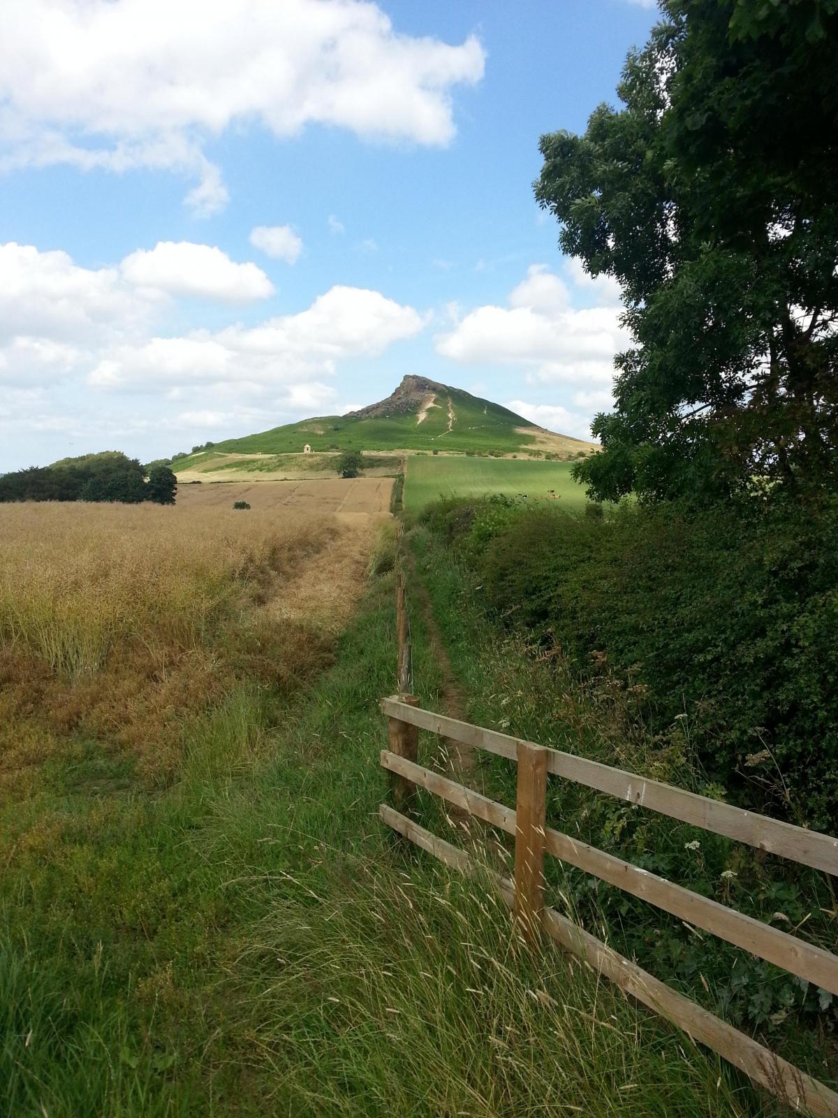
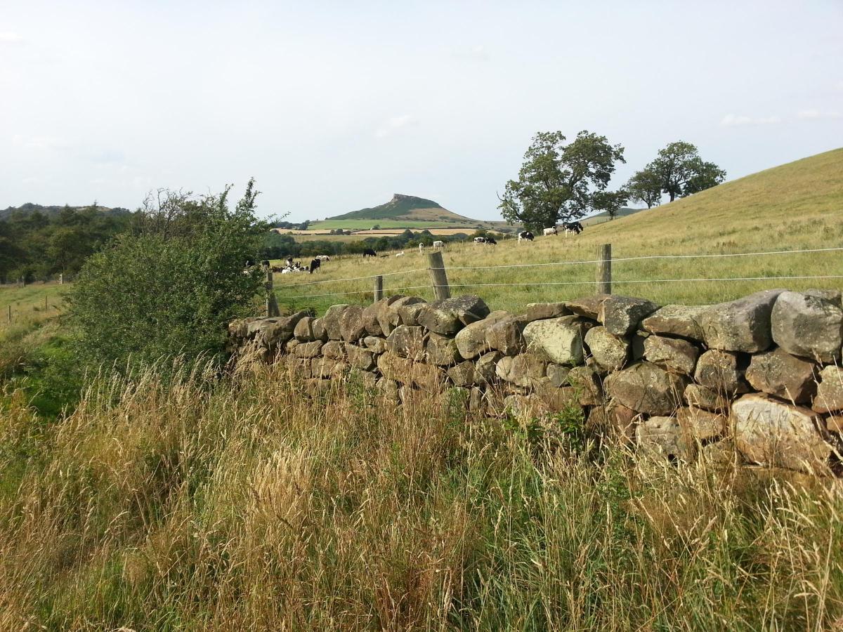
Emerging from the wood into a domed field, you get a first tantalising glimpse of Roseberry Topping, with its stubbed nose and gorse-covered slopes.
But then it is gone again, until you get beyond Cliff Ridge Quarry. Then you can make a beeline for it as you rise across fields.
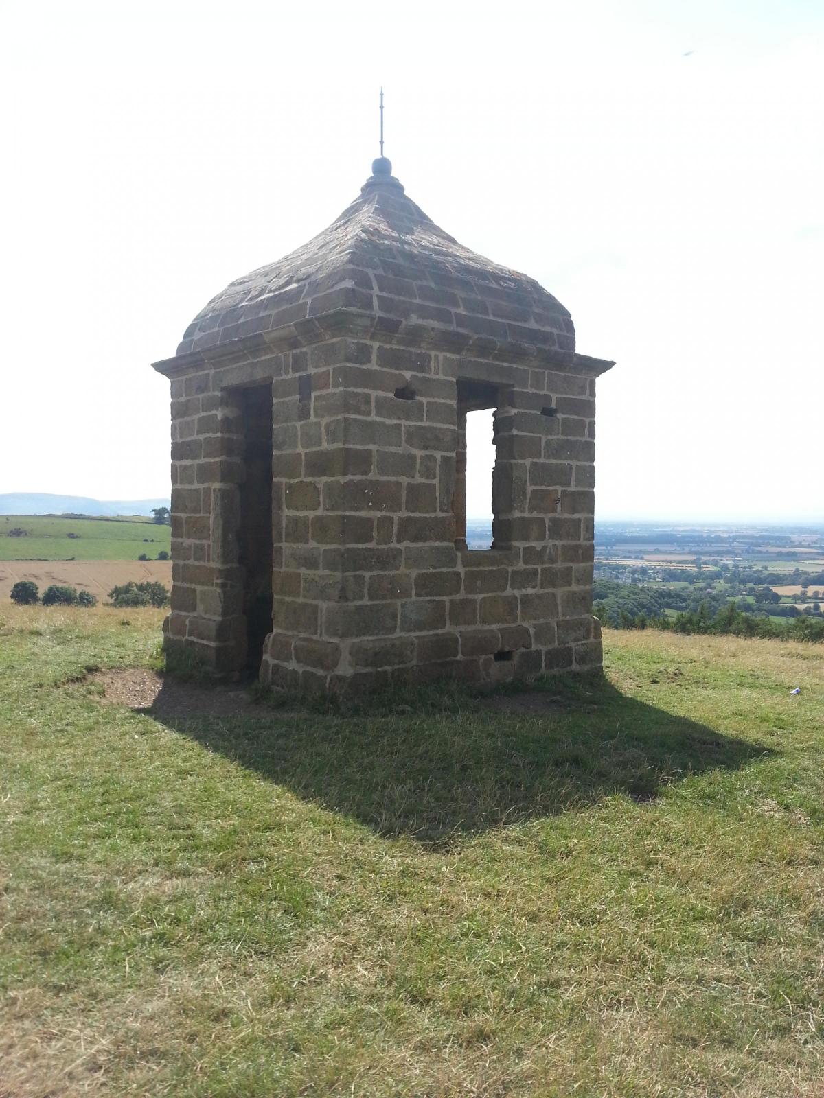
Before tackling the summit, there is a quaint pointed stone summer house to explore to the left. Mystery surrounds its original purpose, but it sadly now seems to be a dumping ground for picnic rubbish.
As you approach Roseberry Topping, you can see clear evidence of the 1912 rockfall that turned the peak from a perfect conical shape into the sheer face you see today.
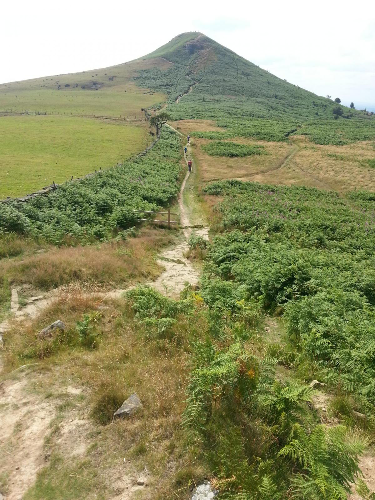
There are three routes to the top, and all three reward you with amazing views in all directions, from the industrial works of Teesside and the North Sea, round to our next destination, Captain Cook's Monument.
The main path off the Topping takes you across a hollow and then steeply up to Newton Moor. It is worth pausing for breath and turning round to take in the zig-zagging path through to the gorse back up to the summit.
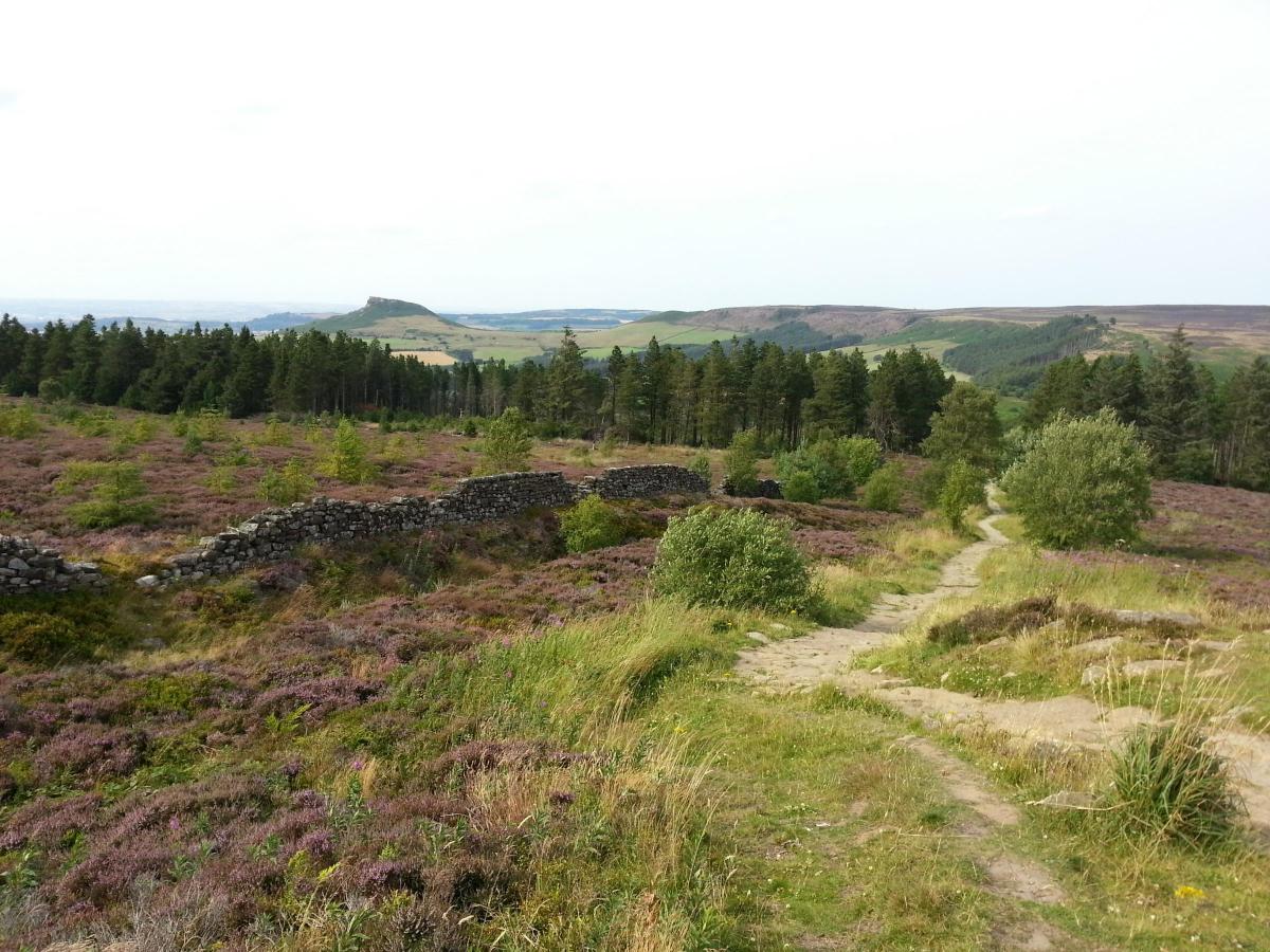
When the path levels out on Newton Moor, the wide open expanse of the North York Moors - turning into a purple heather haze on this late summer excursion - stretches out to the left and Roseberry Topping remains a dominant feature on the right.
The ridge track, which accommodates walkers and cyclists with ease, eventually drops to Gribdale Gate car park before regaining height - and spectacular views of the walk so far - en route to the Cook Monument.
Cook, who regularly climbed Roseberry Topping as a youngster living at nearby Airey Holme Farm, is one of North Yorkshire's most famous sons, one of the great British explorers.
The former Navy captain created detailed maps of Newfoundland and then led three voyages to the Pacific Ocean, breaking new ground as the first European to reach the east coast of Australia and the Hawaiian Islands. His was also the first recorded circumnavigation of New Zealand.
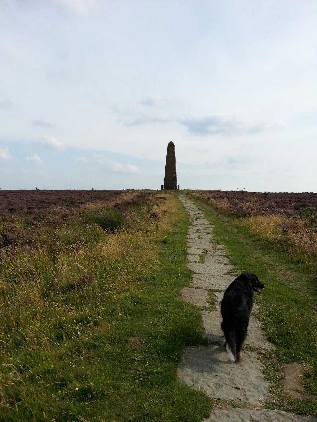
The 60ft monument on Easby Moor pays tributes to his achievements and documents his untimely death on his third visit to Hawaii, "massacred at Owythee Feb 14th 1779 to the inexpressible grief of his countrymen".
It lauds him as "a man of nautical knowledge inferior to none, in zeal prudence and energy, superior to most".
As we descend back to Great Ayton, we can reflect on a circumnavigation of Cook's old stamping ground as a walk that is definitely superior to most.
ROUTE DETAILS
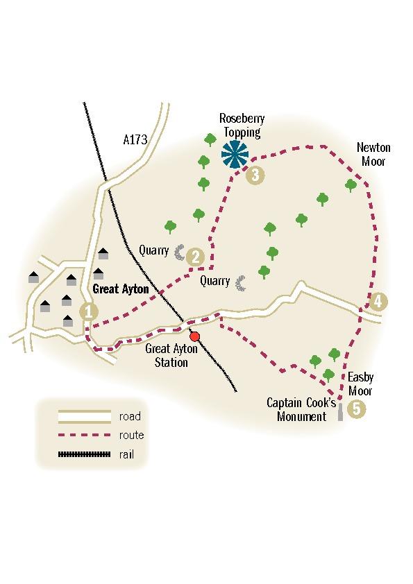
* Leave the centre of Great Ayton on Newton Road. After 100 yards (1), go through gate in the wall on the right. The path goes through trees and continues by a hedge to the railway line.
* Cross the railway line and continue ahead into a field, following the edge as it rises into Cliff Ridge Wood. The path climbs diagonally to the right, leading to a field (2). Turn left to a stile and then turn right over another stile.
* Go straight ahead across a field and, at the corner, bear left to gate. The enclosed path climbs gradually towards Roseberry Topping ahead.
* A clear path crosses the side of Roseberry Topping, with offshoots to the left heading steeply up to the summit. You can stay on the lower path, which follows a fence on the right to reach the Cleveland Way. The summit can be reached by a path to the left (3).
* Our route continues to the right, rising with a wall on the right. Go through a gate at the top and go right, following signs to Gribdale. A clear path follows a wall across Newton Moor, before dropping to Gribdale Gate car park (4).
* Cross the car park and look for a path on the right signed for Kildale and the Cleveland Way. The path climbs for half a mile to Captain Cook's Monument.
* Turn right at the monument (5) and follow a path through a wall. Bear left and then stay left to head into Ayton Banks Wood, where the steep path drops to meet a track at the bottom.
* Go right to a junction and turn left, dropping to leave the woods through a gap. Go down a slope to a track and turn right. Continue ahead through gates as the track becomes a road and reaches Dikes Lane at a crossroads.
* Turn left, passing the railway station as you head downhill. At a roundabout, go right and walk back into Great Ayton.
FACTFILE
Distance: six and a half miles
Parking: Roadside in Great Ayton or at Gribdale Gate
Refreshments: Great Ayton
Map: Ordnance Survey OL 26 North York Moors Western area


Comments: Our rules
We want our comments to be a lively and valuable part of our community - a place where readers can debate and engage with the most important local issues. The ability to comment on our stories is a privilege, not a right, however, and that privilege may be withdrawn if it is abused or misused.
Please report any comments that break our rules.
Read the rules hereComments are closed on this article