
GEORGE WILKINSON encounters mist, a lost city and the ghosts of Roman soldiers at Bardale Head.
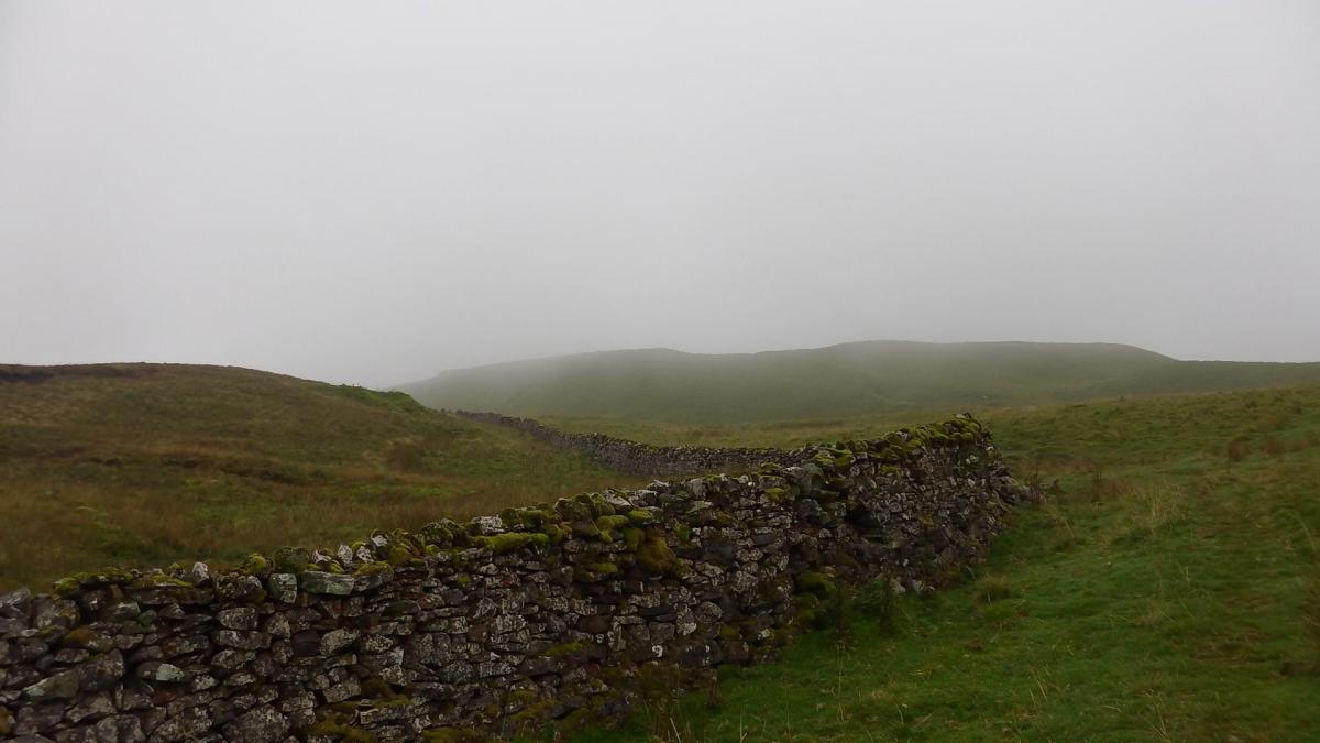
BARDALE HEAD was gloomy, mist hung in the air, the fellsides were dull and blank and vanished into the cloud. I think a buzzard called. We wondered what we might be descending to, winding through small hills of grassland; we wondered about the path and shotguns fired from somewhere.
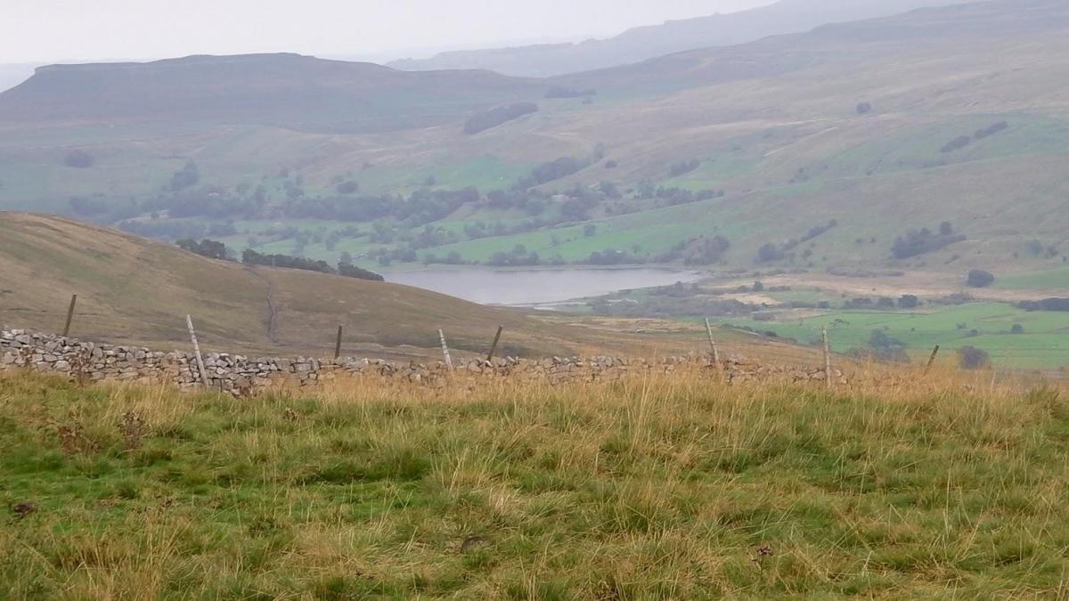
Soon enough we got our reference: the sight, albeit blurred, of the disc of Semer Water, the glacial lake a few miles down the valley.
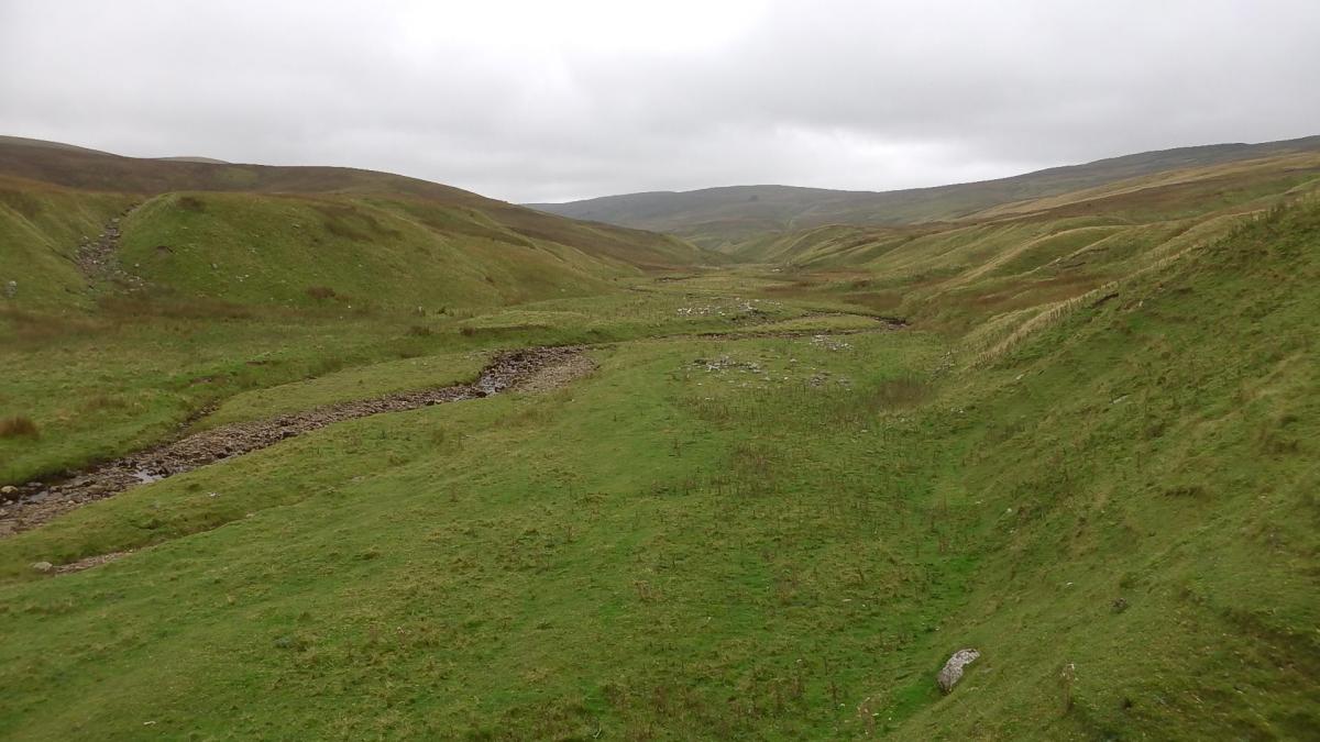
Bardale Beck was dry. The numerous gills that feed it, and that we crossed, were dry fords with optimistic stepping-stones or dips with a damp patch. A waterfall was a dribble of clear water through a beard of moss.
All would be very different on this path below the springline after heavy rain. Indeed, the Ballad of Semerwater by William Watson ends with the lines “and the lost city of Semerwater deep asleep till doom”. That is “deep and drowned”. Moreover the local rhyme goes: “Semerwater rise, Semerwater sink”.
While we sat for a sandwich, a dozen or so hikers crossed our path, at speed, strung out to a crocodile, taking their leader’s variation on the route up the beck, through the higgledy-piggledy terrain and vanishing so fast we wondered if their route was better than ours.
We were slowed again, this time by a nice patch of diversity: a waterfall, a small strid, fly agaric mushrooms, coppiced hazel turning leaf-by-leaf, blue flowers, red berries, ferns on an ash tree and various willows.
Marsett is a hamlet, mostly farm, settled low and a mile from Semer Water. The local jackdaws chattered. It was time to climb, steeply but steadily from 900 to 1,900 feet, by swallow holes and sheepfolds. Luckily, there is good excuse to pause, at intervals, for the view, over Semer Water, past Addlebrough, to Wensleydale.
The last few miles are a march on Cam High Road, a Roman Road. There were 500 professional Roman soldiers garrisoned a few miles away in Bainbridge. Heading our way they would be pointing their pikes towards those west of the Pennines.
Nowadays it’s a free-for-all, as the rough old track is designated a BOAT, a bridleway open to all traffic.
Directions
When in doubt look at the map. Check your position at each point. Keep straight on unless otherwise directed (wm= waymark fp=fingerpost
1. From parking area on dead-end road right to road (sign Kettlewell 14), 200 yards, gateway on left (fp Marsett), grass track, join wall to your right. Track becomes path and descends.
2. Pass clump of trees. 50 yards, fieldgate, path downhill, fieldgate (wm), grass track downhill, stone track over beck and fork uphill 50 yards to fieldgate. Across field.
3. Gateway (wm post). Route not as on OS map. Grassy track straight on turns downhill, two gateways, ford. Before gate near Bardale Beck left uphill with wall to your right.
4. Stile in field corner, path near wall, then descends, stone track, grass track, Where good track heads left uphill, fork right on faint grass path/track, 100 yards.
5. Gated squeezer (wm) in wall on bank 50 yards from river, grass path, stepping-stones/footbridge, by river, through trees, gated squeezer (wm), wall gap, squeezer, steps to footbridge and stone path by river, join track.
6. Left to road in Marsett. Track on left (fp Burtersett, Hawes).
7. Fieldgate (wm) into yard on left, middle track for 50 yards to large gateway, 1 o’clock up bank for 50 yards to small gate (wm), uphill across field to gated wall stile (wms), uphill, ford side stream, steps to gated squeezer, uphill, through gaps in two fallen walls.
8. Left to grass path (three-way fp, Roman Road), uphill, becomes track.
9. Fieldgate and left to walled track/Roman Road, three fieldgates.
10. Left to road.
Fact File
Distance: Seven miles.
Car Parking: Small parking area.
Right of Way: Public.
Date walked: September 2014.
Tourist information: Hawes TIC 01969 666201.
Refreshments: Hawes.
Map: OS Explorer OL30 Yorkshire Dales northern and central.
Terrain: Valley and fell.
Difficulty: Not easy.
Please observe the Country Code and park sensibly. While every effort is made to provide accurate information, walkers set out at their own risk.


Comments: Our rules
We want our comments to be a lively and valuable part of our community - a place where readers can debate and engage with the most important local issues. The ability to comment on our stories is a privilege, not a right, however, and that privilege may be withdrawn if it is abused or misused.
Please report any comments that break our rules.
Read the rules here