

George Wilkinson enjoys the far from desolate joys of Nunnington.
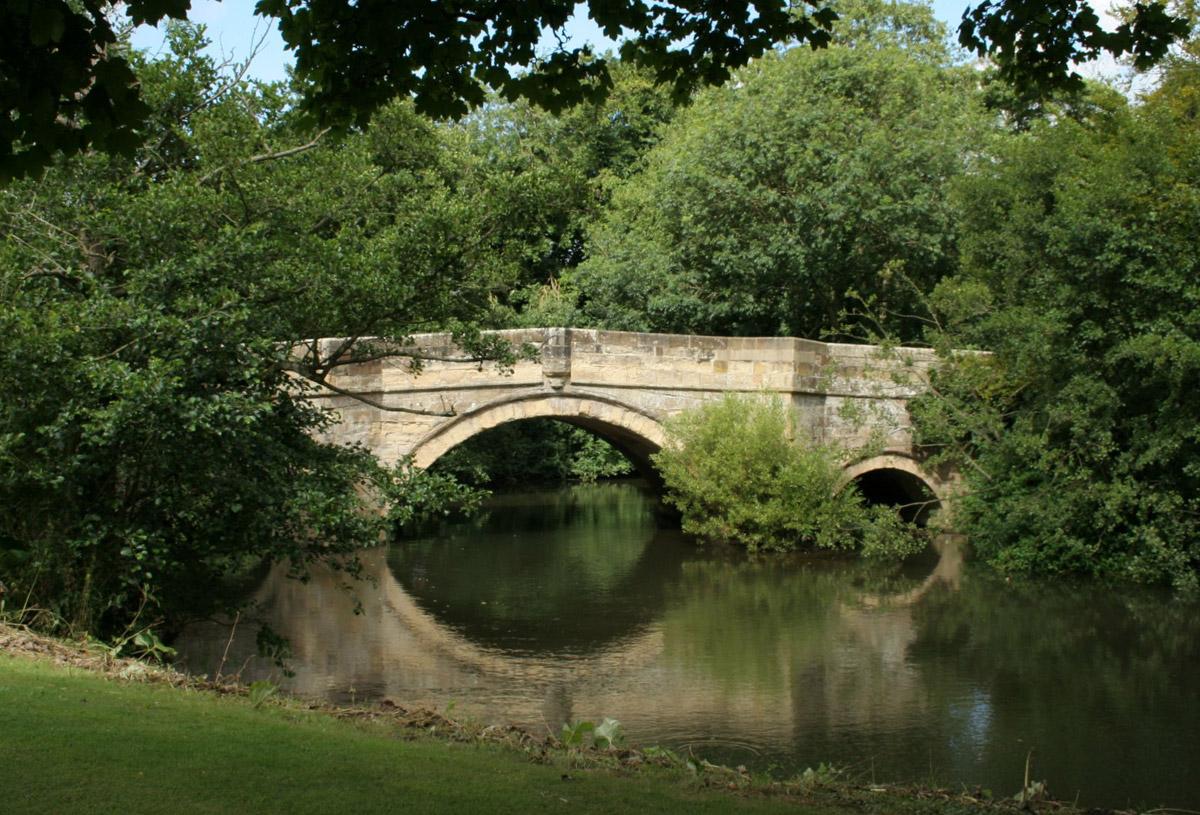
NUNNINGTON is far removed from the ‘desolate north-east’ of Lord Howell’s suggestion. We stepped into the Howardian Hills area of outstanding natural beauty, skirted the walled grounds of the National Trust’s popular and much-cherished Nunnington Hall, strolled over parkland and followed the River Rye. Fields held rich crops and blue damselflies were out in abundance.
Not all is manicured, leaf perfect, the path is not as smooth as a summer lawn and the riverbanks have been invaded by Himalayan balsam.
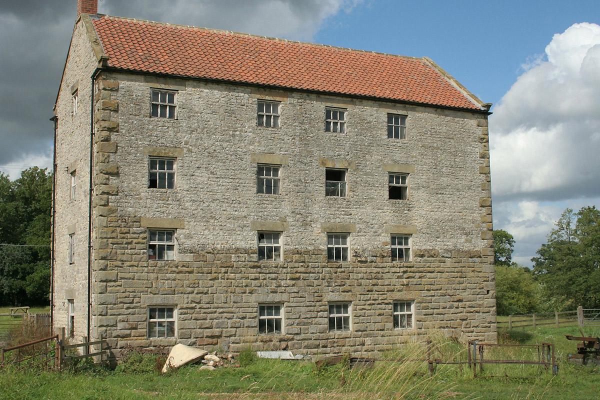
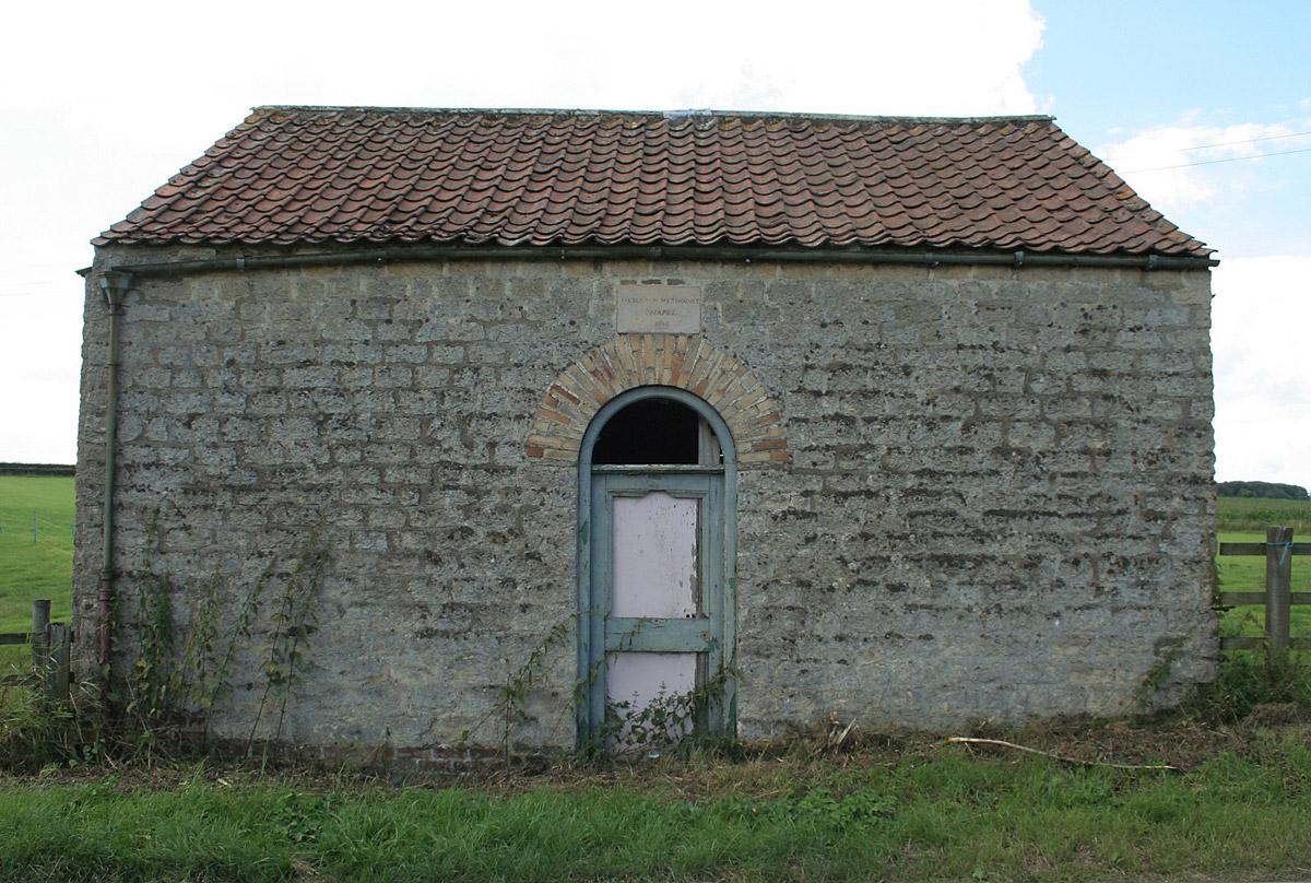
Thrice I registered an element of the forlorn or forsaken, but not desolation, at a four-storey mill, grade 2 listed, where swallows flew; at a redundant Wesleyan Methodist chapel of 1830, the congregation gone; and at the daubed chipboard name-board to a hall at the hamlet of Ness.
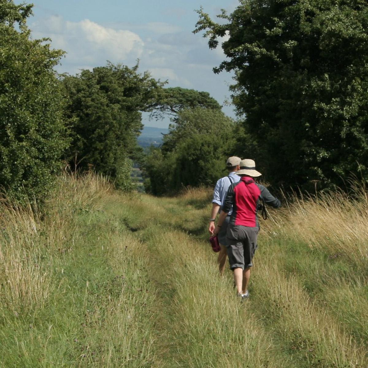
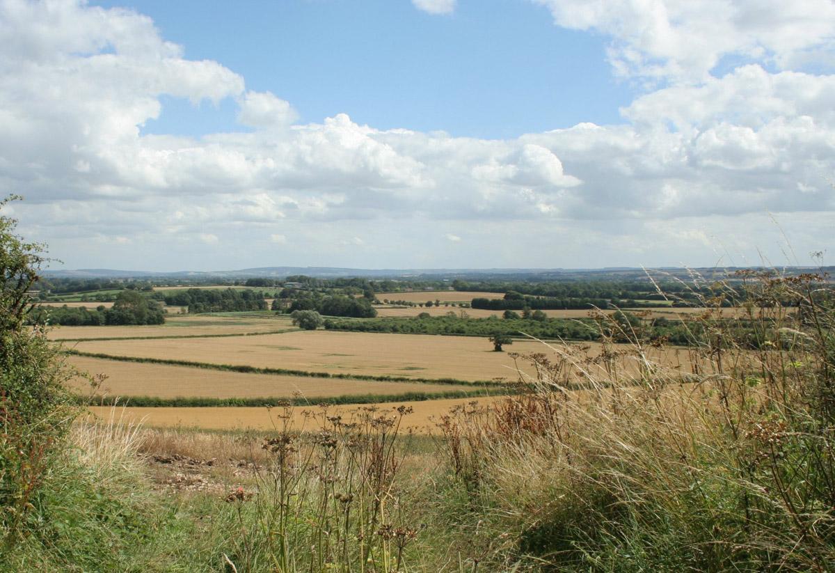
After Ness and the riverside we climbed a track named Caulkleys Lane, which took us up to a wonderful wide ridge, a place with panoramic views.
Butterflies kept low in the hot wind and the walkers clearly enjoyed the gorgeous scene, the thriving farmland. A rusticated trig point with a bench helpfully marks the highest spot, at a civilised few hundred feet.
Of course, this area may once have been rough. A notice informs that excavations of “mid-late Neolithic human skeletons” indicate “feasting on bear, red deer and beaver”. And, for sport, there were horse races along the ridge.
We dropped down to the church and an art gallery at the top corner of Nunnington, passed a pub, and then Nunnington Studios.
And then we settled for a cup of tea in the stylish organic gardens of Nunnington Hall. The pleasure only a little interrupted by an unusual indignity, a rather feeble sting.
The culprit was a lone wasp, half the size of the terrors mass produced in colonies. According to Solitary Wasps by Yeo and Corbet, only the females “can sting but rarely do”, but should be treated with ‘respect’.
Directions
When in doubt look at the map. Check your position at each point. Keep straight on unless otherwise directed. (wm=waymark)
1. Uphill on road from road bridge by Nunnington Hall (verge). After Village Hall and Howardian Hills sign, across grass on left to stile (wm) into field and immediately left across field, gate (wm), 11 o’clock, stile/gate (wm).
2. At Mill Farm, snickelgate (wm), cross yard, fieldgate by barn, four snickelgates (wm) on field-edge path.
3. Right to road, left to dead-end road on bend (fingerpost East Ness), part track. At fieldgate on left with waymark other way, right to metalled drive uphill between houses (no sign) for 50 yards, cattlegrid/gate (wm) into field and good track straight uphill, gate/cattlegrid.
4. Right to road. Before bend, track on left (fingerpost Stonegrave).
5. Keep to right of barn, grass track.
6. At tracks junction, left (fingerpost), 20 yards, grass track on right (fingerpost). Pass trig point and bench.
7. Cross road to track (fingerpost), 400 yards, track on right (three-way fingerpost Nunnington), downhill.
8. Cross road to road downhill, pass church, pass pub, through village.
Fact file
Distance: Five miles.
General location: Howardian Hills.
Start: Nunnington Right of way: Public.
Date walked: August 2013.
Lavatories: None.
Refreshments: Nunnington Hall and the Royal Oak.
Tourist information: Malton TIC 01653 600048. Map: OS Explorer OL26 North York Moors western.
Terrain: Riverside and ridge.
Difficulty: Quite easy.
Please observe the Country Code and park sensibly. While every effort is made to provide accurate information, walkers set out at their own risk.


Comments: Our rules
We want our comments to be a lively and valuable part of our community - a place where readers can debate and engage with the most important local issues. The ability to comment on our stories is a privilege, not a right, however, and that privilege may be withdrawn if it is abused or misused.
Please report any comments that break our rules.
Read the rules hereComments are closed on this article