
George Wilkinson returns to Grinton in the Dales and finds everything grand at 1,500 feet.
GRINTON’S Youth Hostel sold us a good breakfast and packed lunch, and off we were, up and away on the tracks. After a couple of miles, after Low Harker Hill, we reached High Harker Hill.
Here the ground is roughest from the lead mining, and packs of snow persisted in hollows, hushes and holes.
Views of Swaledale were splendid, of, in sequence, Reeth, Healaugh and Low Row, down by the River Swale. Of birds, there were wheatears, grouse, plovers and a buzzard. Frogs cavorted in the high altitude sunlit ponds that were hot tubs in the heather.
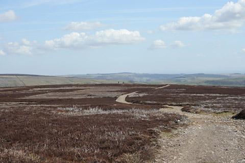
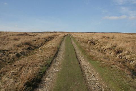
We did miles and miles at about 1,500 feet, it was grand, and must be a fine, fast mountain bike ride, except where the bridleway leaves the track for a mile and crosses a pretty corner with waterfalls and boggy bits.
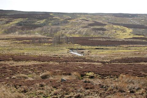
After said boggy bits, we got going again and here the track has a name, Apedale Road, to go with Gibbon Hill above, and it took us for two miles of gradual descent, a drift through an interesting valley that collects dozens of tributaries and widens and flattens. Near some crags a buzzard rose hurriedly and then circled high, out of shotgun range.
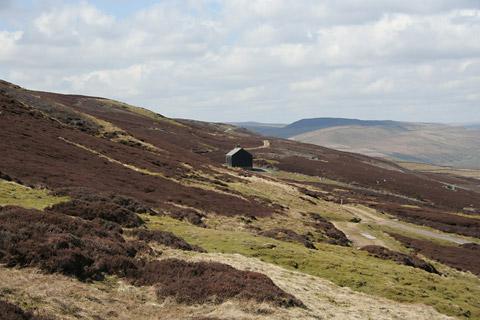
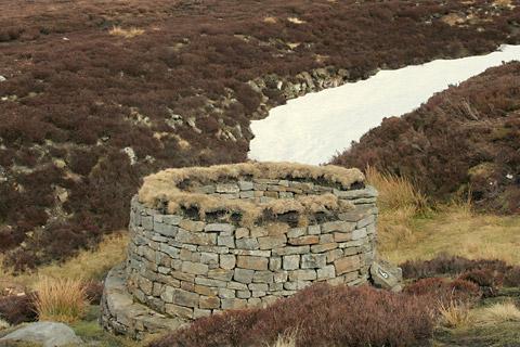
The descent had lost us 500 feet of altitude so at Dent’s Houses, where there is a sheepfold, we ate the last of our packed lunch, a Trekker Bar, and climbed to The Height of Greets on a lovely track.
But on the way down you go through one of those areas where there is an ambiguity of cairns and a fan of paths. The road is best for the last length, easier.
Directions
When in doubt look at the map. Check your position at each point. Keep straight on unless otherwise directed.
1. From parking area, Grid Ref: SE 046977, at junction on Reeth/Leyburn road, near cattlegrid and bench, uphill on Redmire road (Redmire 5), verge.
2. On sharp left-hand bend, good track on right (fingerpost bridleway/No Vehicles), 500 yards.
3. Fieldgate by stream, ford, uphill, 600 yards.
4. At tracks junction with plastic pipe drainage, straight on uphill.
5. Stay on track as it rounds sharp left (not via fingerpost on top of Low Harker Hill). After half a mile track goes through rough, mine-worked ground, then good track downhill. After small gully near shooting house, track contours for half a mile then gradually uphill.
6. Thin path on left uphill through heather (no sign, knee-high cairn). Pass cairn, pick up stream to your right. The bridleway is supposed to cut across the stream after grouse butt number 5, but that side is boggy. So keep stream to your right, pass small waterfalls, cross side stream, a few hundred yards to join track. Otherwise, from direction 6, if ‘Right to Roaming’ simply continue on track for 800 yards, left to track.
7. Left to stone track, gate, ford, bridge, keep on through valley ignore side turns. Fieldgate.
8. At four-way junction (four-way fingerpost) with stone and tin sheet sheds and sheep pens, left uphill, ignore a left fork to a quarry. Cairn.
9. Gate and cairns at top of hill, path by fence downhill.
10. At grouse butts (no. 8), fork right, cairn, ignore a right fork with two small cairns, grass track and keep roughly straight on, cairn. Hereabouts we found it useful to use two mid distance landmarks and to approximately aim between the copse at the youth hostel and the line of the flue of the Grinton lead smelt mine.
11. Left to road.
Fact file
Distance: Ten miles.
General location: Yorkshire Dales.
Start: Near Grinton.
Right of way: Public.
Dogs: Legal.
Date walked: April 2013.
Car parking: Free car park area.
Lavatories: Grinton.
Refreshments: The Bridge Inn at Grinton.
Tourist information: Reeth TIC 01748 884059. Map: OS Explorer 30 Yorkshire Dales northern and central areas.
Terrain: Moor.
Difficulty: Substantial.


Comments: Our rules
We want our comments to be a lively and valuable part of our community - a place where readers can debate and engage with the most important local issues. The ability to comment on our stories is a privilege, not a right, however, and that privilege may be withdrawn if it is abused or misused.
Please report any comments that break our rules.
Read the rules hereComments are closed on this article