
GEORGE WILKINSON walks at Bank Foot in the Cleveland Hills, and climbs to where Rosedale iron ore was once hauled off to the furnaces of Middlesbrough.
BANK FOOT is at the foot of the Cleveland Hills and the bank rears most steeply, but not for us, yet. For a couple of miles we trekked through Battersby Plantation, and though for quarter of a mile the track was muddy due to motorcycle damage, thereafter it was okay, not a trudge, barely up or down and it was sheltered and warm.
A buzzard cried but we didn’t see it until later. A pair of deer bounced away through the conifers, straight up the steep slope until their white rumps vanished. Bare larch allowed for views beyond the trees, to a long far curl of the Cleveland Hills streaked with snow and girdled with black forest.
We reached the Incline, at a quarter of the way up its straight ascent and used it to make 500 foot of height. The Incline was cut by 1861, and was then busy with rail carts of Rosedale iron ore that were winched down, on their way to the furnaces of Middlesbrough.
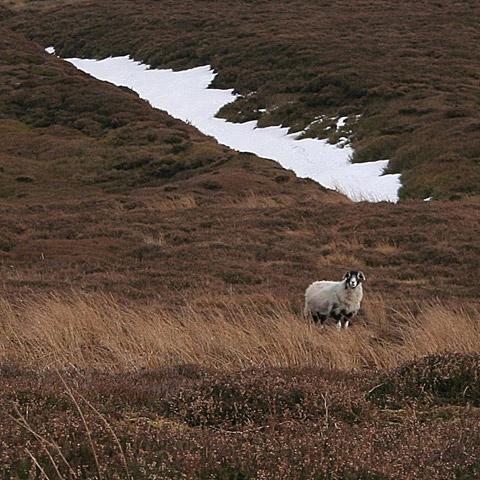
At Incline Top, which workers called Siberia, there were drifts two foot deep of two-day-old snow, melting. It was here we did our only bit of Right to Roaming, a short cut of 200 yards, so if you have Rover, you should look at the Ordnance Survey Map and take him the nearly two extra miles via Bloworth Crossing.
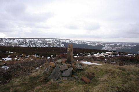
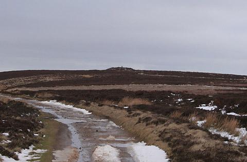
Having reached the Cleveland Way one way or another, there is the pleasure of a moorland cruise for miles with more and more of the grand spread of the Cleveland Plain laid out below. This draws you on, but don’t charge by and miss a closer look at the Bronze Age mound of Burton Howe.
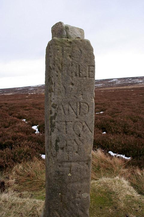
Look out too for old an amusing waymarker, a ‘hand stone’, with a carved hand pointing in the direction of Stokesley, which is spelt ‘STOXLEY’.
On the top, under a small stone, lay a miserly few coppers, by tradition for the impoverished traveller.
Roseberry Topping was lined up sharp for a while, and Captain Cook’s Monument, but it wasn’t the clearest winter day and we couldn’t see to the coast. But the five new wind turbines at Seamer caught the eye, spinning at 15 revolutions per minute, centre stage on the plains, at a range of seven miles.
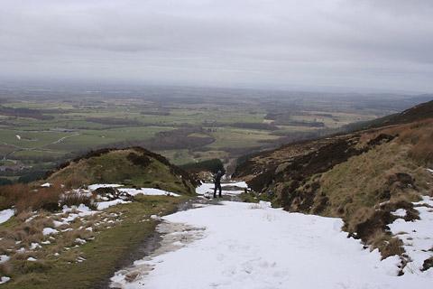
We parted from the Cleveland Way at Tidy Brown Hill, which felt like the highest point of the walk, but wasn’t quite. The descent was gradual until we reached Ingleby Bank where travellers of old, whether with cart or sled or pannier bags, would have held tight as the track dives down 400 feet in a series of tight turns.
Directions
When in doubt look at the map. Check your position at each point. Keep straight on unless otherwise directed.
1. From parking on the flat track near Bank Foot Farm, take track between farmyard and house, stile/fieldgate, uphill into woods for 100 yards.
2. Track on right with metal barrier gate.
3. Left to incline track, uphill, gate/fieldgate, uphill.
4. At top, by remnants of stonework and where track curves right, take track on left, ten yards, fieldgate, track curves right immediately for 25 yards, fork left near wooden posts, 50 yards.
5. Left to Cleveland Way track (no sign).
6. Path on right (waymark) for 100 yards to see tumulus, then return to Cleveland Way.
7. Ignore right fork (Cleveland Way fingerpost), track descends gently.
8. Track curves sharp left, becomes steep, stone with bends. Rejoin outward route near farm.
Fact file
Distance: Six miles.
General location: Cleveland Hills.
Start: Bank Foot, Grid Reference NZ593061.
Right of way: Public paths and open access.
Date walked: February 2013.
Road route: From York via Stokesley and Ingleby Greenhow.
Car parking: Trackside at Bank Foot.
Lavatories: None.
Refreshments: The Dudley Arms at Ingleby Greenhow.
Tourist and public transport information: Great Ayton TIC 01642 722835.
Map: Drawn from OS Explorer OL26 North York Moors western.
Terrain: Bank and moor.
Difficulty: Moderate.
Please observe the Country Code and park sensibly. While every effort is made to provide accurate information, walkers set out at their own risk.


Comments: Our rules
We want our comments to be a lively and valuable part of our community - a place where readers can debate and engage with the most important local issues. The ability to comment on our stories is a privilege, not a right, however, and that privilege may be withdrawn if it is abused or misused.
Please report any comments that break our rules.
Read the rules hereComments are closed on this article